
Blogs

Romantic Geomorphology

In common parlance, romantic typically refers to the pursuit of love and affection, or to an idealistic, unrealistic outlook. The definitions of romantic as idealistic often includes synonyms such as dreamy, starry-eyed, impractical, and Quixotic, and may list realistic as an antonym. However, Romanticism (typically indicated with the capital R to distinguish it from other usages) as a movement of the late 18th and early 19th century applied to science as well as to art and literature. Lately I’ve stumbled across a few things that made me want to play with the idea of what a Romantic geomorphologist would be like.

One was Daniel Gade’s book, Curiosity, Inquiry, and the Geographical Imagination (Peter Lang publishers, 2011). Among many other things, he draws a direct link between Romanticism and curiosity-driven inquiry, and proposed 14 tenets of the Romantic imagination as it relates to research. While focused on Gade’s specialty, cultural and historical geography, many of the tenets describe characteristics of the geoscience and geoscientists I most admire. A little further investigation indicated that some historical scientific giants I admire—Humboldt, Darwin, Gauss—are linked with the Romantic tradition, as well as some whose contributions span science and the creative arts (e.g., Goethe).

Johann Wolfgang von Goethe (1749-1832). Best known for his poetry & plays, he thought his scientific work would be recognized as his greatest contributions. This included work in geology, meteorology, & fluid dynamics. 

According to Cunningham and Jardine’s introduction to their edited volume on Romanticism and the Sciences (Cambridge U.P., 1990), Romanticism in arts and literature had four basic principles: original unity of humans and nature in a “golden age”; later separation of humans from nature and the fragmentation of human faculties; interpretability of the universe in human, spiritual terms; and the possibility of salvation through the contemplation of nature.  OK, this is not much of a blueprint for geomorphology or other sciences, but as a general background attitude for science, Romanticism promoted several themes that are relevant: Holism (admittedly in the form of anti-reductionism rather than in addition to reductionism), a sense of human-nature connection and recursive influences, and a valorization of creativity and experience. It began to seem as though there was some overlap with my notion of Badass Geomorphology.

Two of the tenets seem to apply more to the individual Romantic in than their approach to science and scholarship: an individualistic approach to research, and opposition to “officialism” (bureaucrasies and the status quo). These are right in line with my Badass Geomorphology archetype. So is the notion of historical perspective (“historicist vision”). While this certainly does not characterize all geoscientists, history is an important and irreducible part of our overall program.

Gade’s tenets of “interest in landscape form and content,” “affinity for the organic” (i.e., attention to self-organized wholes rather than parts), and “idea of process” (i.e., ongoing change), described in terms meant to contrast the Romantic with other approaches to cultural geography, are easily translatable to much geomorphological work. The scholar imbued with the Romantic imagination also unapologetically “stands on the shoulders” of previous observers, though this seems to me a hallmark of good scholarship from any perspective.

Romantics also reject utilitarianism. This does not mean they are unconcerned with the implications of their work for society or the planet, or that they reject pragmatism with respect to methods and techniques employed in research. It means that inquiry is driven strictly, or at least primarily, by a need or desire to know. The practical problem-solving value is secondary, and need not be apparent at the outset. I believe this characterizes many of us when we are first drawn to geomorphology, though the exigencies of thesis and dissertation proposals; research funding; and demonstrating “relevance” to governing boards and administrators often beats it out of us over time.

Five other tenets, termed by Gade as a search for the exotic, focus on particulars, depreciation of the obvious, a quest for authenticity, and diversity for its own sake, are a bit harder to reconcile with geomorphology. I’ll take these up in a future post. 

Makin' It Rain

  No, not like this.

Dang, it’s been raining a lot lately.  Today, for instance, here in Mercer County, Kentucky, Herrington Lake’s level has risen almost 2 m in the last two weeks. Discharge of the Dix River has topped 1000 cfs (28.3 cms) twice in the past week, where the mean flow for early July is about 40 cfs (1.1 cms) over the past 71 years. We had another gully-washer, frog-choker rainstorm this morning.

If it seems to have been an unusually wet summer here in Kentucky, you’re right. The graphic below shows departures from normal (mean) rainfall totals for June. That pinkish blob in north-central Kentucky, showing 8 inches (203 mm) above normal is the Lexington area.

This follows a wet spring hereabouts. Below is the departure-from-normal precipitation map for April, 2015, a month in which one-day precipitation records were set in Lexington, Frankfort, and Louisville.

So is there a point, other than griping about a wet spring and summer?

Some recently-published work confirms some earlier studies in showing that ongoing global warming results in more heavy precipitation events. In this case, a team from Germany’s Potsdam Institute for Climate Impact Research (PIK) looked specifically at record-breaking rainfall events. According to a PIK summary: “Heavy rainfall events setting ever new records have been increasing strikingly in the past thirty years. While before 1980, multi-decadal fluctuations in extreme rainfall events are explained by natural variability, a team of scientists detected a clear upward trend in the past few decades towards more unprecedented daily rainfall events . . . An advanced statistical analysis of rainfall data from the years 1901 to 2010 derived from thousands of weather stations around the globe shows that over 1980-2010 there were 12 percent more of these events than expected in a stationary climate, a scenario without global warming.”

Climatologists have long suspected, and then known, that a warmer climate accelerates the hydrological cycle. Evaporation and transpiration go faster at higher temperatures, recycling water vapor into the atmosphere faster, where it is eventually returned as precipitation. Warmer air can hold more water vapor, and vapor-laden air masses are a key in developing intense precipitation events.

The latest downpour here in Mercer County, or the big rainfalls of April, like any individual meteorological event or episode, are neither proof nor refutation of a climate trend (in the June map above, for instance, you can see parts of Kentucky that had below average rainfall). But it seems clear that from here on out we can expect more frequent and intense heavy rainfall events, and more days like today1 (another thunderstorm rain just started outside). That means more runoff (other things being equal, the faster rain falls, the greater the proportion of surface runoff), more soil erosion, and more floods.

So this is about much more than my dog tracking mud all over the house. We should be on the lookout for possible related changes in dominant runoff mechanisms, flood frequencies, soil erosion rates, and nonpoint source water pollution.

The reference for the PIK study is below; the press release is here.

Jascha Lehmann, Dim Coumou, Katja Frieler. Increased record-breaking precipitation eventsunder global warming. Climatic Change, 2015; DOI: 10.1007/s10584-015-1434-y

1July 12, 2015. Not sure when I’ll get this posted, since these torrential downpours interreupt my satellite-based internet. 

$how me the Money

This rant, lament, or diatribe will not be unfamiliar to those who know me, or to most academics, as there’s scarcely a unique complaint here. I reprise it in response to a couple of recent conversations. One concerned a very good geoscientist at another university who was recently promoted and tenured, but told by her dean that she would never make full professor if she didn’t start bringing in some grant money, regardless of the quantity and quality of her research output. The attitude and policy reflected by this is not only not atypical, it is standard in research universities. For a long time academic success (at least in material terms of money and status) in the sciences has depended more on how many external dollars you bring in than how much research you produce, and how good that research is.


The second conversation involved a young scientist venting a bit about what a royal pain in the ass it is putting together a joint proposal. I know from experience that many will agree with me when I say that the administrative details, budget, chain of internal and external approvals, and other miscellaneous hoop jumping is invariably a lot more work than the actual scientific part of a proposal.

I admire and respect my colleagues who are able to pull in research funding. I appreciate what they provide to their programs and institutions. I think they should be applauded and rewarded. The “carrot” bits; the reward structures, don’t bother me at all, except maybe for a bit of petty jealousy on account of my lackluster record in this arena over the past 30 years.

What bothers me is the “stick” part—the implicit punishment of non-promotion, lower raises, and such that are associated with low levels of external funding. To me, external funding is only one measure of research success, and not the most important one (the latter being actual outputs in the form of articles, books, and knowledge and tools put to use).  Thus I don’t think someone should be chastised for not getting a grant in a given review period, any more than they should be for not publishing a book, or an article in a specific journal. They key (to me) is the total quality and quantity of research as measured by any or all of the above, and more besides.

If Dr. Jane Doe can be a productive researcher without having to chase money, and given that chasing money eats up an enormous amount of time and energy (and sometimes getting the money eats up even more), why should she be expected to get on the grantsmanship hamster wheel? Given that some geoscience research is inherently more expensive than others (some of us need a ship, a satellite, or a large lab; others need a rock hammer, a soil auger, or a camera), within a given subfield, shouldn’t there be some reward for efficiency? If I, as an employee of a state university with most of the funding I’ve had coming from government agencies, can accomplish a given piece of research with, say, $1K out of pocket, shouldn’t that efficiency be rewarded, as opposed to doing the same work with a $50K grant. After all, I’m giving the taxpayer more bang for the buck.

But hell, you and I both know I’m living in the past, or maybe even some imaginary plane. For a variety of reasons, university funding has devolved to depend on indirect cost returns (“overhead”) from grants. Rather than that being used entirely to actually support the research or offset depreciation of university resources supporting the research, it has become folded into basic budgeting considerations. In some programs the only way you can mentor a graduate student is to get external funding to support them. Thus university administrators (UA) have come to depend on external funding rain-makers to bolster the budget. A brief digression—no matter what the specific funding model at a public university, the prof who teaches 100 or more students in an introductory class is actually bringing in more money than the grant-getter. But who gets the love from the UAs?

Another issue is the decline of independent, curiosity-driven scholarship, as opposed to the industrial model of the research group designed to maximize throughput of funding. Of course, not all science can be conducted by individuals, or by small ad hoc groups. But I worry that there is increasingly little space for that kind of work. You may have seem some of the arguments and essays that I have, indicating that we could not now produce a Charles Darwin or an Albert Einstein, because the institutional reward structures would not allow them to work they way they worked.

I was fortunate that, even though this trend was well underway when I started my career, I had a series of Department Chairs (Pat Gober at Arizona State, Leo Zonn at East Carolina, Karl Raitz at Kentucky) who, though they certainly valued and rewarded grantsmanship, felt that research productivity and quality is the bottom line. Thus they were happy when I was productive, regardless of how much or how little money it took to achieve that. My subsequent chairs at Kentucky (Sue Roberts, Anna Secor, Rich Schein) have the same attitude, but I wonder how long they’ll be able to maintain it in the face of current trends. Not everybody wants to, or should, build a career the way I did, but it makes me sad that few will even be able to try.

Anyhow, maybe this is just grousing by an old fart, passed over by the rest of the geoscientific world, and longing for a semi-imaginary past where purer motives based on curiosity and results prevailed. But to younger scholars who can, and wish to, get by without much external funding; who want to devote more time to science and discovery and less to chasing and handling money, I wish you well, and am sorry that you will have a harder time of it than I have.

Peace,

JDP

Quo vadis, Physical Geography? Part 2

First part is here. 

An oversimplified, drive-by version of the changing role of physical geography includes these overlapping and not mutually exclusive stages:

1. Discovery and exploration—collecting basic data and observations on topography, geology, biota, meteorology, oceanography, etc., often in conjunction with surveying, mapping, and collection of anthropological and economic data. In this stage physical geographers are simply, but not exclusively, Geographers. They are also, in various cases, anthropologists, biologists, ethnographers, geologists, meteorologists, oceanographers, and surveyors.

2. Holding up the Earth and environmental sciences end of the integrated geographical analysis of places, regions, and various geographical systems (e.g., transportation and settlement patterns, trade networks, cultural landscapes, climate zones, biomes, agricultural systems, etc.). Physical geographers in this stage were either specialists in the physical side of the discipline, or broadly trained geographers with substantive physical expertise.

3. Holding up the spatial analysis and integrative environmental sciences end of climatology, geomorphology, pedology, hydrology, ecology & biogeography. The main role of physical geographers was in making distinct contributions to the subdisciplines using perspectives and methods often neglected by non-geographers.

4. Functioning as specialists within both traditional (e.g., fluvial geomorphology, hydroclimatology, plant geography) and new or emerging (e.g., landscape ecology, global climate modeling, Earth system science) subdisciplines, somewhat independently of institutions and organizations of geography or other traditional disciplines.1  In this, the current stage, institutions associated with traditional disciplines persist and exert important political, social, and economic influence on Earth and environmental sciences. However, with respect to the actual practice of research and discovery, traditional disciplinary boundaries are increasingly irrelevant, and inter-, multi-, and transdiscplinary approaches are common.

In the current stage 4, the scientific community at large has recognized the necessity and value of geographical perspectives and methods, such as integrated environmental science, spatial analysis and modeling, and mapping sciences. Just as researchers invent or adapt mathematical or statistical methods to suit their needs, often without the direct inputs of mathematicians or statisticians, or develop computer code without computer scientists, Earth and environmental scientists now improvise and innovate “geographical” methods without direct involvement of individuals trained as geographers. Geography is more important than ever, and thus so are (physical) geographers. But the extent to which we will continue to be identified as such (by ourselves or others) remains to be seen.


1Somewhat independently means that individuals interact across academic units, professional organizations, and journals associated with two or more traditional disciplines, or newer non-traditional (sub) disciplines. By traditional disciplines I mean university academic departments as they commonly existed in most of the 20th century—geography, geology, biology, oceanography, soil science, forestry, etc. This is in contrast to more recent constructs or interdisciplinary banners such as Earth system, environmental, ecosystem or climate science; landscape ecology; critical zone studies; surficial processes, water resources, etc. 

Trees Behaving Badly

I recently submitted a manuscript to Catena, entitled Hillslope Degradation by Trees in Central Kentucky. The reviews came back generally positive, and requesting minor to moderate revisions. I took care of those revisions, and resubmitted. The paper was then sent to a third referee, who pretty thoroughly trashed it. Catena's editor then rejected it (with option to resubmit). However, I am at an age & stage where I have to pick my battles, and this is not one I choose to fight. But I still think the paper has some worthwhile stuff in it, so I have posted it online. You can get it here

The abstract is below, but be forwarned that the third reviewer deemed it "quite poorly written", "hard to follow," and a "mishmash of various statements." I don't think it's that bad . . . .      


Quo Vadis Physical Geography?

The Canadian Association of Geographers recently held a special session on Changing Priorities in Physical Geography (I did not attend or participate; I was made aware of it by a Canadian colleague). The session description is given here. It got me to thinking about a piece I wrote more than a decade ago in response to a similar mandate, called Laws, Contingencies, and Irreversible Divergence in Physical Geography. I thought I would revisit what I published back in 2004 to see how it holds up. The paper focused on physical geography as science and scholarship, as opposed to the institutional politics of physical geography within geography as a whole, and relative to other disciplines. However, I did predict that physical geography—as geomorphology, climatology, biogeography, soil geography, and geospatial approaches to Earth & environmental sciences—would grow and thrive. However, I also expressed doubt that this work would continue to be called physical geography, and the extent to which it would be conducted under the institutional auspices of geography. Here I think that, so far, I have been on target. Indeed, the growth of physical geography, but not labeled as such, has resulted in a proliferation of new labels such as Earth system, critical zone, climate, ecosystem, and environmental science; geoecology; biodiversity studies; ecoregional mapping; surface processes; etc.

Waving the flag for physical geography! Well, actually the flags of the Czech Republic & the EU . . . .

I think there are several factors at work here. First, physical geography is simply too important, too vital, too much in demand to leave to those of us who use the geography label and have the geography affiliations--because there are simply not enough of us. To meet this demand, we need scientists from other backgrounds. Second, a few decades back (including when I was doing grad school) those whose interests were clearly interdisciplinary; who were interested in combining geology, ecology, soil science, atmospheric science, were not readily accommodated by other disciplines. Geography was one of the few welcoming academic homes for someone whose interests transcended the traditional boundaries of geology, biology, etc. This is no longer the case. In addition to the myriad of new programs in geosciences, environmental science, watershed science, etc., many programs in, e.g., soil science, forestry, oceanography, geology, etc. are open to inter-, multi-, and transdisciplinary work. Geography is no longer the only choice. Finally, I think there are some push factors. Many human geographers and geography programs have de-emphasized, or even abandoned, quantitative and scientific approaches. While the actively anti-scientific strands of critical social theory have either calmed down or we’ve learned to ignore ‘em (I’m not sure which), many geography programs, while not necessarily hostile to the geoscientist, are not particularly welcoming, either.

The 2004 essay, however, was focused on what I saw as four critical challenges: deterioration of common cores of knowledge due to intellectual niche specializations; a need for conceptual thinking to catch up to technological advances; explicit incorporation of human decision making in analysis of Earth surface systems; and confrontation of the creative tension between nomothetic and interpretive science. Let’s see how we’ve done.

Common Cores?

The “irreversible divergence” in the title referred to increasing fragmentation and specialization throughout geosciences, with the result that even, say, geomorphologists or plant ecologists do not operate from a common core of principles and knowledge, much less physical geography or ecology as a whole, and less still geographers or biologists.

From the 2004 paper: “As knowledge expands, the ability of any individual to cope with it stays constant, obliging (succeeding generations of ) individuals to specify increasingly narrow intellectual niches. Specialization and fragmentation is inevitable and unavoidable. As intellectual niche specialization occurs, specialists become increasingly removed from traditional disciplinary cores. This is not entirely—and not necessarily—a bad thing. New, specialist groups may be independent of unhealthy or stifling cultures, politics, authorities, and orthodoxies of the traditional disciplines. There is also the potential for fruitful interchanges and synergies, drawing from different scientific cultures . . . On the negative side, fragmentation may lead to scattered individuals and groups of specialists who operate with no central frame of reference or core base of knowledge or epistemology. This . . . may inhibit communication within and between the specialist groups, and may also be inefficient as wheels are reinvented. The emergence of new cores independent of the traditional disciplines is possible, but is inhibited by the absence of central institutions and authorities to define, negotiate, or enforce a common body of knowledge. Therefore, as these cores emerge, the common body of knowledge is likely to be ad hoc and maintained by informal networks.”

As a simple forecast based on trends a decade or more ago, I think this has proven to be dead on. Irreversible and inevitable divergence has occurred, and no new cores have developed.

Concepts and Technology

In the early 2000s, and continuing today, remarkable technological advances have occurred for surveying and mapping, dating, remote sensing, simulation modeling, laboratory analyses, and much more. In 2004 the new methods were mainly being applied to answer traditional questions. The challenge, as I saw it, was to frame new problems. So how have we done?

Well, to some extent the new tools are still being used on old problems, and to some extent theoretical and conceptual developments have been and are technology-driven. However, I judge that physical geographers have indeed made progress in framing new problems and making theoretical/conceptual advances. For example (and there are many more), new ideas on tight coupling between biological and geophysical processes have emerged, as well as key concepts about complex dynamics in environmental systems.

Human Impacts

“No geographer needs to be convinced about the overwhelming impact of Homo sapiens on the global environment, and most still buy into, at some level, the value of synthesizing human and ‘natural’’ science and scholarship” (Phillips, 2004). The same can be said for the scientific community as a whole at this point. The challenge I articulated, though, was not merely the study of humanity’s effects on the planet, but to do so in a way that gives comparable theoretical/analytical weight and sophistication to both biogeophysical and human (cultural, political, social, economic) factors.

We haven’t done so well on this one. Back then I gave four examples that exemplified the approach I was promoting, and I could not add many more. I think that’s partly because it is simply difficult, and also related to the irreversible divergence. Who can possibly keep up with all the geomorphological or ecological literature on, say, wetland responses to sea-level rise, much less the relevant literature on coastal and wetland planning, management, and engineering, much less still key ideas from human geography and other social sciences? Even with a team, the conceptual and methodological frameworks are often so different that a relatively seamless synthesis is fiendishly difficult.

Some of the more recent efforts to integrate human and physical geography (or social and geosciences), such as the critical physical geography movement, or political ecology, strike me as fairly one-sided. That is, they seem to want geoscientists to embrace the perspective of critical social theorists, without any corresponding effort from the “other” side to embrace geoscience perspectives—and perhaps most importantly, little or no consideration of shared perspectives outside the prevailing social theory orthodoxies.

Finally, scholars who attempt serious study of environmental effects on human society or even reciprocal influences, are almost invariable accused of environmental determinism, and thereby summarily dismissed by many human geographers, anthropologists, and economists. I blogged about this earlier.

Laws and Contingencies

This relates to one of the common themes of my work over the past two decades, and many of these blog posts: the irreducible importance of geography and history (geographical and historical contingency) and the need to integrate local, historical, and interpretive approaches with nomothetic approaches which emphasive generally or globally applicable laws. “The challenge is to fully integrate nomothetic and idiographic approaches—to move from methods that place either historical and geographical particulars or general laws in a clearly secondary position to those that give equal or comparable weight to laws and contingencies” (Phillips, 2004).

Here we’ve done pretty well. Most published work is still pretty firmly based on the dominance of one approach or the other, but an increasing amount of research meets the challenge outlined above. Further, it is now more often acknowledged that contingent factors may be critical, even where they are not directly dealt with.
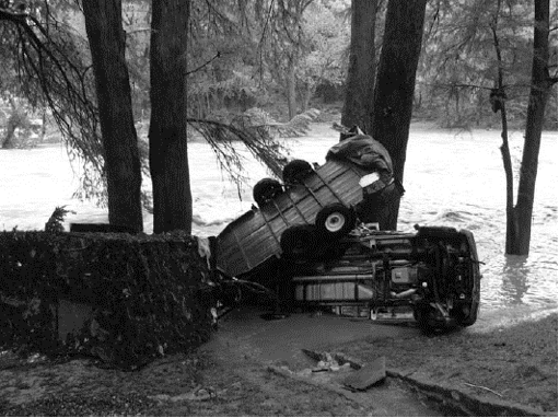
Geomorphology and Graph Theory


Tobias Heckmann, Wolfgang Schwanghart and I recently published the second of our two articles on applications of graph theory in physical geography & geosciences: Graph Theory—Recent Developments of Its Applications in Geomorphology (Geomorphology, v. 243, p. 130-146).  The other paper, an overview of graph theory in geosciences, was promoted in this post.

Example of a structural graph, from the article. 

Example of a spatitally-explicit graph (Fig. 6 from the article. The caption: (A) Spatial graph of sediment pathways in the Zwieselbach catchment, Austrian Central Alps. Nodes represent raster cells of a DEM with 5 m resolution. Edges (coloured by geo- morphic process; hSCA and fSCA refer to slope wash and fluvial processes, respectively) were created using numerical models. (B) Node classification highlighting the role of the respective node as sediment source, sink, or link within sediment cascades. (C) Summary of types of sediment cascades starting from sediment sources. The letters denote the sequence of geomor- phic processes within the respective cascades, arrow thickness represents the number of the corresponding cascades. All figures are taken from Heckmann and Schwanghart (2013).

Climate and History: Geography Matters


Just finished John Brooke’s Climate Change and the Course of Global History: A Rough Journey (Cambridge University Press, 2014). If nothing else, the book is a remarkable achievement with respect to the breadth and depth of literature and ideas brought to bear, including history, geography, geology, anthropology, economics, climatology, ecology, and archaeology. Brooke also makes a compelling case for a significant role for environmental change in general, and climate change in particular, in influencing human affairs and history (and, of course, vice-versa).

Brooks does not ignore, or even downplay, effects of culture, politics, power and social relations, economics, and technology. Yet he will almost certainly be accused, if not already, of being an environmental determinist. Environmental or geographical determinism is a set of ideas positing that physical geography is a (and in its extreme forms, the) major factor in determining human culture and societal development. Environmental determinist is used a perjorative in academic circles. Late 19th and early 20th century environmental determinism was used to support and justify racism and imperialism. This, plus its inherent scientific/intellectual flaws (some unique to ED, some shared by any explanatory frameworks that claim that it’s all about one set of factors), caused ED to not only fall out of favor, but to become a put-down applied to anyone or anything suggesting a major role for environmental and geographic factors in the course of human affairs.

Few (hopefully, no one) would deny that the physical environment poses both opportunities/advantages and constraints/disadvantages for various human affairs and activities in different locations and situations. Few would argue (and as far as I know, no scholar has in the late 20th and early 21st century has) that environmental factors influence humans independently of society, culture, politics, economics, and individual actions and decisions. Some human phenomena are very strongly influenced by physical geography; some hardly at all.

ED was practiced and espoused by anthropologists and economists, but most of all by geographers. The rejection of ED and the (understandable) revulsion toward its racist/imperialist past have caused some geographers to swing too far in the other direction—to seriously underestimate the role of the environment in some cases. Even more commonly, the tendency is to label scholars who choose to focus on environmental or geographic factors as environmental determinists and thereby dismiss their work as clueless, racist, or both (see, e.g., the vitriol aimed at Jared Diamond).

Arguments that projects such as Brooks’ do not do full justice to non-environmental factors are true enough, I suppose. But equally true are arguments that the work of, e.g., political ecologists, political economists, feminists, geneticists, etc. does not do full justice to factors other than their primary focus. Except perhaps for work of a very limited geographical and historical scope, I doubt that anyone can do full justice to all relevant explanatory factors. Yet few are ever accused of being political, genetic, or gender determinists.

I close with two points:

It is never “all about” anything. Whether we are dealing with the human condition, physical landscapes, ecosystems, or anything else, no single (set of) factors—climate, geology, topography, economics, politics, culture, etc.—tells the whole story and explains all that needs explaining.

Geography matters. Human survival and well-being affects, and is affected by, the non-human environment. Location, both absolute and relative, confers advantages and disadvantages. Natural resources provide the capital that underlie economies. As much as we might like to think that the human spirit and ingenuity can negate these facts, they can’t. And as much as we might like to place all the on blame humans and our institutions when things go wrong, (because we can potentially fix these, while we cannot fix insolation or tsunamis), we can’t always do so.


The Perfect Floods of Texas


As I write, there is flooding in central Texas, and more to come. The focus is rivers and creeks in the San Antonio and Guadalupe River systems in the Balcones Escarpment area along the San Antonio-Austin Corridor, with effects beginning to felt downstream.

Destroyed trees along banks of the Blanco River, Wimberly, TX, after the flood of 24 May, 2015 (photo by Jay Janner, Associated Press).

This area is no stranger to large floods. In the vicinity of the Balcones escarpment, the Guadalupe and other rivers that cross the escarpment are prone to high-magnitude flooding—the incidence of such flooding is higher than any other area of the U.S.  Caran and Baker (1986) identified a combination of climatological and runoff-response factors contributing to the high flooding potential. The region lies within a zone of convergence of polar air masses and easterly waves or tropical cyclones. A well-developed easterly wave approaching a lobe of high pressure, such as those often associated with a polar surge into middle latitudes, may produce strongly instability and heavy rains, as was the case, for example in the extreme floods that occurred on the Guadalupe River in 2002. Orographic effects associated with the escarpment topography can also enhance these rains (Caran and Baker, 1986). Nielsen-Gammon et al.’s (2005) climatological analysis shows that in general, exreme rainfall events in central Texas are associated with a northern deflection of the northeasterly trade winds into Texas, with deep southerly winds extending into the troposphere. This pumps abundant tropical moisture into the region with high potential for instability. Precipitation events producing more than 20 in (500 mm) of rain occur several times per decade in Texas (Earl & Dixon, 2005; Neilson-Gammon et al., 2005).

Cars transported by the Guadalupe River in Gruene, TX, during a June, 2010 flood (NWS photo).

The topography and surface conditions result in a large and rapid runoff response to heavy rainfall events. Steep slopes, narrow valleys, thin soils (many with low infiltration capacity) over limestone bedrock, and relatively sparse vegetation cover result in high runoff and consequent stream discharges. Several other studies have confirmed the atypical flood regime of this area, and the general causal factors identified above (Baker, 1977; Patton and Baker, 1977; Alfinowicz et al., 2005; Curran et al., 2005). Recent work suggests a general pattern of increasing base flow discharge in Hill Country rivers such as the upper Guadalupe as grasslands formerly degraded by overgrazing convert to woodlands (Wilcox and Huang, 2010). Unusually high roughness or flow resistance values in rivers of the Edwards Plateau and Balcones escarpment such as the upper Guadalupe may contribute to flooding by reducing channel conveyance capacity (Conyers and Fonstad, 2005).

The thin soils of the Edwards Plateau are believed to be a legacy of Quaternary climate change. A combination of temperature, precipitation, and vegetation changes led to soil degradation, according to the reconstruction of Toomey et al. (1993). During the late glacial maximum and the latter stages of the most recent glacial period (about 20-10 Ka), the uplands had thick, reddish, clay-rich soils under open savanna vegetation. The transition to the Holocene climate resulted in reduced vegetation cover, and initiated soil erosion and truncation. The general phenomena identified by Toomey et al. (1993) have been confirmed by other studies in the region (see review in Ricklis, 2004).

So what we have in this region is a confluence of factors (a perfect storm, if you will)—climatology, topography at both a broad (escarpment) and local scale (steep slopes), soils, vegetation, and land use—that combine to produce a propensity for high-magnitude floods. In this the San Antonio/Guadalupe River area is unique—there are certainly other areas particularly prone to flooding, but not for exactly the same reasons. But the area is also typical, in that all places and environmental systems have a unique combination of environmental factors and historical legacies (e.g., the Quaternary legacy of thin soils) that result in elements of uniqueness or idiosyncrasy, overprinted on the general laws and principles that apply to hydrology and flooding everywhere and always. Sometimes, from the human perspective, these “perfect landscapes” have obvious and negative aspects (e.g., extreme floods in Texas), sometimes obvious and positive traits (e.g., some famous wine-producing regions), but more often “perfection” that is more subtle.

-----------------------------------------------------------------------

Afinowicz, J.D., Munster, C.L., Wilcox, B.P. 2005. Modeling effects of brush management on the rangeland water budget: Edwards Plateau, Texas. Journal of the American Water Resources Association 41, 181-193.

Baker, V.R., 1977. Stream channel response to floods, with examples from Texas. Geological Society of America Bulletin 88, 1057-1071.

Caran, S.C., Baker, V.R., 1986. Flooding along the Balcones Escarpment, central Texas. In:The Balcones escarpment-geology, hydrology, ecology and social development in central Texas, Geological Society of America p.  1-14.

Conyers, M.M., Fonstad, M.A.  2005. The unusual channel resistance of the Texas Hill Country and its effect on flood flow predictions. Physical Geography 26, 379-395.

Curran, J.C., Bryan, D., Jennings, M. 2005. A comparison of modeled flood characteristics to measurements of the 2002 flood on the Guadalupe River, Texas. Physical Geography 26, 396-408.

Earl, R.A., Dixon, R.W. 2005. Reassessment of storm and flood probabilities in south-central Texas. Physical Geography 26, 365-378.

Nielsen-Gammon, J.W., Zhang, F., Odins, A.M., Myoung, B. 2005. Extreme rainfall in Texas: patterns and predictability. Physical Geography 26, 340-364.

Patton, P.C., Baker, V.G., 1977. Geomorphic response of central Texas stream channels to catastrophic rainfall and runoff. In: D.O. Doehring, Editor, Geomorphology In Arid Regions, State University of New York, Binghamton, NY, pp. 189–217.

Ricklis, R.A. 2004.  The archaeology of the native American occupation of southeast Texas. In The Prehistory of Texas, Pertulla, T.K. (ed.). College Station: Texas A&M University Anthropology Series, No. 9; 181-197.

Toomey, R.S. III, Blum, M.D., Valastro, S., Jr.  1993. Late Quaternary climates and environments of the Edwards Plateau, Texas. Global and Planetary Change 7, 299-320.


Plenty of Peneplains?


In the late 19th and early 20th century, William Morris Davis popularized the concept of the peneplain, an extensive low-relief erosion surface graded to sea level. Peneplains were strongly associated with Davis’ cyclical model of landscape evolution, which fell out of favor with most geomorphologists decades ago. By association, the discussion and study of peneplains also fell out of favor.

But peneplains are making a comeback. This is best illustrated by a report from the Geological Survey of Denmark and Greenland (Green et al., 2013), though the ideas and evidence are also laid out in a number of journal articles by the various co-authors. The report is concerned with development of elevated passive continental margins (think of, e.g., the Great Escarpment of Africa, the eastern Australian highlands, or the main subject of the report, west Greenland). The arguments are strongly dependent on the identification and interpretation of planation surfaces. As these planation surfaces are low-relief, regionally extensive, and are eroded across geological materials of varying resistance, and because the authors present evidence that they were originally graded to sea-level (they were subsequently uplifted), they can be legitimately referred to as peneplains.

The report also includes a nice review and synthesis of the peneplain concept and its utility in reconstructing landscape evolution. One of the papers they cite is my 2002 paper: Erosion, isostatic response, and the missing peneplains. On the few occasions this paper is cited, it is normally, and not completely unfairly, cited as representing the anti-peneplain viewpoint. The main point of that paper, however, is to attempt an explanation as to why so few (some would argue no) examples of contemporary peneplains exist.  The paper acknowledges existence of old planation surfaces that fit all definitions of peneplain other than their role in a Davisian cycle, and that the theory of peneplain formation (i.e., what would happen with long periods of denudation in the absence of substantial changes in tectonics or base level) is sound. This being the case, and with the amount of effort geomorphologists and other geologists have put into searching for peneplains, where are they? Note that this refers to peneplains graded to Quaternary sea-levels, not the elevated planation surfaces identified by Green et al. (2013) and others.

My proposed explanation was based on the dynamical instability of the interrelationships among denudation, deposition, elevation, isostatic uplift, and isostatic subsidence. This implies that no particular state of landscape evolution (peneplanation or otherwise) would persist over long periods in the face of perturbations associated with tectonics, climate, sea-level, or other factors affecting topographic evolution over long time periods and broad areas. If this is true, then: (1) There should be few, if any, examples of landscapes (such as peneplains) that require the operation of a single mode of topographic evolution over time periods longer than those at which fluctuations of climate, sea level, and tectonic activity occur. (2) Evidence should exist that changes in climate, sea level, and tectonic activity result in changes in the fundamental mode of landscape evolution rather than just fluctuations in the rates of geomorphic processes. (3) Ancient landscapes should not show evidence of (or their existence should not require) the continual existence of any particular mode or state of landscape evolution throughout their history. In the 2002 article, I tentatively accepted all three, and still stick with (1) and (2).  Evidence presented by Green et al. (2013), both primary and in their review of other work, brings point (3) into serious doubt. The question is, is this because my model is wrong (nnnnooooooo . . . . .!), or because (as others have argued) the late Cenozoic has been more active than Earth’s geological norm with respect to tectonics and climate change? This could explain the presence of ancient, uplifted peneplains and the absence of geologically contemporary ones. Green et al. (2013) do, for instance, point out that 6 millon years is apparently not enough time for a peneplain-type planation surface to develop; 26 Ma being more like it.

Overall, their work is an excellent example of integrating topographic, stratigraphic, thermochronological, and age-dating evidence, and of arguments where observational evidence (rather than theoretical predispositions or prevailing orthodoxy) are paramount. It also poses some interesting challenges to the tectonic-geological orthodoxy regarding mountain building, in the tradition (in my opinion, Green et al. do not cite it) of Ollier and Pain’s The Origin of Mountains (Cambridge Univ. Press, 2000). It also shows the utility of elevated planation surfaces in reconstructing landscape evolution, regardless of how uncool it may be to call them peneplains.

Finally, a minor, maybe even trivial, quibble: Green et al. (2013) cite my 2005 paper on weathering and landscape evolution as supporting a view that base level is unimportant with respect to weathering. This is off-base (pun, as always, intended); my paper includes the statement “ .  .  . denudation and weathering are limited by base level . . . . “

So there.


Green, P.F., Lidmar-Bergstrom, K., Japsen, P., Bonow, J.M., Chalmers, J.A., 2013. Stratigraphic Landscape Analysis, Thermochronology, and the Episodic Development of Passive Continental Margins.  Geological Survey of Denmark and Greenland Bulletin 30, 150 p.  URL: http://www.geus.dk/publications/bull/nr30/index-uk.htm