
Blogs

A CHURNING URN OF BURNING FUNK

In studies of soil formation and landscape evolution, we often think in terms of a (over-) simplified "conveyor belt" model, where bedrock is weathered to create the raw material for soil formation at the base. Further up toward the ground surface, this weathered rock is progressively modified into soil. Thus, as you go from the base of the soil or weathering profile, material gets progressively more modified, and (in terms of soil rather than rock), older.

Anyone who's spent time in more than a few soil pits or road cuts knows that the conveyor belt is, at best, a loose approximation and often hardly applicable at all. Variations in properties of the rock or parent material, dynamical instabilities and positive feedbacks in weathering and other pedogenetic processes work in many cases to create increasingly variable and heterogeneous (both vertically and horizontally) regoliths over time. Critical processes operate in all directions (not just vertically), and moisture fluxes and biological activity follow preferential, self-reinforcing paths. Further, mass is added not just from weathering, but from deposition and organic matter, and removed by erosion, leaching, fire, and decomposition.

Weathering profile in Union County, South Carolina, formed in granitoid rocks. At the top, mostly out of view, is an Ultisol. At and next to the rock hammer are minimally weathered granite corestones. The lines are highly weathered veins from the rock, where preferential water flow and root penetration are concentrated. Within the area of the photo are intact rock, weathered rock (saprolite), near-final weathering products (iron and aluminum oxides and kaolinites) and everything in between. The solid bedrock weathering front is >10 m below the section pictured.

In fact, the mechanical metaphor I prefer is not a conveyor belt, but (to borrow a phrase from James Taylor's "Streamroller Blues"), a Churning Urn of Burning Funk. If you want to stick with a conveyor belt analog, you should realized that in a given landscape there are actually multiple conveyor belts, operating at different rates, moving in different directions, and some of them re leaky or prone to breakdown.

Conveyor Belt? I think not (Sumava Mountains, Czech Republic).

Some previous published thoughts on these issues are here, here, and here

METANARRATIVES, EXTREMAL PRINCIPLES, & ANOTHER REJECTION

The attached paper (In Defense of Metanarratives:Extremal Principles, Optimality and Selection in Earth Surface Systems) was originally written in early 2015 and revised in April 2015, as an invited paper for a special issue of a geography journal. By mutual agreement with the guest editors, I withdrew the paper after deciding that I was unwilling/unable to satisfy some of the major recommendations of reviewers. The major, but by no means only, issues were that referees and guest editors felt I should more fully address history and philosophy of science issues and parse the definitions of principles, theories, narratives, etc. I felt that I could say what I was trying to say without getting into that stuff, which would have taken a lot of work on my part that would have seriously inhibited my studies on the (to me) far more interesting and important topics of how Earth surface systems actually work. After sitting on it for two years, and publishing bits and pieces of the ideas on optimality and selection in other contexts (but not the metanarratives part) I concluded that I am unlikely to ever resubmit it anywhere. But I did put a lot of work into writing the damn thing, so I am posting it online, for what it is worth. I have not changed it, other than a bit of formatting (embedding figures and tables in the document and an added note or two) and correcting a few errors I missed the first time around. 

Attachments:

BIOGEOMORPHOLOGICAL SELECTION

Biogeomorphology considers the impacts of organisms on surface processes and landforms (e.g., biological weathering, effects of burrowing animals), and vice-versa (e.g., the role of landforms as habitat, effects of erosion on biota). We are particularly concerned these days, however, with reciprocal interactions, such as sediment trapping by vegetation, and the feedback effects of this deposition on plants and their habitat. We are also learning a lot about biogeomorphic ecosystem engineering (BEE), whereby biota modify the abiotic environment in ways that influence habitat or resources (positively or negatively) for themselves or other species, and biogeomorphic niche construction, where BEE effects influence selection pressures and biological evolution.

Somewhat neglected--not totally ignored, but far less studied by geoscientists--is the role of geomorphology and geophysical processes in shaping the evolution of organisms. I was reminded of this during a recent conversation at a meeting with Sean Bennett, a fluvial geomorphologist who specializes in the dynamics and process mechanics of stream flow and sediment transport. Sean has been working more with aquatic organisms, and was remarking on how many are "perfectly engineered" for the fluvial environment--the adaptations of fish, for instance, to detect and to remain stable or move in complex, dynamic flow fields; or of mussels to both the substrate and shear stresses of stream beds. Other examples jump quickly to mind--birds and flying insects adapted to complex fluid dynamics of air flow, plants and microbes poised to colonize particular rock types exposed by erosion, and so on.

Channel catfish--perfectly engineered for particular geomorphic environments. And also delicious!

Sean also brought up the potential relevance of these ideas for stream restoration. There is such a thing as evolutionary engineering, which seeks to mimic natural selection processes for engineering practice. Thus far it seems mainly applied in biochemical engineering (e.g., development of new polymers) where biological selection is pretty obviously directly applicable.

Is the concept applicable to BEE and niche construction? Could what we learn about coevolution of landforms and biota be applied to environmental restoration and rehabilitation? Could what we learn about geomorphic selection pressure also be so applied?

The answers are almost certainly yes, and there may be examples that could be construed as biogeomorphic evolutionary engineering. But some more explict proof-of-concept is currently missing (as far as I know).

More interesting in the grand scheme of things, at least from the scientific perspective, is the selection pressure of abiotic geomorphic processes. It seems pretty clear, for example, that the evolutionary appearance of woody vegetation had profound influences on the subsequent forms of fluvial systems. But the development of fluvial systems even earlier must have spurred the evolution of, e.g., fish and insects and benthic organisms adapted to flowing water and mobile substrates.  


REGOLITH MOBILITY

Some recent theoretical and modeling work on regolith and the so-called critical zone draws a distinction between the entire thickness of weathered material H and the mobile thickness h that is potentially (re)movable by erosion and mass wasting. As H > h this implies that in many cases there exists a subsurface immobile layer.

This distinction between a potentially laterally mobile and a fixed layer of weathered material is no doubt useful as a model assumption. It is also probably true, or close enough, for some very thick weathered mantles. And of course, the mobile:immobile distinction is self-evidently true during periods when a portion, but not all, of the regolith thickness is being transported.

Regolith in the flysch Carpathians, Czech Republic. Lighter upper layer is a landslide deposit. Lower material (the black layer is charcoal, apparently from a fire at some point) is weathered in place. It is all potentially mobile.

It is a mistake, however, to assume that a mobile upper and a fixed lower layer of regolith is a good general conceptual model of how regoliths and hillslopes work.  As with many other such concepts (e.g., various steady-state assumptions; distinctions between solum and the "rest" of the soil; random disturbances, etc.) situational accuracy and conceptual and/or modeling utility do not necessarily add up to generally applicable truths.

First, consider phenomena such as deep-seated mass movements, gully incision, and regolith stripping. All may involve movement of the entire regolith, even in some cases where the weathered mantle is pretty thick. Second, the H vs. h concept is based on notions of surface removal, emphasizing mechanical processes. We have to keep in mind the importance in some situations of mass transport in solution, and of vertical transport (e.g., leaching and vertical translocation).

Soil and weathered mantle, Sumava Mountains, Czech Republic.

The assumption that mobility decreases with depth, or of a movable:fixed threshold also overlooks a great deal of empirical evidence and conceptual models involving lateral material movement on the subsurface. Soil piping, pipe/macropore/conduit erosion, and lateral translocation are all examples (see, e.g., Sommer et al., 2000; 2001; Uchida et al., 2001; Fox and Wilson, 2010; Jones, 2010). The importance of such processes is explicitly recognized in 3-layer models of regolith, hillslope, and landscape evolution, which recognize not only the potentially erodible surface at the top and the bedrock weathering front at the bottom of the regolith, but also an intermediate surface where contrasts (in e.g., permeability, bulk density, biological effects) associated with regolith layering direct fluxes laterally. Don Johnson's dynamic denudation model is not only a good example, but his papers review other concepts along these lines, too (Johnson, 1993; Johnson et al., 2005).

Sometimes the rooting depth of plants (especially trees) or the biologically active layer or biomantle is equated with the mobile layer. I wonder if this association, where it occurs, is inevitable. In most environments exposed bedrock (and other subsoil material) is quickly colonized and modified by plants, animals (especially insects), and microbes. They play a key role in weathering and in accumulation of both organic and inorganic material. Biota also play important direct and indirect roles in mass fluxes. Thus, to the extent biomantles and mobile surface layers are coincident, it is more likely to be because biota created the layers than to be a matter of organisms colonizing the mobile layer.

Weathering profile with thin soil but thick regolith, Czech Republic.


Being of the opinion that the entire weathered mantle is potentially movable under all circumstances except perhaps thick sedimentary layers on low-relief terrain, in my own work I distinguish between the entire weathered thickness (basically the same as H above) and the portion of H that has been converted to soil S (that is, has acquired pedogenic properties not inherited from the parent material).  I argued that for a non-eroding landscape in steady-state, H/S approaches 1, or H ≈ S. Thus a significant layer of weathered material that has not been converted to soil (e.g., saprolite, saprolith, Cr horizons, loose rock) indicates non-steady state (which is very common)--but not necessarily immobility of the lower layer. My arguments in this regard are here.


----------------------------------------------------------------------------------

References:

Fox, G.A., Wilson, G.V. 2010. The role of subsurface flow in hillslope and stream bank erosion: a review. Soil Sci. Soc. Am. J. 74: 717-733.

Johnson, D.L. 1993. Dynamic denudation evolution of tropical, subtropical and temperate landscapes with three tiered soils: toward a general theory of landscape evolution. Quat. Internat. 17: 67-78.

Johnson, D.L., et al. 2005. Reflections on the nature of soil and its biomantle. Ann. Assoc. Am. Geogr. 95: 11-31.

Jones, J.A.A. 2010. Soil piping and catchment response. Hydrol. Proc. 24: 1548-1566.

Sommer, M., et al. 2000. Lateral podzolization in a granite landscape. Soil Sci. Soc. Am. J. 64: 1434-1442.

Sommer, M., et al. 2001. Lateral podzolization in a sandstone landscape. Geoderma 103: 231-247.

Uchida, T., et al. 2001. Effects of pipeflow on hydrological process and its relation to landslide: a review of pipeflow studies in forested headwater catchments. Hydrol. Proc. 15: 2151-2174.


WE DON'T HAVE TO SHOW YOU ANY STINKIN' FACTS (1)

We are currently mired, at least here in the US, in a political and cultural milieu where truth, facts, and logic are not only ignored by many citizens and alleged leaders, but are actively resisted. (2)   This drives scientists especially crazy, as we are trained and wired to argue and act based on hard evidence and logic. Our efforts in this regard are wildly imperfect, but it is a universally agree upon ideal, and in our world, while facts can be modified and tested, they cannot be ignored or denied.

Alfonso Bedoya in the famous "no stinkin' badges" scene from the Treasure of the Sierra Madre.


For years there has been a great deal of (justified) hand-wringing over how scientists can and should communicate with the general public--how to translate complex and specialized concepts into understandable terms, without oversimplifying or trivializing them. These concerns have accelerated lately with respect to the deliberate obfuscation and politicization of issues such as climate change, sea-level rise, and environmental protection.

Efforts to help scientists better connect with the general public have mainly focussed on how to more effectively communicate facts and scientific reasoning. But what do we do when so many powerful interests, and so much of the general population, either does not care about or is actively opposed to objective truth, logic, and reason?

I don't know, but at least people are starting to think about the problem.

The American Geophysical Union recently posted "Responding to Climate Change Deniers With Simple Facts and Logic," to assist scientists and other truth-oriented folks in communicating key ideas (climate is changing, human activity does play a role, it is likely to be bad for humans, we can still do something about it, and it is economically advantageous to do so).  While this is still in the communicating-facts-and-logic vein, it is a step in the right direction, in that it goes straight to the bottom-line issues, and that it attempts to frame the issue in terms of questions and answers rather than received wisdom.

In these times we can use all the help we can get.

Singer-songwriter Hayes Carll. In his song "Bad Liver and a Broken Heart," he asks "Doesn't anybody care about truth anymore? Maybe that's what songs are for."

-----------------------------------------------------------------------------------------------------------------------------------------------------

(1) Paraphrased from a famous line (with "badges" rather than "facts") from the 1927 book and 1948 movie The Treasure of the Sierra Madre.

(2) While this trend accelerated during the George W. Bush administration and has reached its zenith (this has to be its zenith, right? It can't get any worse, right?) in the Trump era, I trace this back to President Ronald Reagan, who firmly grasped and exploited the idea that perception matters more (in politics) than reality. 

THE (NECESSARY?) ILLUSION OF EQUILIBRIUM

Overwhelming evidence exists that single stable equilbria, or other balance-of-nature notions are not a normative state for Earth surface systems (ESS), and not more common or significant than nonequilbrium. Despite this evidence, management, policy, and even scientific models and theories are often grounded in notions of a single stable, normative state. Why? I suggest six interrelated explanations.

1. Steady-state is a useful simplifying assumption

Nature is vast and complex. Comprehension requires some simplifying framework(s). Equilibrium is means of simplification appealing to a basic human preference for order and predictability. Models based on equilibrium assumptions that are unproven or even known to be false can nevertheless produce useful results (as is also the case in social sciences). This modeling success can contribute to an illusion of equilibrium as an accurate characterization of nature.

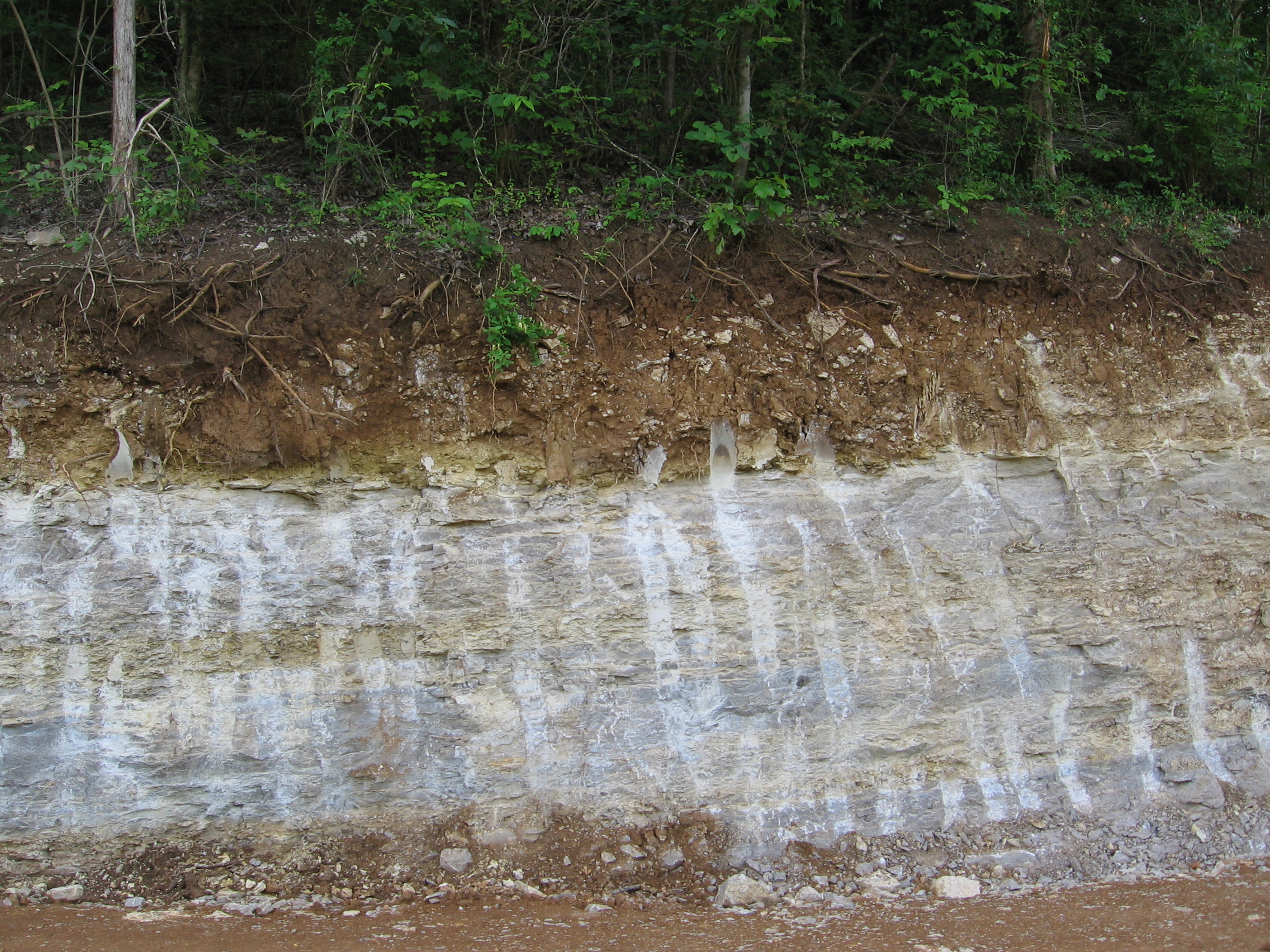
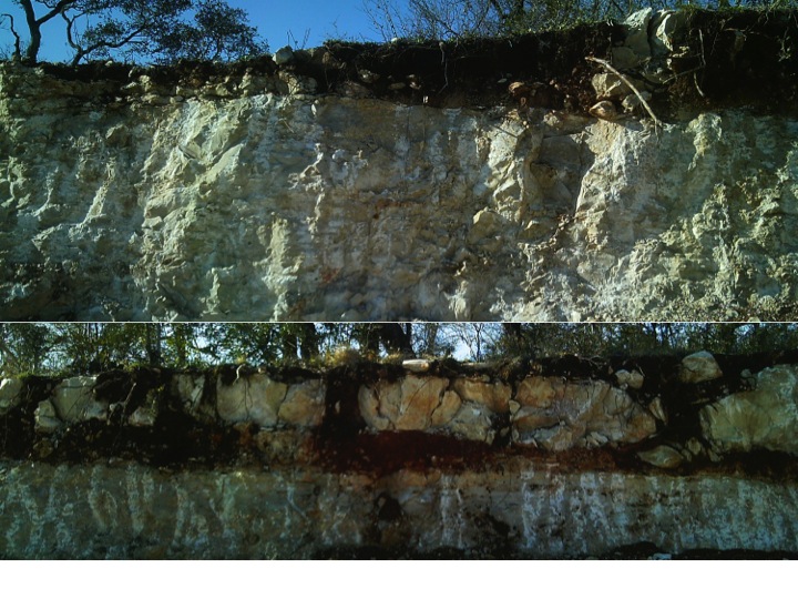
Steady-state regolith or soil thickness, whereby weathering at the bedrock interface roughly balances surface removal, does not accurately describe actual weathering and pedogenesis. However, it is a useful and convenient fiction for many modeling purposes. (Madison County, Kentucky)

2.  Goals & targets

Second, engineering, restoration, and management typically require some sort of goal. Selecting goals is easier when we assume or imagine a single natural or balanced state. Justifying and explaining goals is easier if one claims to be doing exactly what nature intended. And, faced with multiple options and limited information, the assumed normative equilibrium state may be as good a choice as any.

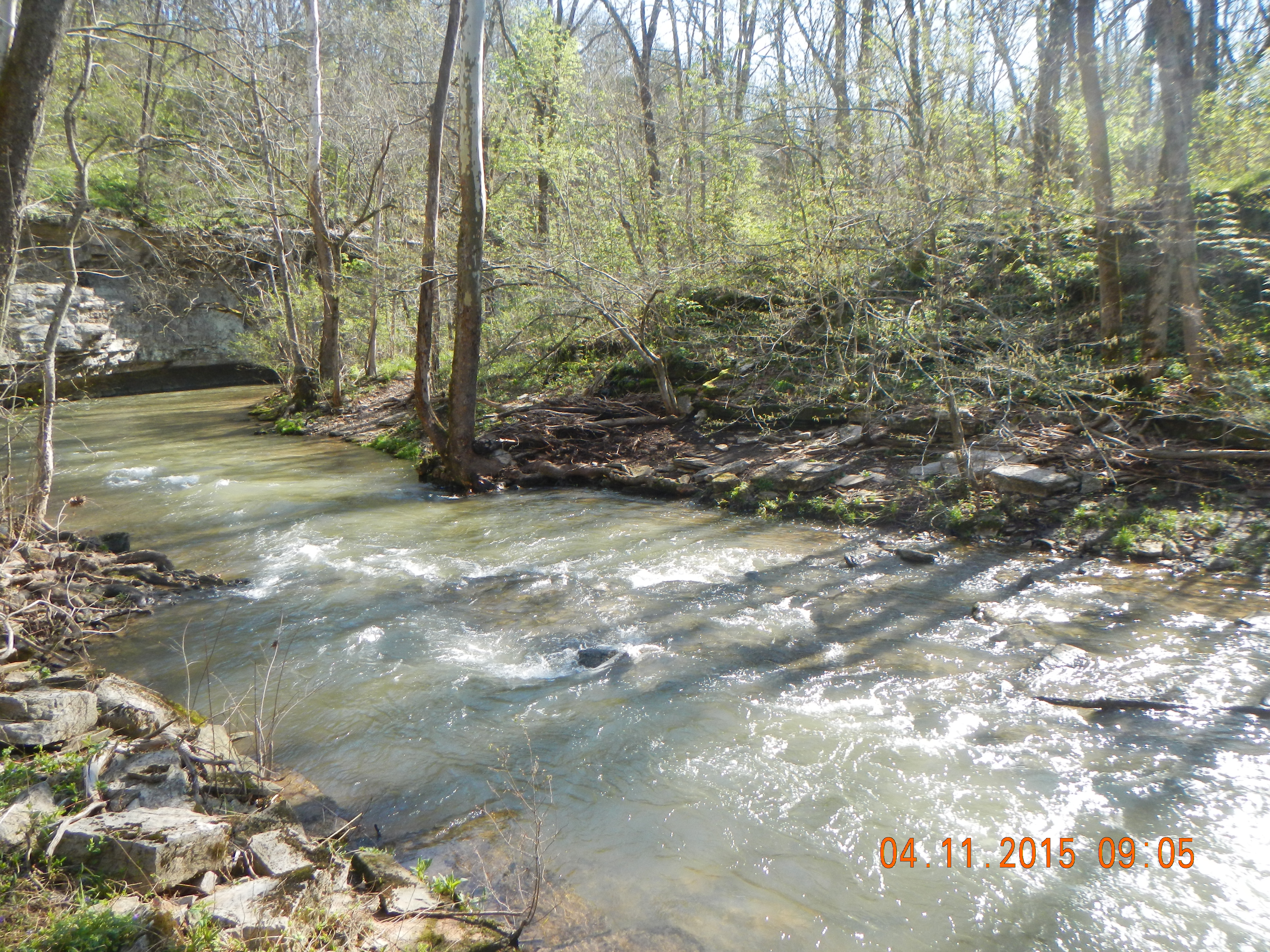
What should the management target be for this wetland? Might as well be based on equilibrium, in the absence of other goals or criteria. (Middleton Swamp, North Carolina)

3. Ontological uncertainty

Scientists emphasize what we do (think we) understand, rather than what we do not, and we understand equilibria better than non-equilibrum states. Thus we have traditionally focused on regularities, predictable patterns, and equilibria, even when we are fully aware of irregularities, unpredictable  patterns, and nonequilibria.

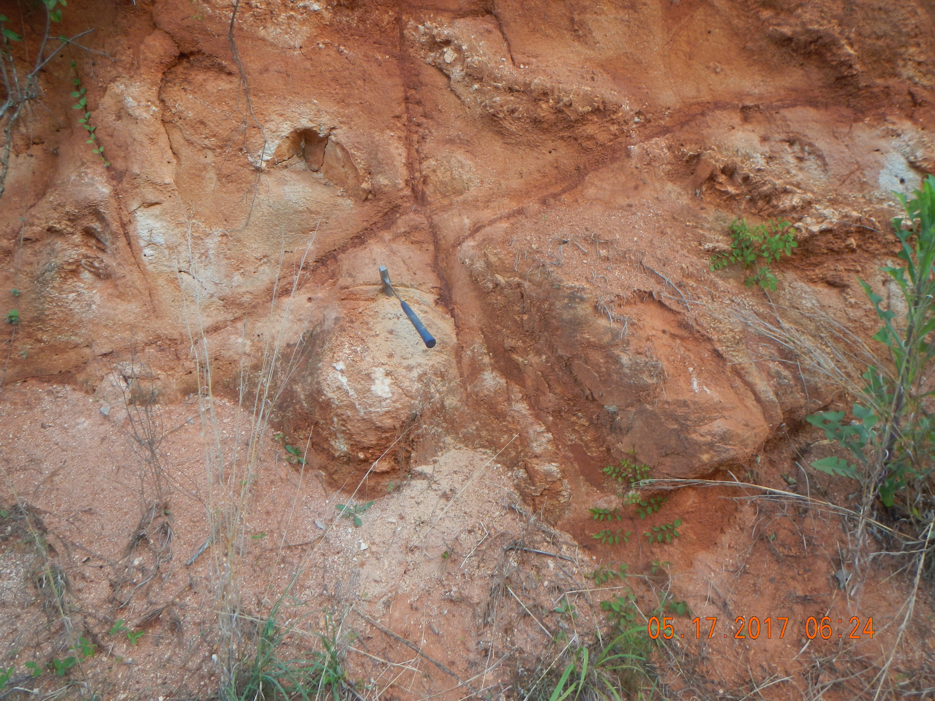
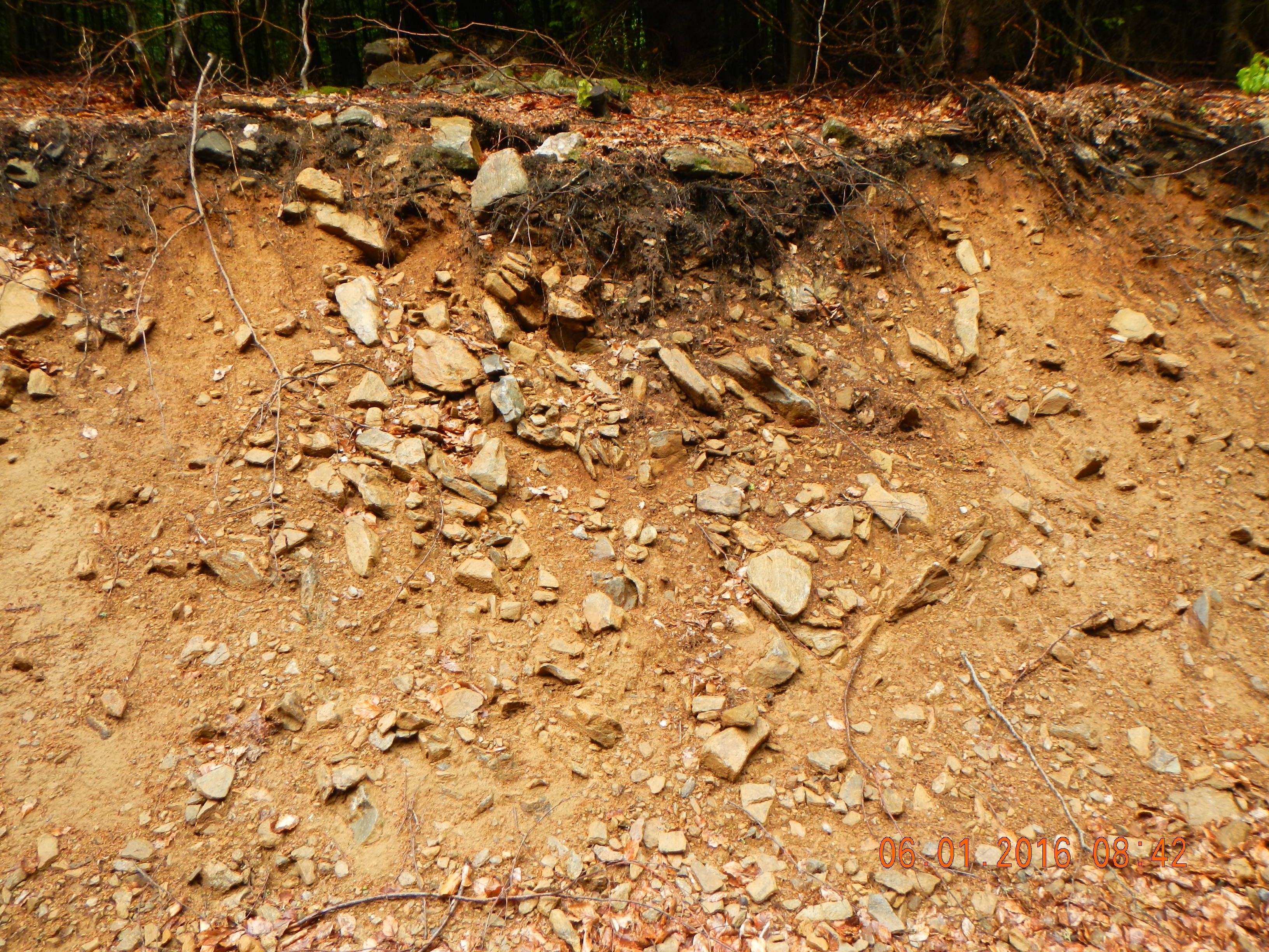
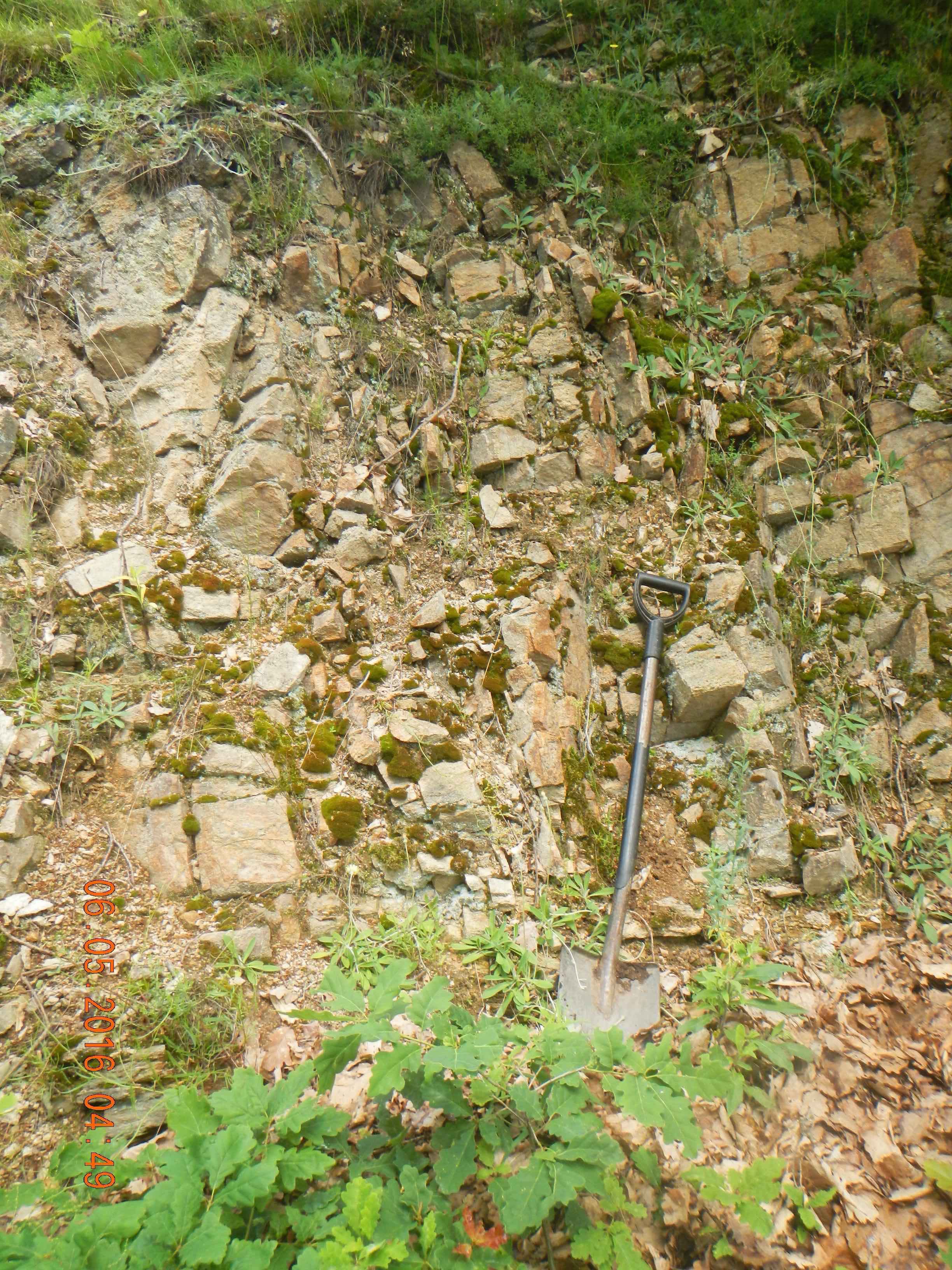
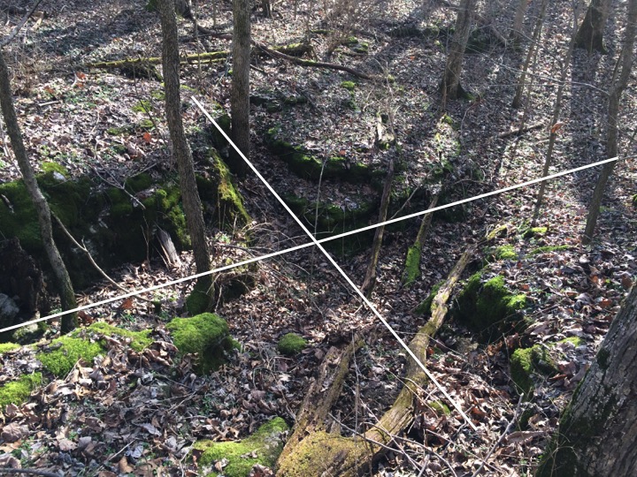
Instead of focusing on the complicated weathering profile on the bottom, why not explain the easier one on the top? The two are actually within a few meters of each other in Comal County, Texas.

4. Scale contingency

Since steady-states, etc. do exist in nature, we can find them. And because equilibrium is scale contingent, we can often broaden or restrict scales to find it.  Turbulent fluid flows, for instance, are a canonical example of dynamical instability and deterministic chaos. However, we can refocus the microscope on the interaction of two or three particles, and the physics are well-known and well-behaved. Or, we can refocus the telescope on the aggregate properties of flow, where despite the chaos, overall tendencies and behaviors can be readily described and understood.

Turbulent flow, Shawnee Run, Kentucky.

5. Relaxation time equilibrium

Relaxation time is the period required for a system to adjust to a change or perturbation. Relaxation time is always finite, and usually decelerates. This can interpreted as achieving a “new equilibrium.” More likely is simply that relaxation time has elapsed, and the new state was not necessarily preordained.

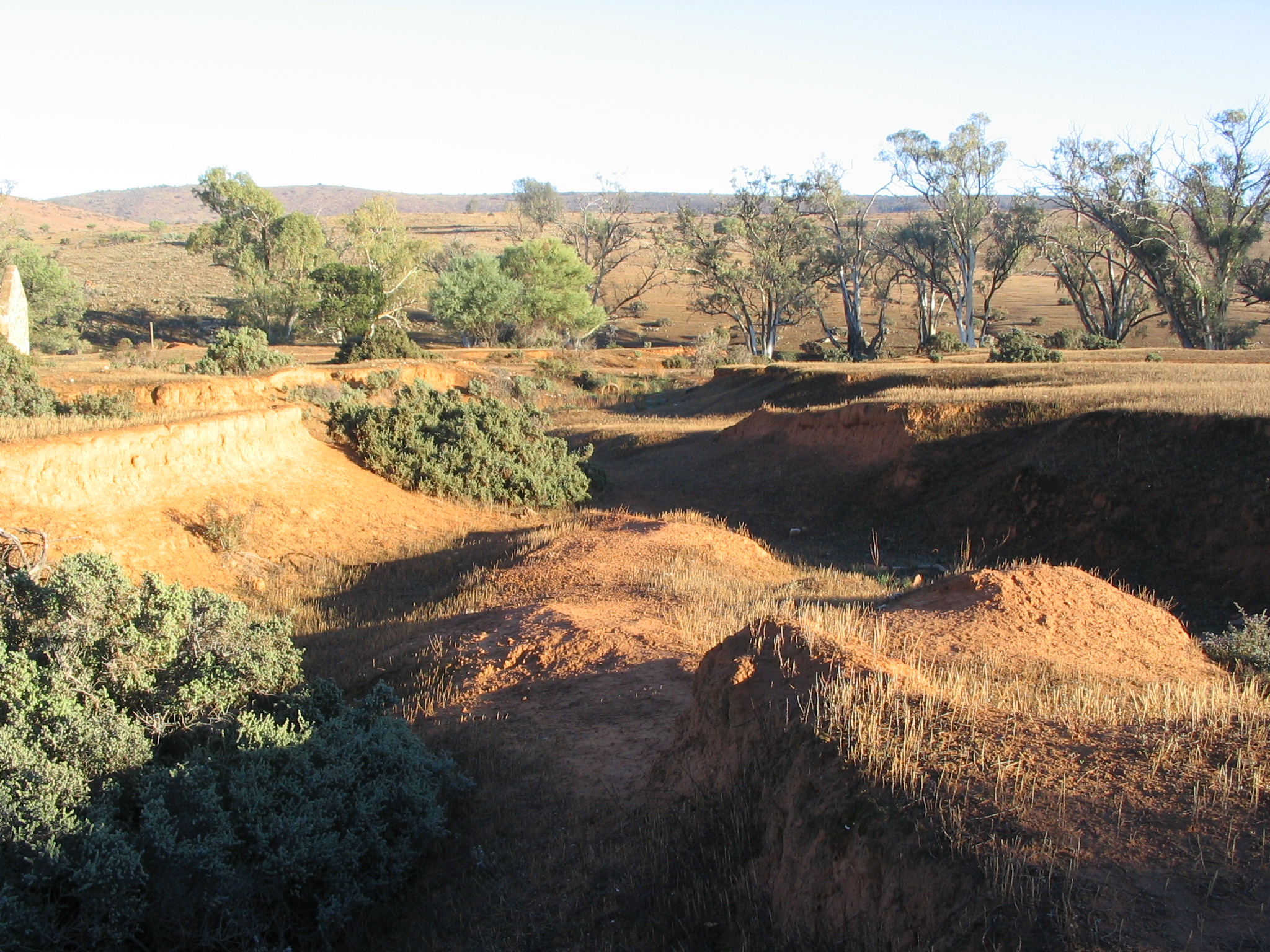
Revegetated gully on abandoned grazing land, South Australia. New state of balance, or just finished responding to land use change?

6. Constraints

Sixth, ESS have buffering capacities, feedbacks and multiple degrees of freedom in responding to changes. These do not necessarily operate to restore or maintain a (single) balanced state, but they do, along with first-order constraints imposed by general laws, constrain what can happen. Together, these phenomena can easily give an impression of a balance of nature to those who are looking for it--and many humans are.

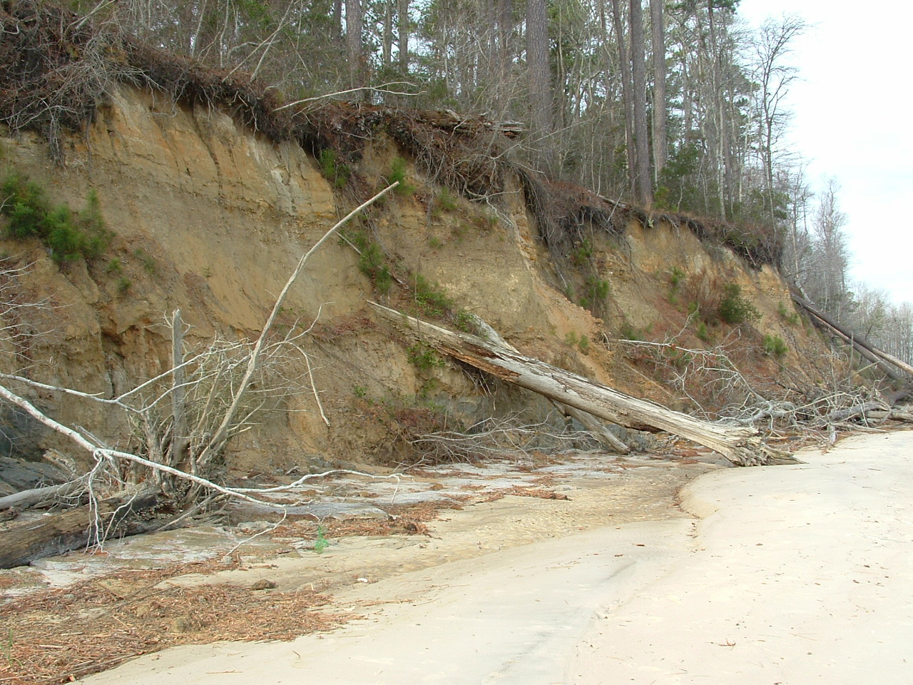
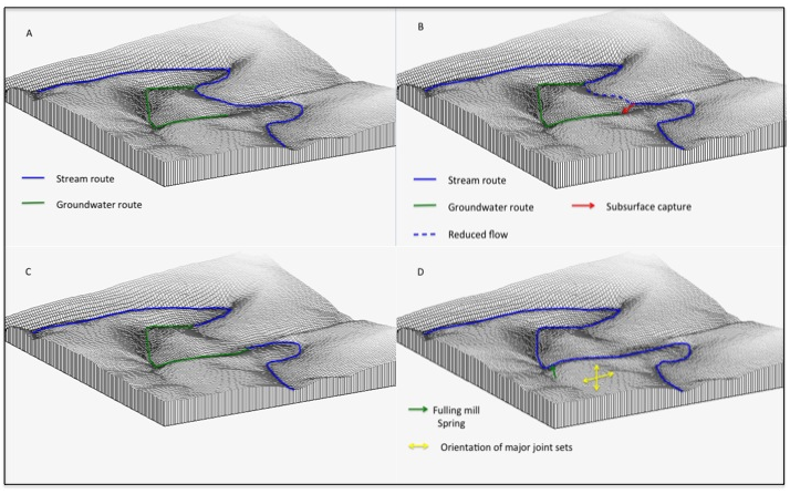
There are many possible evolutionary trajectories for this eroding bluff in Craven County, North Carolina. But not an unlimited number!

What does it matter?

Admitting that a balance of nature is merely a convenient fiction does not imply a lack of any kind of order or predictability. It does change the context of predictability, but this can be dealt with, as a vast literature on complexity, nonlinear dynamics, nonequilibrium dynamics, multiple stable states, path dependency, and state-and-transition models in geomorphology, ecology, pedology, climatology, and other sciences shows.

And maybe, I have to admit, even if an ESS is not trending toward a steady-state equilibrium in a dynamical systems sense, it doesn’t hurt to call a relaxed state; a restoration target; a reference condition that—as long as we recognize what’s really going on.

GEOMORPHOLOGICAL STATE-AND-TRANSITION MODELS

State-and-transition models in geomorphology, co-authored with Chris Van Dyke, has just been published in Catena. The abstract is below:

State-and-transition models (STM) are used to describe, model, interpret, and predict when landscapes will undergo a qualitative state change. Although rangeland ecologists pioneered STMs, geomorphological STM-type models were developed prior to and independently of ecological STMs. This study categorized 47 geomorphological STMs according to whether they were: based on single or multiple study areas; primarily for description and interpretation or predictive and prescriptive use; explicitly concerned with complex system dynamics; and the role of biogeomorphic interactions in the model. Each STM was represented as a graph and the structure identified. Spectral radii were calculated to measure the complexity of each STM. Although STMs are associated with conceptual frameworks that recognize the possibility of nonequilibrium, alternative states, and path dependency, results show that an explicit concern with complexity does not necessarily lead to the identification of more states and transitions, or a more complex transition pattern. The purpose for which a STM was created, as well as the number of study sites it can be applied to, also had little bearing on the models’ complexity. This review suggests that geomorphic STMs, rather than being used to fit explanations about landscape evolution into predefined theoretical categories, are veridical representations of empirical observations. Although STMs are particularly useful for grasping the biogeomorphological dynamics of landscapes, this review indicates their utility is not limited to biogeomorphology or to systems with a strong ecological imprint. Time scales involved in geomorphic change can make it difficult to observe a large number of states and transitions, which may constrain what types of STM structure can be identified, as the number of observed states and transitions required to develop particular graph structures varies widely.

STM for the San Antonio River delta, Texas.


Reference: Phillips, J.D., Van Dyke, C., 2017. Geomorphological state-and-transition models. Catena 153: 168-181.

KARSTIFICATION AT BOWMAN'S BEND

As the Kentucky River in central Kentucky continues to downcut through Ordovician limestones in the Kentucky River gorge area, entrenched meanders grow. On the outside of these bends tributary streams are truncated, their slopes accordingly steepen, and fluvial dissection becomes more dominant. On the inner part of the bends, slip-off slopes develop that are far less steep than valley walls on the outer bends, but steeper on average than the adjacent uplands. These inner bend areas are hotspots for karstification, and are pockmarked with numerous dolines (karst sinkholes). Streams are few and small; larger tributary streams are apparently diverted away from the inner bends; in any case no tributaries with a surface drainage area of more than a few km2 join the river on the inside of a meander (at least in the gorge area). This article includes a section on the "Badass Bends" and their diverging karst vs. fluvial dynamics. This previous post discusses the expansion of the Polly's Bend compound meander.

The interior of Bowman's Bend on the Kentucky River, from 1.5 m LiDAR data. The numerous pockmarks are karst sinkholes (dolines).

While it is relatively easy to explain what the inner bends are karsty-er and the outer bends fluvial-er, and vice versa, it is not so easy to explain why the inner bend areas are such karst hotspots, even compared to adjacent uplands. It seems to be a combination of three factors. First, Kentucky River incision is, at least over the last 1.5 million years or so, the major driving factor in landform evolution for both karst and fluvial processes. Areas closer to the river are more profoundly affected, so any karstification going on there is likely to be faster and more intense, on average, than on the interfluves. Second, in some cases groundwater flow takes a shortcut across the bends, forming and widening karst conduits. Some surface expression of this is to be expected as collapses occasionally occur into the underlying conduits and cavities. Third, the erosional bevelling of the slipoff slopes may promote karst development by exposing underlying joints, etc.

These dynamics are evident on the ground, especially during winter, when our lush vegetation does not obscure them so much. Last weekend I was out hiking at Bowman's Bend, and got a few pictures--just the tip of the iceberg, so to speak.


Solutional features are often focused where joints intersect. The white lines added to this photo show the trend of the two joints that intersect at the center of this sink. 


Interaction of fluvial and karst--a swallet connectedt to a subsurface conduit in an ephemeral channel. 


LESSONS FROM ICICLE BEND

Last year, my fluvial geomorphology class investigated the origin of an unusual overhanging bedrock stream bank on Shawnee Run, Kentucky. Because on our first field visit the cliff above was festooned with large (up to 2 m long) icicles, we named it Icicle Bend. In the course of our fieldwork, we discovered what we eventually determined to be higher level paleovalley of Shawnee Run nearby. Stream channel changes by cutoffs, avulsions, and capture happen all the time. But, invariably, the new, "winning" channel represents a more efficient (i.e., more direct and steeper) path. In this case, however, the opposite appeared to have happened--a shorter, steeper path represented by the paleovalley was abandoned during general downcutting of the stream for the modern path via Icicle Bend. PhD student Tasnuba Jerin and I decided to further investigate this anomaly.

To make a long story short, we found that the abandonment of the old channel was associated with capture of streamflow by a subsurface karst conduit, which was later uncovered. Beyond being an interesting field problem, the case indicates (or reinforces) that the laws governing flow paths operate on a very local scale--thus achieving maximum efficiency at a given point (in this case, where the conduit opened in the stream channel) may not lead to a more efficient path at the broader scale.

Inferred evolution of the Icicle Bend area, with the modern topography as a background, adapted from Figure 9 of the article. A is pre-capture, with a presumed groundwater flow following general trends of major joints. In B, flow is diverted into the subsurface route, with the surface route drying up. At stage C, the former surface route has been abandoned, with groundwater flow connecting the upstream and downstream portions of Shawnee Run. Subsequent exhumation or collapse of the karst conduits produces the contemporary situation (D).

The article based on this work was recently published in Geomorphology. The abstract is below:

Development of fluvial systems is often described and modeled in terms of principles related to maxima, minima, or optima of various hydraulic or energy parameters that can generally be encompassed by a principle of efficiency selection (more efficient flow routes tend to be preferentially selected and enhanced). However, efficiency selection is highly localized, and the cumulative effects of these local events may or may not produce more efficient pathways at a broader scale. This is illustrated by the case of Icicle Bend on Shawnee Run, a limestone bedrock stream in central Kentucky. Field evidence indicates that a paleochannel was abandoned during downcutting of the stream, and the relocation was analyzed using a flow partitioning model. The bend represents abandonment of a steeper, straighter, more efficient channel at the reach scale in favor of a longer, currently less steep and less efficient flow path. This apparently occurred due to capture of Shawnee Run flow by a subsurface karst flow path that was subsequently exhumed. The development of Icicle Bend illustrates the local nature of efficiency selection, and the role of historical contingency in geomorphic evolution.

OCCAM'S SELECTION

Generalized Darwinism holds, in essence, that the principles of variation, selection, and retention (preservation) and replication that are the cornerstone of Darwinian biological evolution are applicable to development and evolution of (to exaggerate only slightly) damn near anything. This perspective, most actively debated in evolutionary economics, is detectable (though sometimes without the specific label) in many science and social science fields.

Generalized Darwinism has many critics, but most critiques I've seen fall into two categories (to simplify and generalize wildly): (1) a lack of fidelity to biological evolution; or (2) an inability to solve every problem in evolutionary economics, system theory, etc.  Those criticisms are accurate, but not valid (in my estimation), as the "generalized" clearly implies a move beyond biological evolution, and no conceptual or analytical framework is ever the answer to everything, even in a relatively small subdiscipline.

Like others, rather than invoke Darwin's name and all the associated baggage, I prefer to point out the importance of selection (of which Darwinian natural selection is one example) in a variety of environmental systems (see these previous posts: A, B, C). The logic I propound (which is hardly unique or original to me) is that (1) variations occur; (2) some variations are more durable, stable, efficient, or otherwise favorable; and (3) those are more likely than others to be preserved, enhanced, and replicated (i.e, selected).  Pretty consistent with GD, in other words. So I have no quarrel with GD in terms of its axioms and worldview, though I hardly endorse (or even know about) all its claims or applications.

The problem I have is when selection is interpreted as a goal function or a purported law of nature rather than an emergent property. The fact that some phenomenon recurs repeatedly, and can be interpreted in terms of selection, does not mean that nature has adopted this outcome as a goal. Does nature prefer sandstone ridgetops? Maybe, but a simpler explanation is that sandstones are more weathering resistant and physically durable than the other sedimentary rocks they often occur with. Thus they are preferentially preserved (selected) as denudation proceeds, and thus plateaus and tablelands in sedimentary rocks around the world often have sandstone ridgetops.

My first published arguments along these lines--in the context of ecosystem and biosphere evolution--are here.  I subsequently made similar arguments for geomorphic and hydrological systems.

Because variations occur and selection happens in all sorts of phenomena, temptation is strong to propose natural laws or goal functions. For example, this paper expresses it as the "persistence principle," which is stated as "nature seeks persistent forms."  Mostly the authors are not wrong, but the "nature seeking" part is troublesome. A more accurate, if self-evident, way to put it, is "persistent forms persist." Thus they are more common and last longer than other forms. They are selected for, probabilistically (as almost all selection occurs), and their common occurrence is an emergent property of this selection, not a goal function of Mother Nature.

The emergent approach is simpler (and thus preferred by Occam's Razor) than trying to ascertain and explain why rivers, atmospheric energy transfers, biogeochemical cycles, or chemical reactions (for instance), should seek or prefer anything.