
Blogs

MAKING PEACE WITH MACROPORES

The journal Hydrological Processes has recently been publishing a series of articles and commentaries in tribute to the estimable Keith Beven, the recently retired hydrologist from the University of Lancaster. One of his many fundamental contributions has consisted of drawing attention to the importance of, and making fundamental insight into, the phenomenon of macropores and preferential flows. One of those commentaries, by Markus Weiler, addressed these contributions as well as unresolved issues in understanding and simulating preferential flow.

No hillslope hydrologist, geomorphologist or pedologist would dispute the existence or frequent occurrence of preferential water flux in soils, or its importance in many cases at the scales of soil physics to hillslopes. However, Weiler points out that the observed differences in flow pathways at the pedon or hillslope scale are not necessarily detectable at the watershed scale. Does macropore flow matter at the catchment scale? Weiler's answer is yes, though he points out that many scientists believe otherwise.

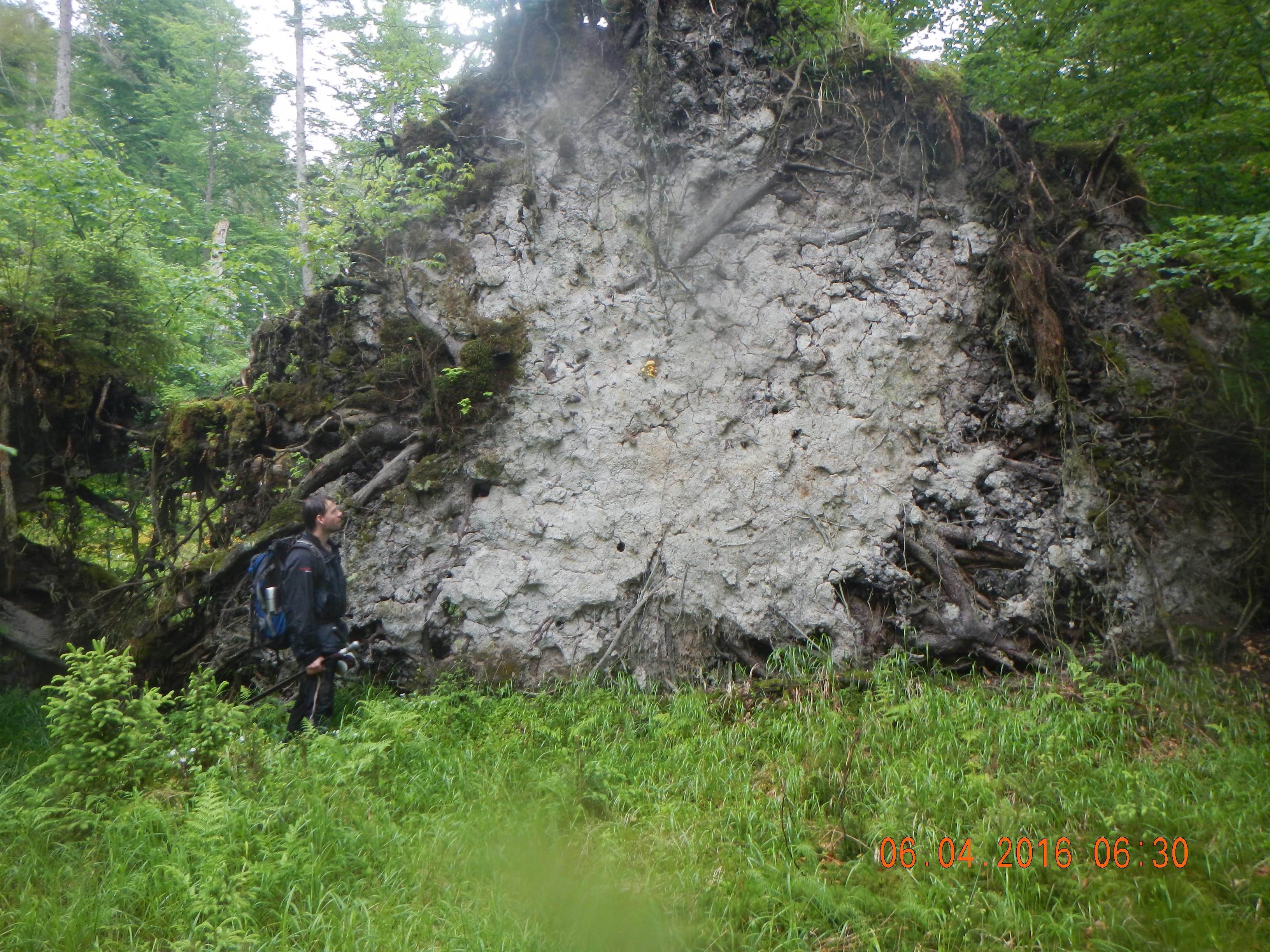
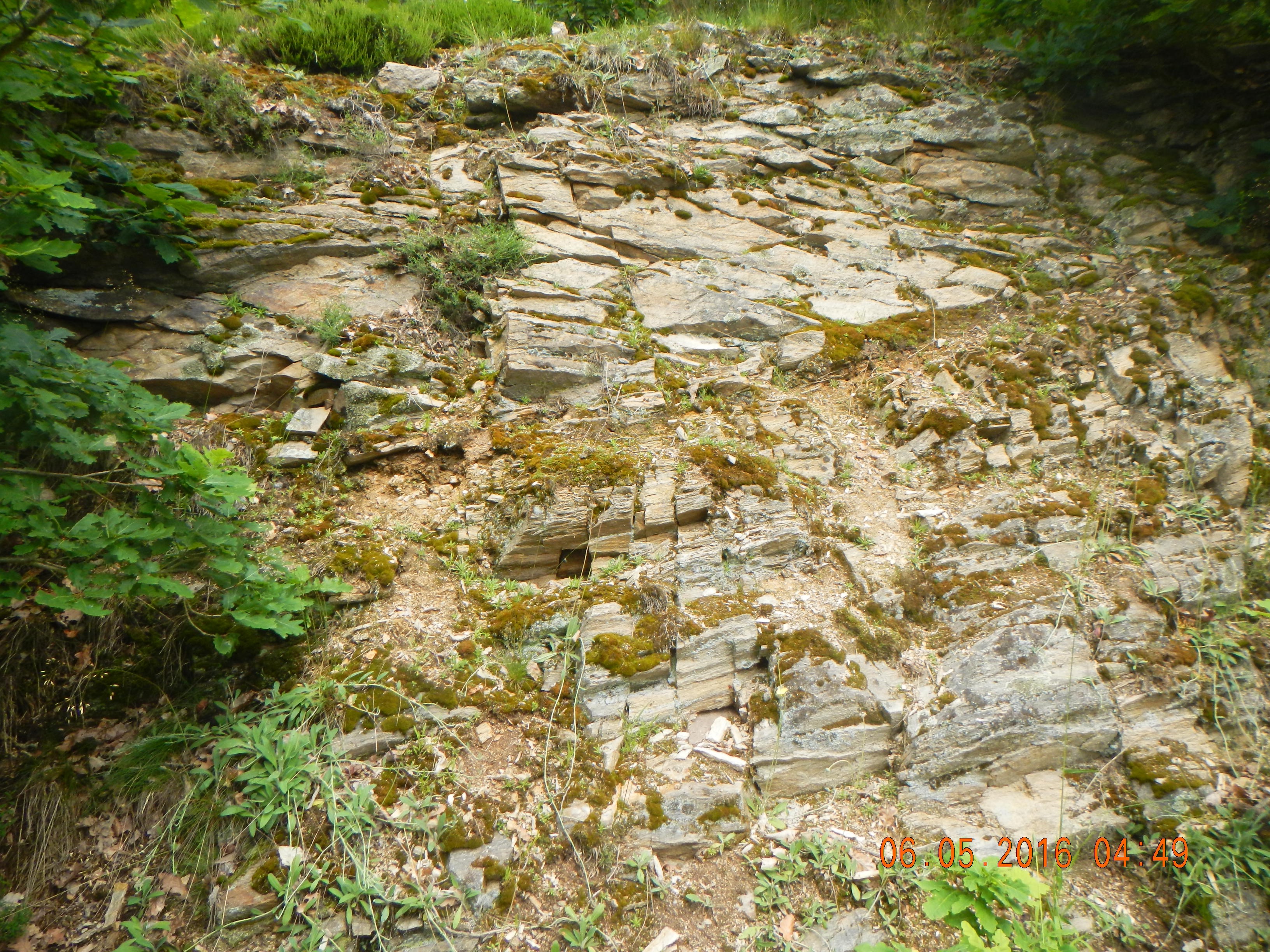
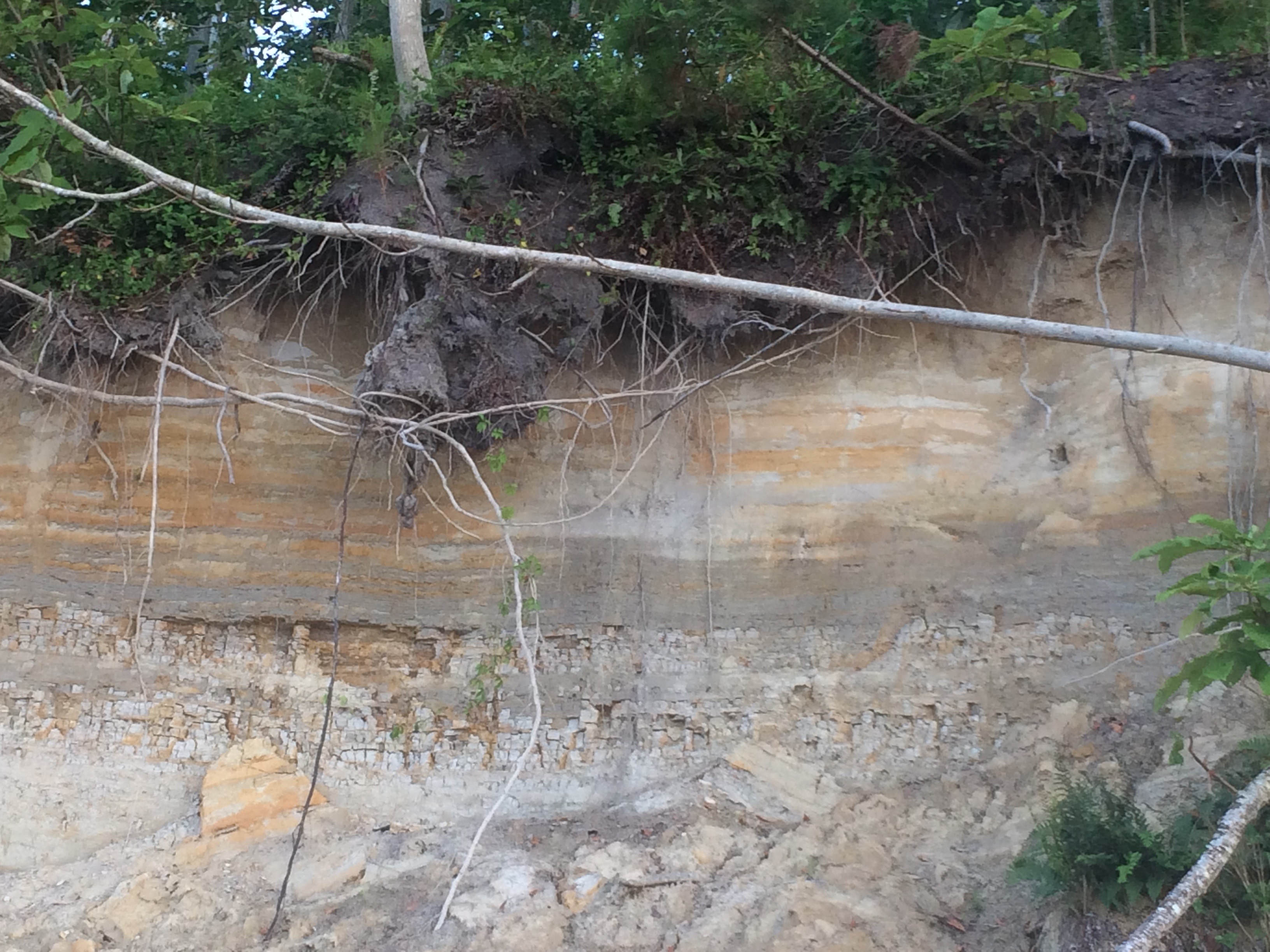
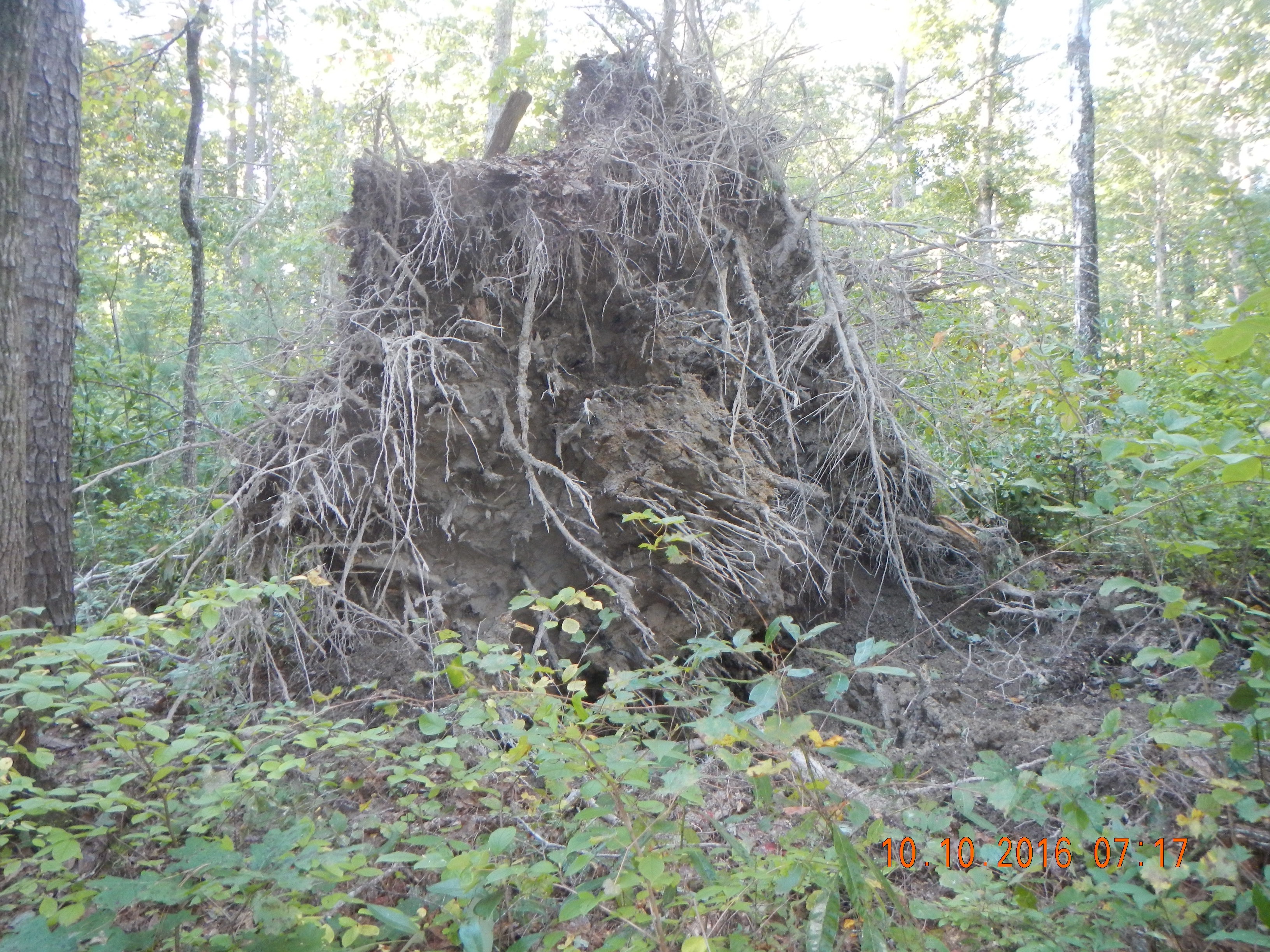
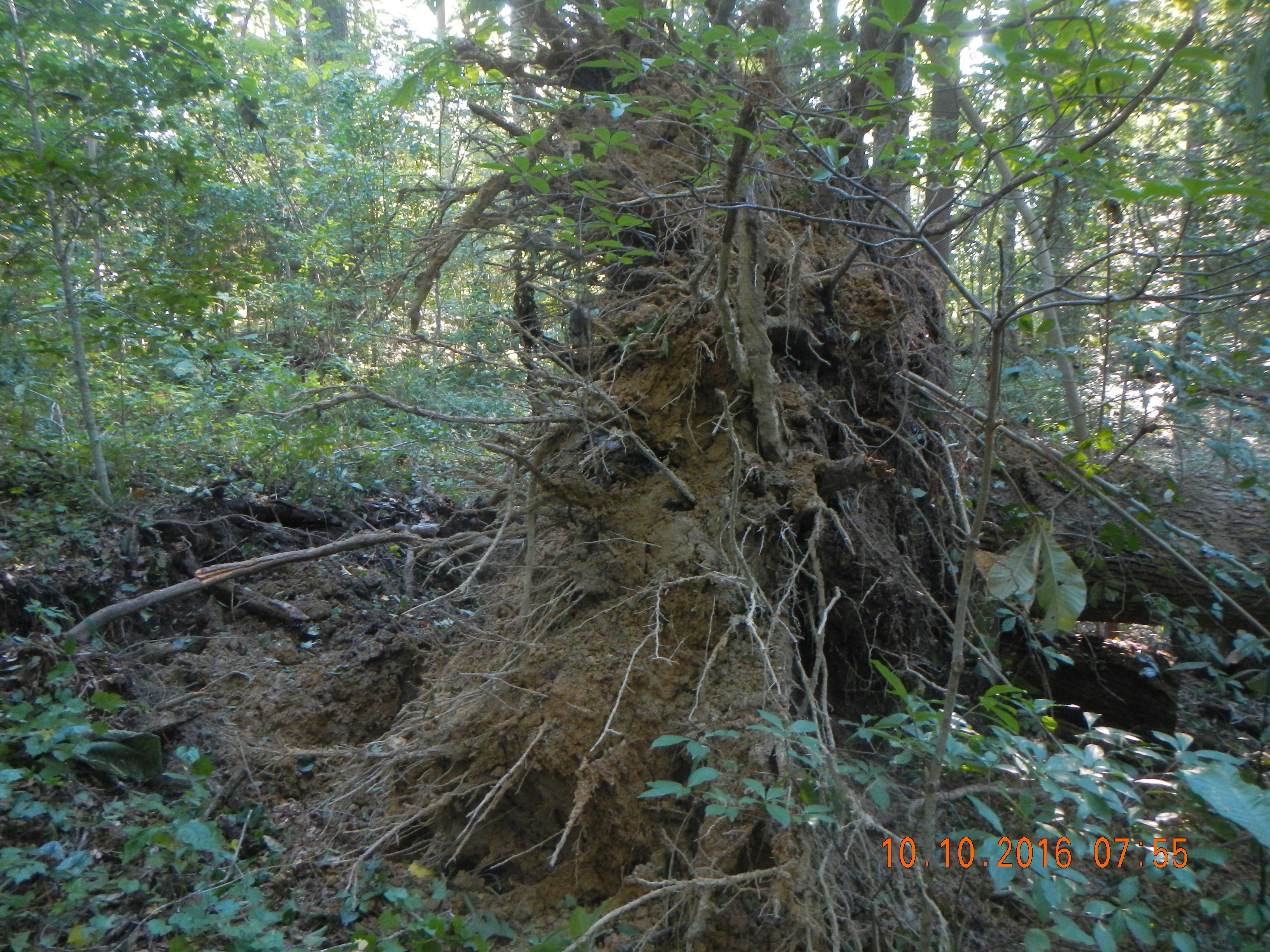
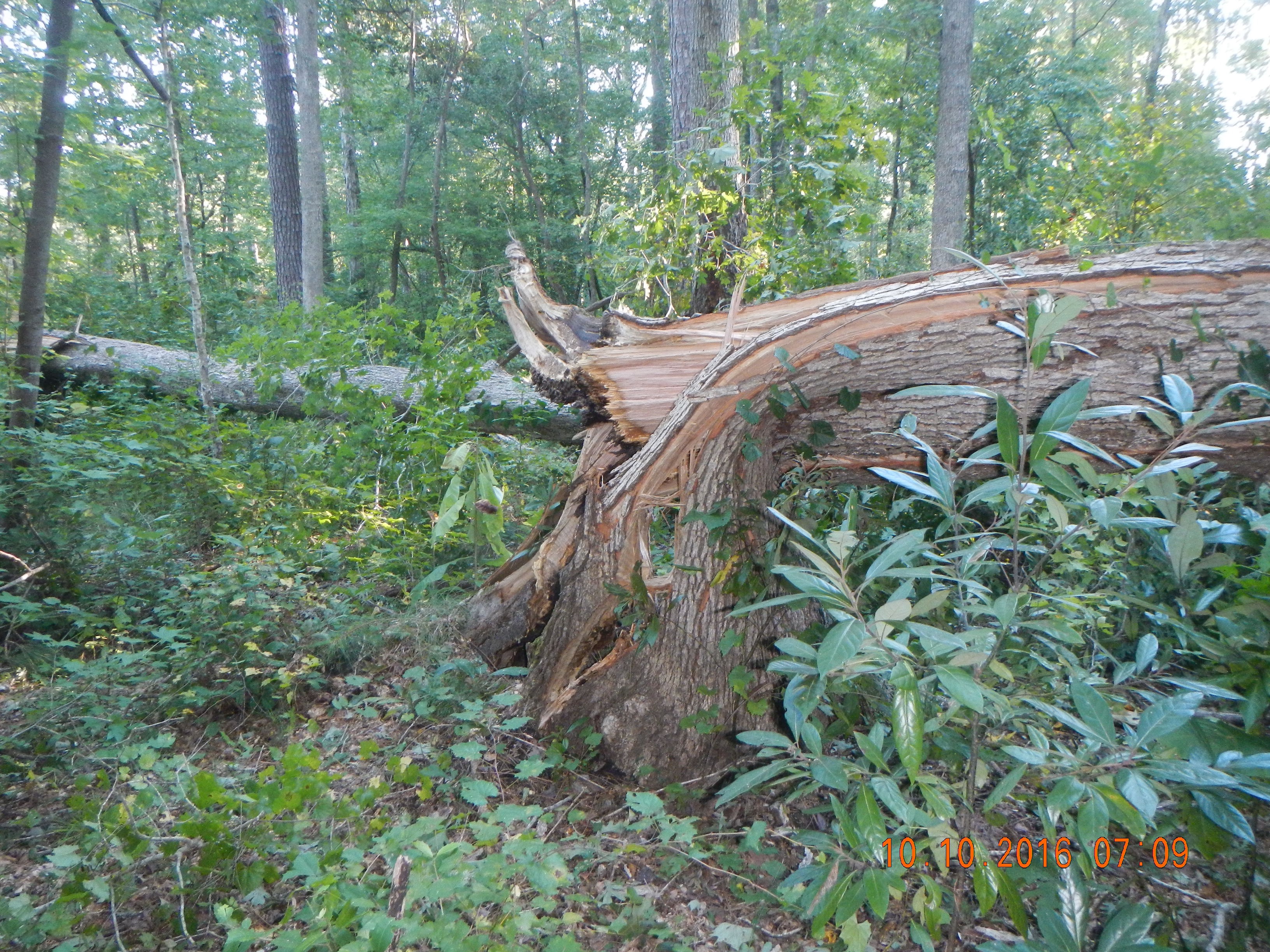
Uprooted tree at Zofinksy, Czech Republic. The soil in the rootwad shows roots, large pores or pipes associated with root channels of decayed roots, and soil cracks. These and other less obvious features in most soils are avenues for preferential flow.

Weiler's commentary got me to thinking about a long time interest of mine--scale linkage. That is, how do we link processes and phenomena that operate at widely varying spatial (and temporal) scales. After all, in hydrology, geomorphology, and pedology we deal with scales from the molecular to the planetary. You can't explain the hydrology of the Ohio River based on soil water tension in an earthworm burrow; nor can you gain insight into macropore (or for that matter matrix) flow based on global hydrology. Yet the processes are indeed related across those scales.

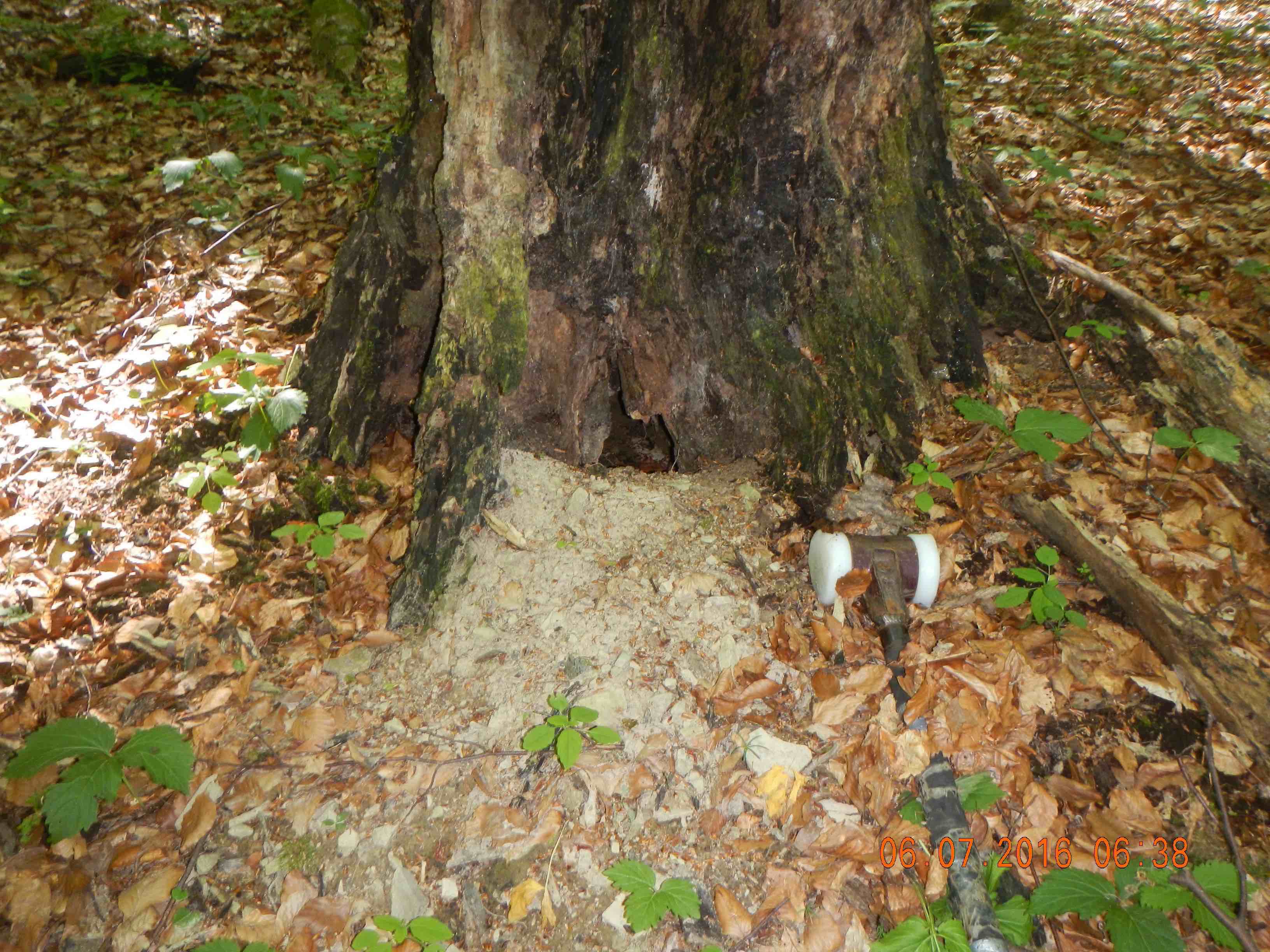
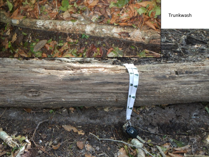
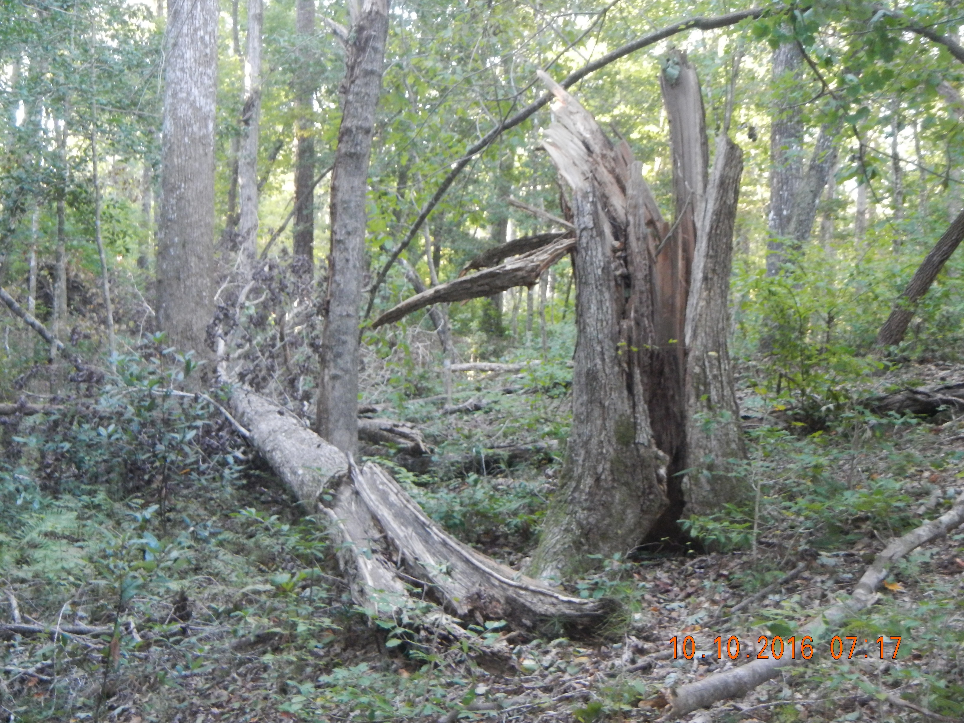
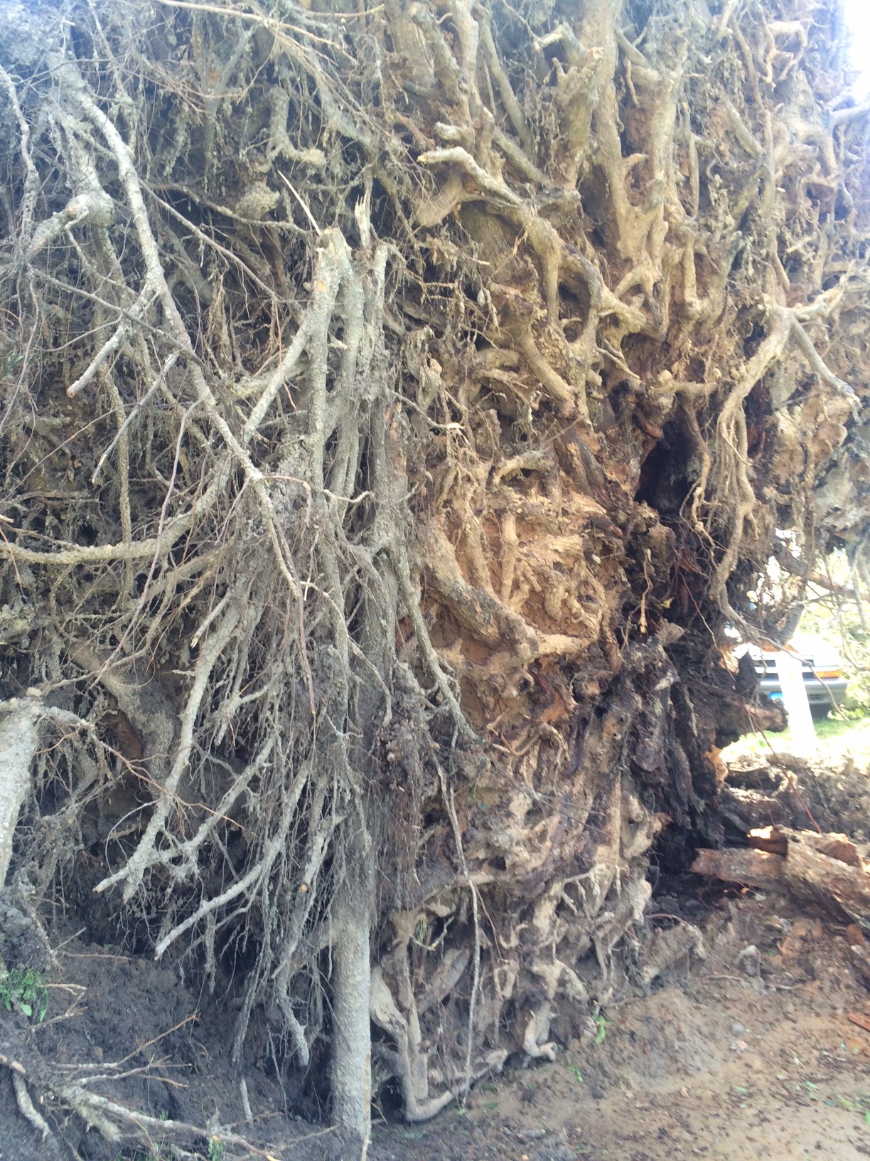
Stemwash reflecting a key form of preferential flow, stemflow (Razula, Czech Republic).

What I've found via several different approaches (most recent publication here) is that processes and relationships operating at fundamentally different scales (e.g., more than two levels apart in a scale hierarchy) are essentially independent, in the same sense that macropore vs. matrix flow at the scale of soil physics is not detectable in stream discharge. However, as Weiler points out, preferential flow is detectable in stream and watershed chemical properties.

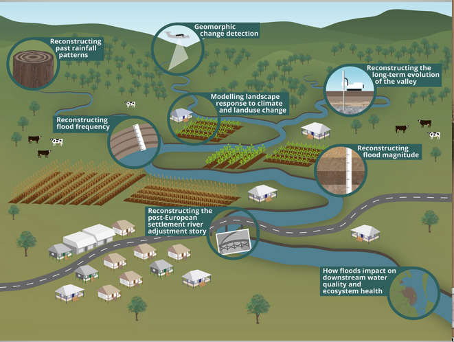
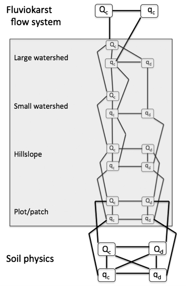
The diagram below comes from an analysis of fluviokarst systems in Kentucky reported here, but except for the top one the hierarchical levels (if not the specific nodes and links) are applicable to hydrogeomorphic systems in general. Watershed runoff is several levels away from the soil physics or the plot/patch level, and thus should be independent of processes restricted to those lower levels. When it is not, this suggests that macropores and preferential flows are manifest at the intermediate, hillslope scale. That in turn supports Weiler's inference that connectivity of preferential flow paths is key (where they are strongly connected, then preferential flow should be manifest at the hillslope level).

To add a bit to the questions and research agenda laid out by Weiler, a potential complication could be different preferential flow paths at different, overlapping scales--for example, macropores at a soil physics scale, stem and root flow at a small plot scale, and biogeomorphically-induced microtopography at a hillslope scale. Further, the "selection" of individual flow paths is highly localized and may or may not be reflected in broader-scale patterns.

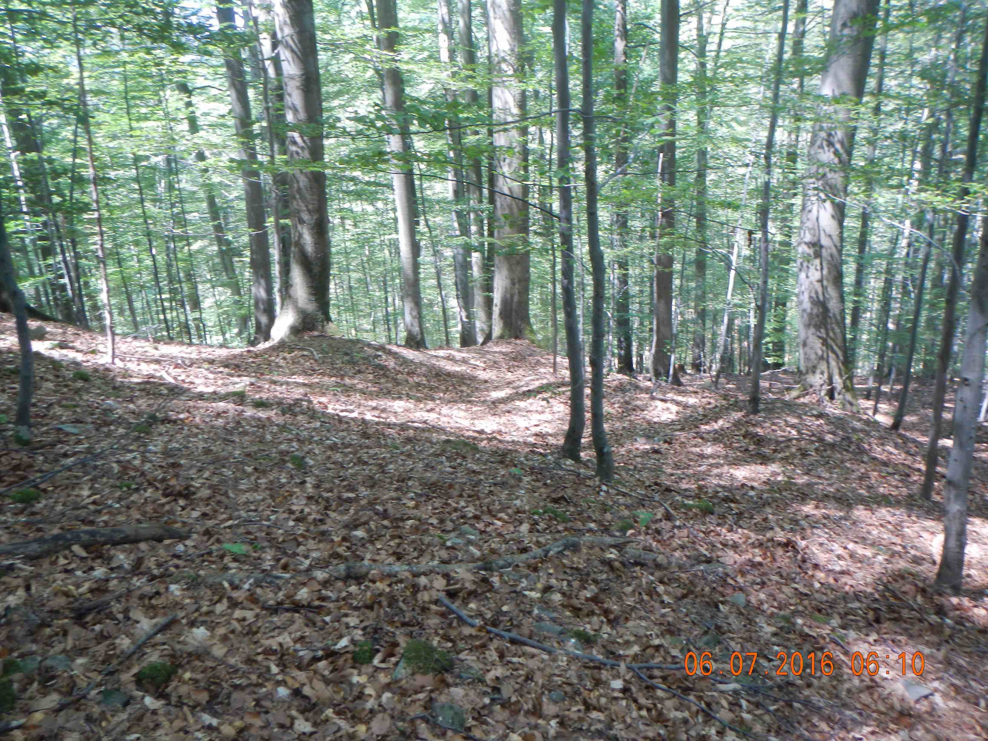
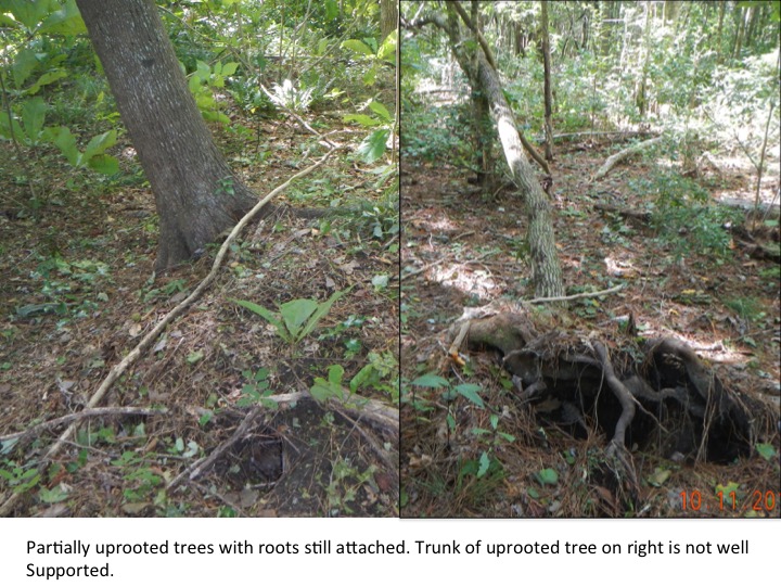
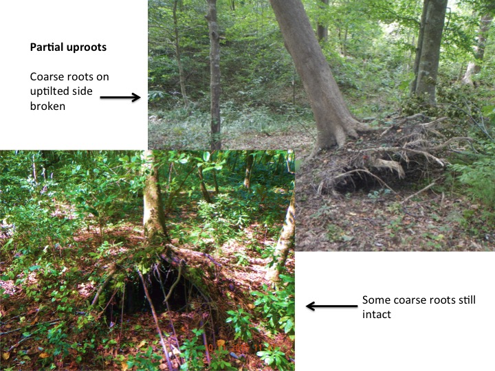
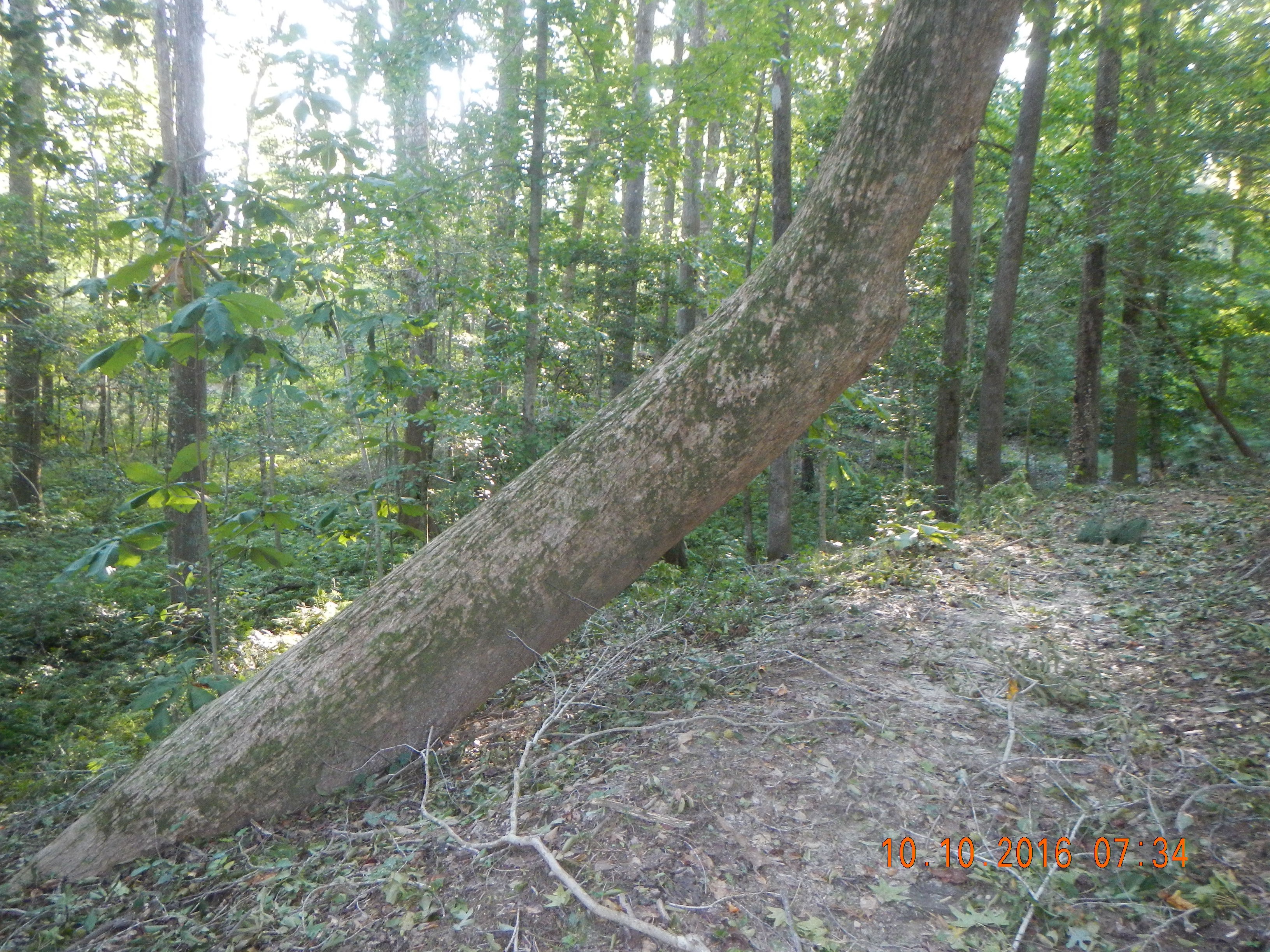
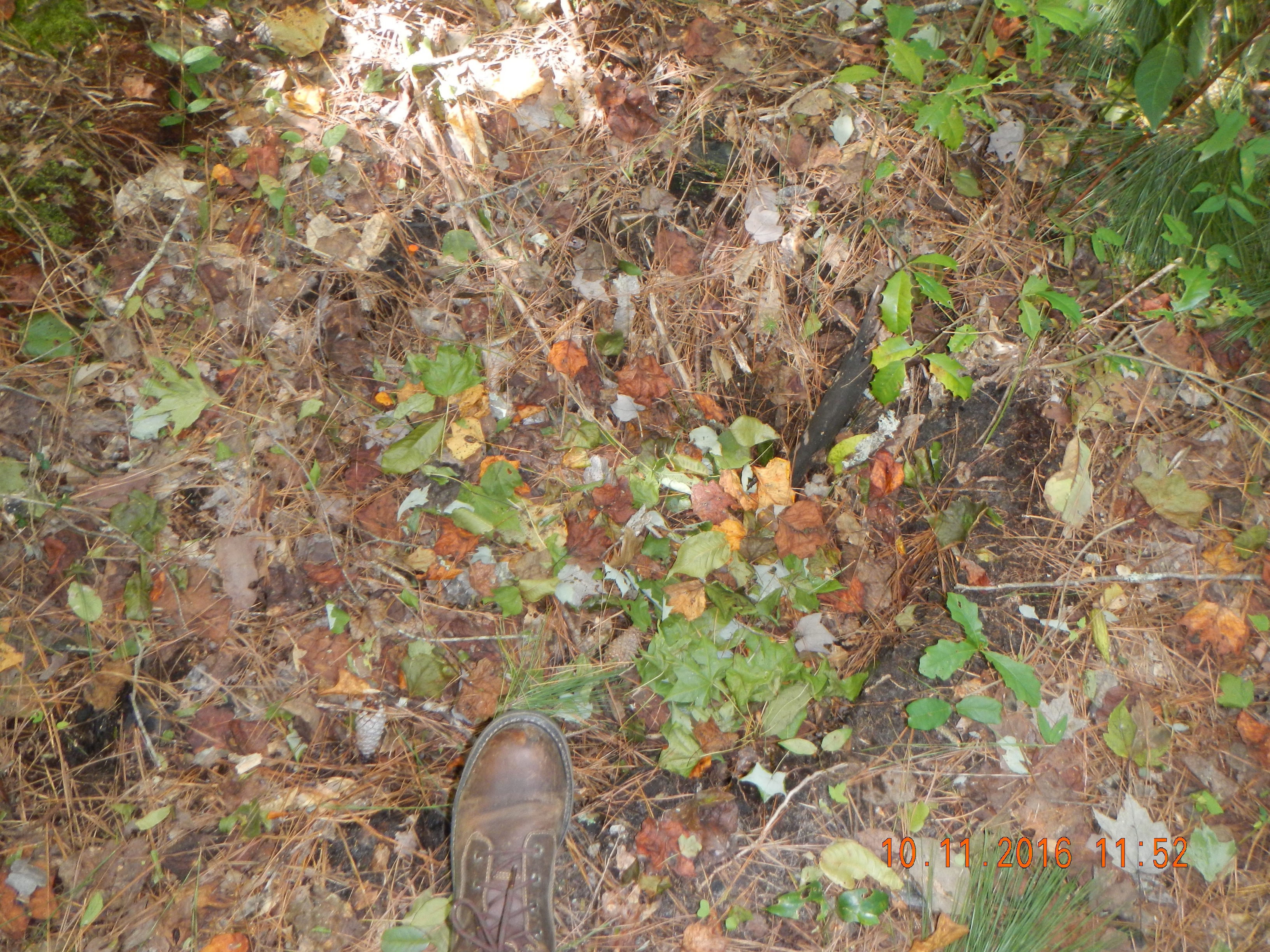
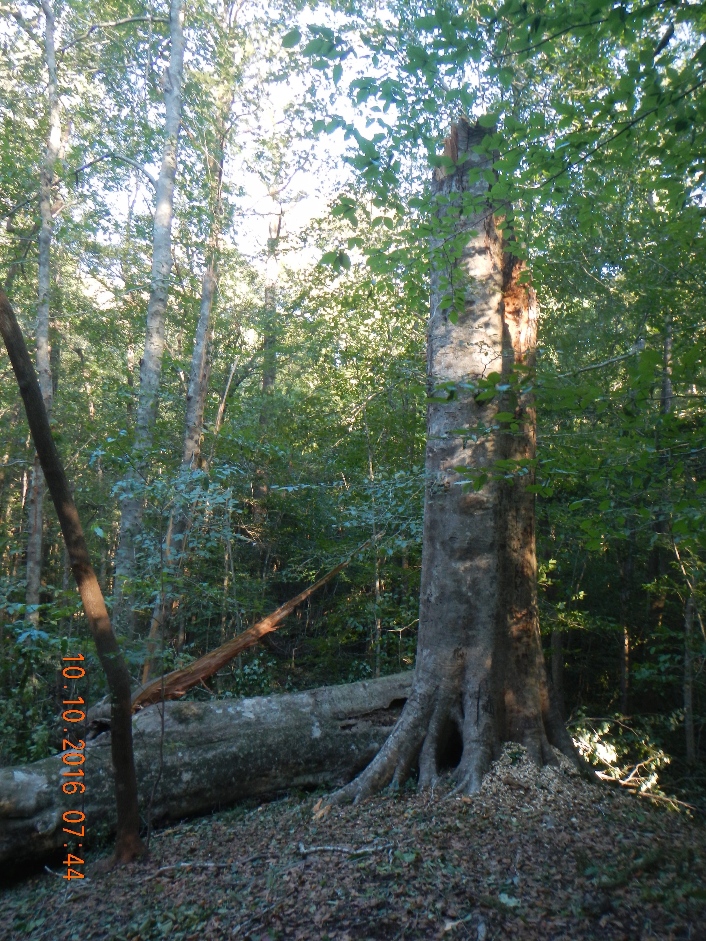
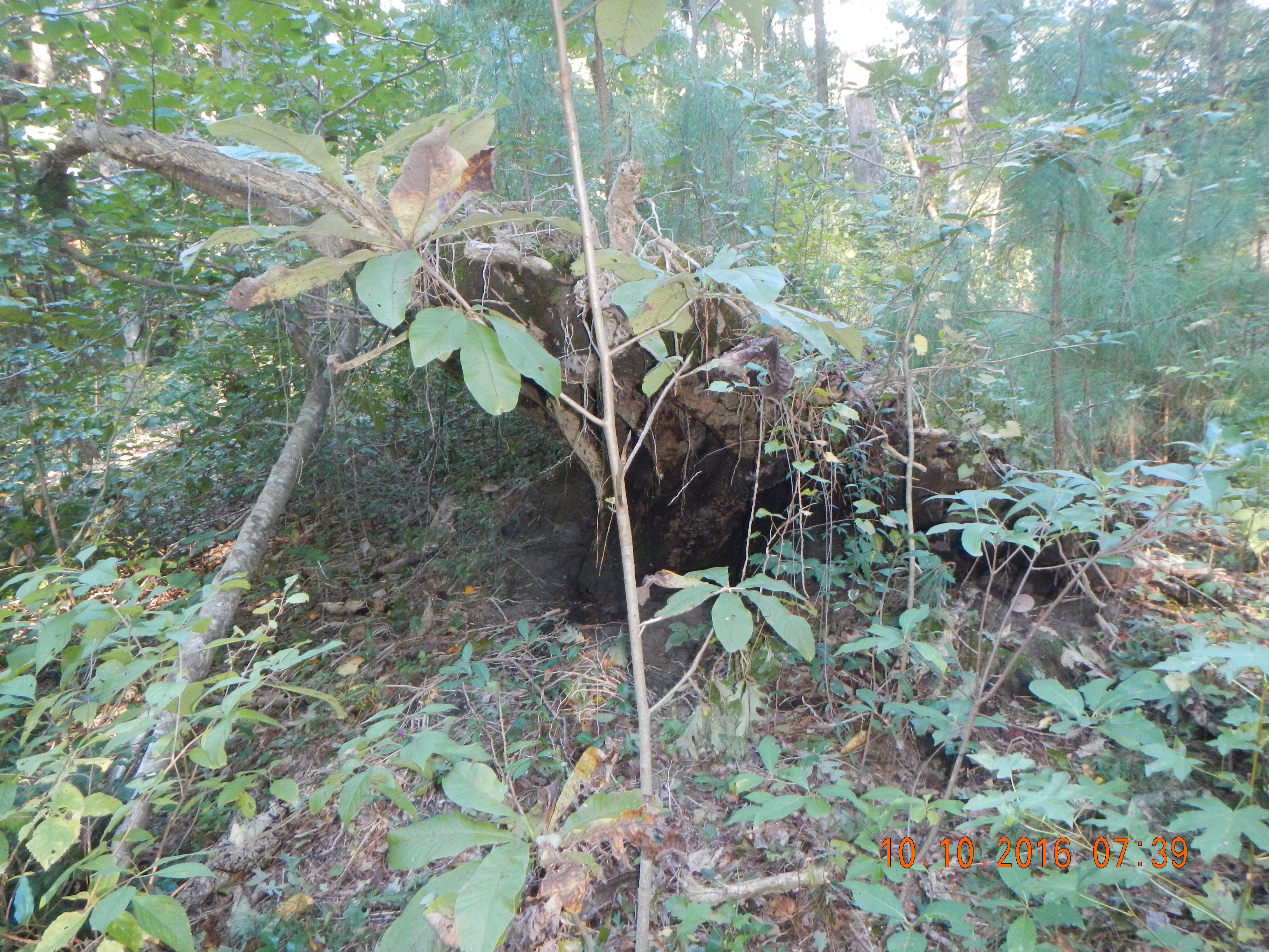
Surface runoff (and other mass fluxes) on this hillslope (Razula, Czech Republic) is disconnected by microtopography associated with tree uprooting.


From my student days onward, the aspects of nature that interested me most were the apparent anomalies--the things that were uncertain and unpredicted; that weren't like they were supposed to be. Nature contains both regular, ordered, predictable aspects, and irregular, disordered and unpredictable facets. As scientists we are taught to focus on the former and eliminate, ignore, or circumvent the latter.  But anyone who spends much time in the field knows that our planet is a source of infinite variety and ever-increasing uncertainty (because the more you learn, the more you realize that you don't know). But what always fascinated me was not that (for instance) the soils or streams or eastern North Carolina or central Kentucky fit, and can be predicted by, some broad pattern. It was the fact that you can often auger the ground at two spots less than a meter apart and find completely different soils, or walk or canoe a stream channel and easily find features not explained or predicted by the conventional scientific wisdom.

Thus my career has focused on spatial and temporal variability in nature; on sources of irregularity and uncertainty.  I have come to view the world primarily through the lenses of spatial variability, historical contingency, nonlinear complexity, etc.  So much so, in fact, that I figured it was time to stop and remind myself (and whatever readers of this blog are out there) of the aspects of nature that DO facilitate predictability and create order.

First and foremost is the fact that Earth surface systems are determined by a triad of factors: laws, place, and history. While place and history factors are geographically and historically contingent, and have to be evaluated on a case-by-case basis, the law factors are general, if not universal, and to the extent we understand them, we can use them to predict.

Second, some phenomena are strongly influenced by predictable cycles. The best known in a geoscience context are those controlled by Earth-sun-moon relationships--diurnal and seasonal cycles and lunar tides. Other celestial mechanics (i.e., Croll-Milankovitch cycles) can also introduce a degree of predictability. Cycles also exist in some biological phenomena (cicadas and other insects; mast production in walnut and other trees, for instance).

Teleconnection patterns in ocean-atmosphere interactions such as the El Nino-Southern Oscillation, Madden-Julian Oscillation, Pacific Decadal Oscillation, etc.  provide some degree of predictability in climate and oceanographic phenomena, though these effects are still being teased out. Note that while the patterns themselves are not always predictable, their impacts on climate and ocean phenomena can be, as well as subsidiary impacts on, e.g., hydrological, ecological, and geomorphological processes.

A fourth source of predictability in Earth systems are circumstances where a single dominant, overriding factor comes into play. A rather obvious example is landscape and topographic change for a site being mined or landscaped for construction. Here the effects and forcings of weather, climate, hydrology, biota, geomorphic processes etc. almost cease to matter--it is the plans and activities of humans that determine the outcome. A meteorological example in the southeastern U.S. is development and strengthening of the Bermuda High. When this feature is in play, the weather is easily predictable (and reliably, nastily hot, humid, hazy, and still).

Rock wearing--an inexorable, unidirectional, irreversible process.

Slowly varying, irreversible, directional processes provide another aspect of predictability. These are basically inevitable trends that proceed irreversibly in only one direction. For example, when rocks are exposed at the surface they began to weather, and continue to do so until they are broken down as far as they can be or something (e.g., deep burial) shuts down the process. General denudation and downwasting is another example--it continues inexorably until complete or the geomorphic clock is reset, even if offset or opposed by uplift.

Finally, even where multiple causality is involved and laws, place and history factors are all relevant, sometimes particular combinations of circumstances provide signatures or diagnostics that can predict or explain. This is the basic of synoptic meteorology and climatology, still a basic tool of forecasting. A comparable approach to hydrology and geomorphology has been applied by a number of researchers, often under the name of event-based prediction or explanation. 

Axiomatic approaches to science and mathematics depend on an underlying set of statements, principles, or propositions that apply to all situations within the domain of study. The axioms run the gamut from undisputed universal laws to widely or even universally accepted but unproved or unprovable generalizations, to propositional stipulations adopted for analytical convenience or because they raise interesting questions.

Examples abound in mathematics and formal logic, and in science, engineering and technological applications of math and logic. Although it is only occasionally referred to as such, the laws of stratigraphy (details in any geology textbook) form an axiomatic approach to sedimentology, sedimentary geology, and related palaeoenvironmental studies. The laws of original horizontality, lateral continuity, superposition, and cross-cutting relationships are assumed in this approach to apply to all sedimentary deposits, and therefore form an axiomatic system for interpretation.

Thinking about these matters inspired me to make a preliminary stab at a set of axioms for geomorphology, which are laid out below. There exist at least three different definitions or concepts of axiom: (1) a self-evident truth that requires no proof; (2) a universally accepted principle or rule; and (3) a proposition that is assumed without proof for the sake of studying the consequences that follow from it. I make no effort to distinguish the axioms below with respect to these categories, or to get into the semantics of axioms, laws, principles, maxims, propositions, guidelines, etc. I do not deny that these differences might be significant, but for me personally that sort of parsing bores me to tears.

Let me also note that there have been previous efforts to lay out a list of key general concepts or principles of geomorphology, admirably summarized by Gregory & Lewin (2014), and including my own 11 principles of Earth surface systems (Phillips, 1999), focusing on nonlinear dynamics.

(Proposed) Axioms of Geomorphology

These are based on the assumption that the ultimate goal of geomorphology is to explain the origin, evolution, and changes in landscapes. I acknowledge that some axioms are irrelevant to specific research problems (e.g., principles related to environmental and historical context are not directly relevant to laboratory experiments).

1. Landscape forms and patterns are indicators (clues) of formative processes and history. This has always been an underlying implicit or explicit assumption of our field, and in many cases is a necessary one, as the long timescales involved prevent direct observation.

2. Different aspects of the landscape are inherently no more or less important as clues or indicators. Key indicators and the ability to interpret them, however, will vary in different situations. This is intended to highlight that we cannot assume that “it’s all about” , for instance, topography or geochemistry in all situations, and that we cannot assume a priori that factors such as vegetation, soil type, grain size, etc. either are or are not key to the story to be told.

3. History matters. Landscapes cannot be fully explained and interpreted without considering their history, including inheritance, path dependence, event timing and sequence, and changes in environmental controls.

4. Geography matters. Landscapes make little sense outside their geographic (place and ecological) contexts.

We can learn a lot from abstract theory, models, and lab work. However, understanding landscapes ultimately requires boots on the ground.


5. Landscape processes, forms and patterns are underpinned and constrained by general laws and principles. These include laws per se and generally applicable principles of (at least) physics, chemistry, biology, geology, and geography. The most important, general, and inviolable are laws of conservation of matter and energy. Thus Landscape systems can be described and understood based on flows, transformations, and storage of energy and matter.  I can’t decide if this should be a separate axiom, or a corollary.

6. Laws, Place, History: landscapes can be understood as representing the combined, interacting effects of generally applicable rules or principles, location- or region-specific environmental influences and controls, and age, time or path-dependent factors (follows from 3, 4, 5).  An essay on this, discussing this axiom and providing some further explanation and justification for items 3-6, is available in online-first form here.

7. Scale matters. The relationships between, and the factors governing, landscape forms and processes vary with spatial and temporal scale or resolution.

8. Selection happens. More durable, resistant, resilient, stable, and efficient forms, patterns, and behaviors are preferentially preserved, and may be reinforced and replicated, relative to less durable, resistant, resilient, stable, and efficient entities. Previous posts on this theme are here, here, here, and there.

9. Selection is non-deterministic. Selection is an aggregate phenomenon, expressed in tendencies and probabilities. It does not always apply or occur in individual cases.

10. Dominant controls.  While many different law, place, and history factors may influence landscapes, for any particular landscape, a relatively small subset of these control landscape evolution and responses. The dominant controls concept holds that while there may exist a very large number of factors and processes that can influence a given phenomenon, in any given geomorphic system some will be irrelevant and others of comparatively negligible influence, leaving a few dominant controls to deal with. In another post I laid out five axioms underlying the DCC, and acknowledging its inspiration from the dominant processes concept in hydrology.  

Comments, critiques, additions, deletions are all welcome. Send ‘em to jdp@uky.edu.


In 2011, a massive flood swept through the Lockyer Creek valley in southeast Queensland, Australia. The environmental, economic, and geomorphic impacts were immense, and Australian geoscientists immediately set out to document, understand, and contextualize them. The “Big Flood” project, led by Jacky Croke, has already produced 19 scientific journal articles, and they just this week went live with their web site, with numerous resources for scientists, managers, and the general public.

Floodwaters in Grantham, QLD, 2011 (http://www.thebigflood.com.au/whathappened.html)

The project has already produced some novel results with respect to flood geomorphology and hydrology, and is unique as far as I know with respect to direct efforts to integrate geoscience research with public policy, public education, and practical land and water resource management.

I recommend you check it out.

Graphic summarizing the multiple approaches employed in The Big Flood project (http://www.thebigflood.com.au/approach.html

SOIL COLORS IN THE NATIONAL PARKS

Those who have worked with soils are familiar with the Munsell system for measuring/assessing soil color, and with the many environmental clues soil color can give us. Now the Munsell company that produces the soil color chips, charts, and books we use in the field and lab has produced a fascinating and visually exciting celebration of soil and its colors, based on the centennial of the U.S. National Park system.

From Munsell's announcement:

The Soil Colors of the National Parks - 100 Years of Conservation & Soil Science

August 25th, 2016 marked the 100 year anniversary of the National Park Service in the United States. In celebration of this historic event, we continue the efforts of others to drawn attention to the importance soil plays in the vitality of these parks. By showcasing the beautiful soil colors of the parks, we can better understand and appreciate the soils surrounding us. Soil color is not just an indicator of the makeup of the soil in a certain region, it can also help to indicate what the soil can be used for, whether it be for food production, maintaining, restoring or rebuilding ecosystems, conserving and promoting biodiversity, viability for water systems, classification of artefacts and more. Soil is the often overlooked “skin of the earth,” so let us “dig” deep and discover.

Read more: http://munsell.com/color-blog/soil-colors-national-parks-anniversary/

Among other things, the site has several examples from national parks, such as this one from Mt. Ranier:

Munsell's site also shows a great graphic of the geographical variations in soil color in the conterminous U.S.A., produced by the U.S. Department of Agriculture's National Soil Survey Center. It incorporates soil color observations over decades of field work to show the patterns of variation at various depths. Check out the site for some geographical interpretation of the patterns shown.


Last year our geography department underwent an external review, as we do every five years or so. One of the recommendations was that we seek to integrate our Earth surface systems and physical geography program with political ecology. We happen to have a couple of political ecologists who understand and appreciate physical geography, and vice-versa. But I wonder what, at the subdisciplinary rather than the individual level,  we really have to offer each other.

Despite the word "ecology" and a tradition early on in political ecology (PE) of careful analysis of environmental change, contemporary PE appears to have very little general concern with ecology as a science (as opposed to ecology as a general reference to the environment, nature, or natural resources) or to other Earth and environmental sciences. This is not true of all PE or political ecologists, of course, and to the extent it is true, is not meant as a criticism of the field. Political ecologists are free to define and practice their field as they see fit, and it is not up to a geomorphologist to decide how central biophysical sciences should be.

But, to those of us on the geoscience, ecosystem science, and physical geography side, biophysical science is what we do. If it is not crucial or significant for PE, then I'm not sure how we are meant to integrate, as political analysis is not significant for our work.

My understanding and interpretation of this eastern North Carolina soil stratigraphy provides no help whatsoever to political ecologists. 

I do not intend to revisit debates within PE on the role of biophysical science, but with a few exceptions (e.g., Karl Zimmerer), definitions of PE do not include or imply inclusion of ecological or geoscience. Piers Blaikie, a godfather of PE (and, by the way, well versed in physical geography and ecology) defined the field this way: ‘The phrase “political ecology” combines the concerns of ecology and a broadly defined political economy. Together this encompasses the constantly shifting dialectic between society and land-based resources, and also within classes and groups within society itself ’ (Blaikie and Brookfield, 1987, Land Degradation and Society, p. 17).

The abstract for the political ecology chapter in the International Encyclopedia of Human Geography (Elsevier, 2009) by R.P. Neumann reads:

Political ecology emerged in the 1980s as an interdisciplinary field that analyzed environmental problems using the concepts and methods of political economy. A central premise of the field is that ecological change cannot be understood without consideration of the political and economic structures and institutions within which it is embedded. The nature–society dialectic is the fundamental focus of analysis. Marxian political economy provided the initial primary theoretical influence, while the development of post-structural social theory and nonequilibrium ecology infused new ideas and concepts in subsequent years. A range of methodological approaches characterize political ecology research, including multiscalar analysis, political-economic analysis, historical analysis, ethnography, discourse analysis, and ecological field studies. Political ecology’s approach to nature–society relations has explicitly linked capitalist development with ecological change across multiple temporal and spatial scales. The field has been an important source of critical analyses of the social and ecological effects of economic development and conservation initiatives, focusing particularly on the material and discursive aspects of property rights. Recent trends and future directions for research include an expanding urban political ecology theme, critical responses to environmental security theory, an engagement with the philosophies of ethics, and a focus on environment and identity.

And, in a keynote address at the 2016 Dimensions of Political Ecology (DOPE) conference (held annually here at the University of Kentucky), Tracey Osborne, Director of the Public PE Lab at the University of Arizona, defined PE as "a highly flexible approach for addressing diverse, shifting and interconnected environmental problems that emphasizes political economy and power relations as causal factors."

Not much call for coastal geomorphology, ecoystem modeling, or bioclimatology there. 

A look at the table of contents of the major texts in PE shows little or no evidence of ecological science. If you look at past programs of the DOPE conference (politicalecology.org) or the contents of the Journal of Political Ecology you see no indication that a biophysical scientist--unless they are deliberately stepping out of their normal activities to address some political economic ramification of their work--has a place there. Again, that's OK--there's not much room for politics in Earth Surface Processes and Landforms or Ecological Modelling either. It just calls into question whether PE is a reasonable venue for physical geographers (and, again, vice-versa).

As a closing caveat, these musings relate to academic and disciplinary matters. In terms of actually addressing environmental and natural resource issues, in my views, it's all hands on deck. Biophysical sciences, social sciences, humanities, engineering--we all have important work to do, together or separately. Sometimes geomorphology or biogeochemistry is the right tool for the job; sometimes political economy or sociology. 

MORE FOREST BIOGEOMORPHOLOGY & GEOECOLOGY

Imagine exploring and mapping a newly discovered cave opening. At this point, there is only one set of questions--how long, deep, tall, wide, etc. is the passage, and where does it go? But as you begin to map it, more often than not, other passages and fissures will be discovered (and many of them will lead to others, and so on). This opens up a whole new set of questions. Some of the passages can be mapped, assuming someone can get the time and resources. Others can't be no matter how skilled the spelunker; they are too small. But even these can possibly be explored later, perhaps with remote control or AI tiny robots or probes; or with imaging techniques that can see through rock.

This is a pretty good metaphor, I think, for research in general. The more you learn, the more you discover you don't know, and more potential pathways for research appear--some possible now, some awaiting new techniques.

I was thinking about that recently, assessing the impacts of Hurricane/Tropical Storm Matthew on a forest in North Carolina (see this previous post). Despite all the work that I and (mostly) others have done on the geomorphological, pedological, hydrological, and ecological effects of strong wind events in forests (due to, e.g., tree uprooting and breakage), every time I look it seems more questions are raised.

What follows are basically observations, questions, and suggestions, with limited answers or insight. All photos are from the Croatan National Forest in Craven County, N.C.

I already talked about wind-driven uprooting vs. breakage, but in my further forays into the forest I noticed more partially uprooted trees. In the cases I observed, this happened because the tipped-over trunk is blocked by other trees. Thus, you'd think denser vegetation and closer tree spacing would favor this phenomenon. However, in some cases uprooting of one tree can cause a chain reaction, knocking others over (either directly, or in concert with the wind). I observed this also, but didn't get any really good pictures.

Even among the partial uproots, we see variations in the extent of root exposure & breakage on the uptilted side--compare the photos below to those above.

At least some of the trees simply continued growing in their tilted position, reorienting their trunks, and/or sending up new vertical branches from the tilted trunk.


Speaking of tree spacing, check out the picnic area below, where there was no uprooting or breakage at all, despite the greatest exposure to winds off the Neuse River estuary of any site examined. Possible reasons--removal of unhealthy or dead trees by the forest service, and better drainage than many of the other sites I looked at.

Breakage vs. uprooting also depends on the type of tree and its root system:

For dead trees, or living trees with unhealthy root systems, shallow uprooting may occur--that is, the rootwad will consist of just a thin layer of soil. This results in a much smaller microtopographic feature (smaller mound, shallower pit) than uprooting of a live tree with healthy roots.

Also observed some trunkwash, a phenomenon my colleagues and I recently recognized in this article. The net effect of trunks and branches lying on the ground seems to be bioprotection and upslope sediment retention, but sometimes the funneling of runoff results in some slopewash on the downslope side.

Since 2004, I've been harping on the idea that trees preferentially reoccupy the same microsites, with implications for weathering and soil formation. Those who've spent a lot of time in the forest have noted plenty of stump-sprouting (new shoots and ultimately in some cases trunks) from stumps. In some cases, however, a different species can sprout from a stump, or trees of two different types may essentially share a microsite--this may happen when animals (e.g., squirrels) bury a nut or seed beneath roots of living trees.

But what determines whether the rotted stumps host new trees before a depression can be formed, vs. forming a stumphole, like the one below? And we still don't know much about the extent to which (or circumstances under which) stumpholes infill via slumping of the surrounding soil, deposition of transported sediment, or organic litter.

Finally, it used to be thought that there was little or no water erosion in the flat coastal plain. However, that was disproven for good back in the 1990s (see, e.g., this and this). At least some of the water's gotta move, and when it does it takes some sediment with it, as the rill below shows.

CZECH IT OUT!

A forest biogeomorphology two-fer, courtesy of my central European boyz, who have graciously allowed me to ride their coattails here in the twilight of my career. The first is one where Pavel Daněk took some of my ideas and methods on applying graph theory to soil geomorphology, and went places with them I never even imagined:

Daněk, P., Šamonil, P., Phillips, J.D., 2016. Geomorphic controls of soil spatial complexity in a primeval mountain forest in the Czech Republic. Geomorphology 273: 280-291.

The second is one  that arose when Pavel Samonil took me to one of his field sites, where I saw things I hadn't imagined:

Phillips, J.D., Šamonil, P., Pawlik, L., Trochta, J., Daněk, P., 2017.  Domination of Hillslope Denudation by Tree Uprooting in an Old-Growth Forest. Geomorphology 276: 27-36.

The abstracts are below.


ON BEING WIDELY IGNORED (OR NOT)

In the brief biography on my departmental web page, I refer to myself as the "author of a vast number of widely-ignored articles."  This statement reflects the lifelong tug-of-war between my inherent boastful, egotistical leanings and the humility my parents tried, with mixed success, to instill. Thus the boastful "vast number" juxtaposed with the humble "widely ignored." The latter, by the way, is based on the relatively low number of citations and other metrics generated by ISI, etc., compared to the most popular and influential scholars.

I revisit this because I got an e-mail from a master's student working on a research paper who asked: "When going through the bio section of the webpage for the university you work for, it says that a lot of your work is widely ignored.  I am wondering why this is, as I have seen some of your work and think it is fascinating.  Maybe you could help me in this matter by explaining a little further?" The egomaniac within wants to answer that it is because I am so far out front that few have caught up with me; a genius-ahead-of-his-time narrative. The answer dictated by my upbringing (which in this regard is typical for anyone of my generation raised in the small-town or rural USA) is that I just need to try harder and do better (and thanks for the compliment!).

But really, why do scientific publications get ignored, or not? I tried to think this through both in general and in my case.

First, of course, is the awful possibility that the work is simply crap. The conclusions or interpretations are wrong or unsupported; methods or data of poor quality; the results are unhelpful or uninteresting; the findings are old news; etc., etc.  Though some of my work has flaws and errors, and some has certainly been improved upon, I can't bring myself to admit that any of it is simply too bad to be worth a read (though I have to acknowledge that possibility). As far as I know, no one has shown that the major findings of any of my papers is dead wrong (although maybe no one thought it important enough to try).

I hope my work isn't registering too far on the left of this meter.

Second, even if the science or scholarship is good, the presentation and communication can be so poor that its quality, value, or interest is unclear or invisible. Again, I can't bring myself to confess to this crime (I was a journalist in a brief earlier professional life), though some referees have disagreed. But there's no doubt I could do or have done better in this regard. I do try. For example, one paper that I think has some of my most interesting theoretical results just proved hard to write up. If I had figured out a way to communicate it more clearly, it might have gotten more than the 18 citations (2 by me) in 11 years that is has garnered.

Third, a solid, well-written paper may simply deal with an unpopular topic. The subject may be outdated, esoteric, or simply unfashionable. In the 1980s, for example, I did a bit of work on soil erosion modeling. One journal reviewer remarked that one of my papers was sound enough and useful enough, but that erosion assessment was so dominated by the U.S. Department of Agriculture's programs and paradigms that it was pointless to publish alternatives. Since my approach was geared toward on-the-ground practical applications rather than theory, why bother? The article was rejected, though I eventually put it into an obscure proceedings volume.

Which brings us to item four, obscure venues. Work can escape notice because it is published in things few people read. These can be regional journals of limited circulation, proceedings, technical reports and other "gray literature," and other outlets of limited circulation. I have indeed published three times in a regional journal (The Southeastern Geographer, which is actually a good-quality journal). I also had the misfortune of putting what I still think is a pretty good paper into Geographical and Environmental Modeling. Never heard of it? That's because it lasted only six years, and my paper was in its very last issue in 2002.

This does not apply to yours truly, but increasingly "obscure" can mean non-English. Most international scientific literature is now published in English, so even excellent highly relevant work published in prestigious outlets in another language can get ignored.

Fifth, I should note that poorly cited does not necessarily mean ignored. Some work (e.g., "thought pieces," reflections on scientific trends and practice, etc.) may be widely read and assigned in graduate seminars without being cited. Also, some applied or technical/methodological research may be used or applied in practice without being cited much in the literature.

Here I am not being ignored, by some of my beloved students who brought me a gift basket (containing two of my favorite things, Kentucky bourbon, and chocolate) following my recent heart surgery.

Sixth, maybe politics plays a role. I have no reason to believe that any of my work has ever been given short shrift due to any of my scientific connections or allegiances, or my methodological affinities. However, I firmly believe that this has happened to some geoscientists whose work deserves better. And I know damn well it happens in social sciences and humanities, where politics are (unavoidably) more prevalent. I have even heard rumors of "citation circles"--scholars who agree to cite each other's work.  Certainly sociology and politics can play a positive role--being wired in with an "invisible college" can ensure your publications get noticed, and increase the likelihood of citation.  This is sometimes absolutely innocent--it is simply human nature that you are more likely to pay attention to work by people you know.

Seventh, and finally, there is (at least I fervently hope, in my case) always the possibility that the work is ignored because it is indeed ahead of its time; so advanced and/or innovative that few are prepared to deal with it. One can always hope . . . .

Image: http://www.devinchughes.com


HURRICANE MATTHEW & FOREST BIOGEOMORPHOLOGY

Hurricane Matthew devastated Haiti and other Caribbean areas, and did tremendous damage in Florida and South Carolina (I rode out the storm in Myrtle Beach, SC with my son Nate, his wife Morgan, and my delightful 2-year-old granddaughter Caroline). By the time it got to North Carolina, winds were down to gale force, but rain was ferocious (15 to 40 cm) in much of eastern N.C. Where I am at the moment, in Croatan, there was "only" about 10 cm of rain, and only gale force winds. However, that was enough, as it usually is, to get some geomorphic work done in the forest.

Below are some photos of trees uprooted by the storm in Croatan National Forest in the Flanner Beach area. Uprooting not only does significant soil mixing, but the pit-mound topography left behind significantly influences hillslope and soil processes for decades (and occasionally longer) thereafter.

Another example from a cemetery near Maysville, N.C.

Despite the wet ground (which facilitates uprooting), there was a lot of breakage at the Croatan/Flanner Beach sites. This is common for pines in the coastal plain, which have a deep taproot and are well-anchored. Hardwoods such as oak and beech, in this setting, tend to have shallower root systems and are usually more likely to uproot. Today, though, I saw a number of broken hardwoods:


The geomorphic impacts of broken trees are not as immediate as those of uprooting, beyond the sudden addition of a lot of biomass to the surface at one time. However, as the stumps decay, they leave behind depressions (stumpholes) and root channels that strongly influence both surface and subsurface water and sediment fluxes. Below is a stumphole from an older event at the same site; it's more than a meter across.


This area is prone to tropical cyclones and midlatitude cyclones (northeasters), so events that cause a number of tree uproots and breakages come along every few years. The Flanner Beach site includes several generations of uproots, for example. How can you tell the old ones from the recent ones? Actually it's pretty easy now; the hardwoods still have their leaves here, and the understory is still green. So the trees uprooted in Matthew still have green leaves, and have crushed green plants below them. In this subtropical environment plants grow fast, and even the soil on a rootwad quickly gets a vegetation cover. Below is a tree that was uprooted several years ago, and cut because it fell across a trail. The rootwad ended up almost upside down above the ground surface, and is now home to a mini-forest of approximately 5-year-old loblolly pines.

Forest biogeomorphology involves the reciprocal interactions between biological effects of trees on geomorphology, and geomorphic effects of topography, soil formation, drainage, etc. on trees. This Matthew-uprooted tree shows the flattening or spreading of roots that often occurs here due to high water tables--similar phenomena occur in other environments when roots encounter bedrock.

As coincidence would have it, the storm came along just as my coauthors and I got word of acceptance of an article on the domination of hillslope denudation processes by tree uprooting (in a much different environment in the Carpathain mountains). The preliminary version is available via http://authors.elsevier.com/sd/article/S0169555X16305001. When the final version is published, I'll let you know with one of my shameless self-promotion posts.