
Blogs

GEOPHYSICAL ADAPTATION

Can geophysical systems adapt to changing environmental conditions or to disturbances, in a way broadly analogous to biological adaptation, but independently of any biological components? Yes, according to my analysis using the example of hydrological systems. Just published in Ecohydrology, https://doi.org/10.1002/eco.2567 and attached here. 

hydrological adaptation

ABSTRACT: The question of whether the concept of adaptation can be applied to Earth surface systems (independently of biological adaptation) is addressed by examining hydrological flow systems. Hydrological systems are represented in terms of a partitioning of water inputs among various flux and storage components and outflows or outputs of the system. Partitioning is contingent on the flow system in question and the synoptic situation (i.e., drier, low-input vs. wetter, high-input conditions). The general allocation among inputs, flows through or within the system, storage and outputs is examined via analysis of 20 scenarios for soil hydrology, a fluvial channel-wetland complex and a fluviokarst landscape representing different combinations of positive, negative and zero (neutral) relationships among these elements, and positive self- reinforcing and negative self-limiting effects. Conditions for stability were determined using the Routh–Hurwitz criteria and linked to the two fundamental roles or ‘jobs’ of hydrological flow systems. The ecological job is to support biota and biogeo- chemical fluxes and transformations necessary for ecosystem functions. The geophysical job is to remove excess water. Results show that low-input scenarios for the soil, fluvial wetland and fluviokarst scenarios are marked by dynamical instability. During drier periods the geophysical job is irrelevant and the ecological functions are suboptimal. Instability allows for rapid state changes when moisture inputs increase, to system states that support ecosystem functions. High-input, excess moisture and flood scenarios, by contrast, are generally dynamically stable. In wetter conditions, the ecological functions are not moisture-stressed, and the geophysical job becomes paramount. The high-input stability is associated with activation of ‘spillway’ mechanisms that allow the systems to maintain themselves by efficient export and augmented storage of excess water. Contingent partitioning indeed appears to be an adaptation mechanism in hydrological systems and suggests the possibility of adapta- tion in other Earth surface systems with important abiotic components.

Attachments:

CLIMATE ATTRIBUTION IN GEOMORPHOLOGY

Just published, in Geomorphology (Vol. 403, article no. 108666): Landscape Change and Climate Attribution, With an Example From Estuarine Marshes.

Climate change and related effects such as rising sea-levels and increased frequency and severity of severe storms and fires is resulting in geomorphological, hydrological, ecological, and pedological change. But landscape change is influenced not only by climate and severe meteorological events, but also by a host of other environmental factors, not least human impacts. How can we sort out the effects of recent and ongoing anthropically-driven climate change amidst all the other signals (and noise)?

The science of attribution of weather events and episodes, developed to address the issue of the extent to which human-driven climate change causes or influences such events (or not), is advancing rapidly. But attribution of landscape responses adds several additional causal layers to unravel due to all the non-climate factors involved.

LRA protocol

This paper is my attempt to work out a protocol to address landscape response attribution (LRA). It is based on proven, traditional methods in field and historical geomorphology and to varying extents represents existing practice in historical branches of Earth and environmental sciences. The LRA protocol, presented in the form of a decision tree, is more a checklist than a specific methodology. As problems of LRA span the entire range of geomorphology (and ecology, hydrology, etc.) the potentially applicable methods and techniques are as broad as the discipline itself.

The abstract is below, and the article is attached.

abstract


Attachments:
LRA.pdf (5.41 MB)

ACTIVE & PASSIVE HYDROLOGICAL RESTORATION

A recent article in Coastal Review (a service of the North Carolina Coastal Federation) about the possibility of “farming carbon” in peatlands of northeastern North Carolina via carbon sequestration and trading and carbon trading markets caused me to revisit some work from my younger days—a frequent diversion for old codgers like me. Many of the pocosin wetlands were artificially drained by ditches and canals sometime between the 18thcentury and the 1980s, and the key to maximizing carbon sequestration there is restoring the wetland hydrology. Back in the 1980s I did some work on artificially drained peatlands in the region, and in the 1990s on other artificially drained farmland in eastern N.C. One of the bottom lines was that this is a case where passive restoration works. In other words, if you simply don’t maintain the ditches and canals, they rapidly lose conveyance capacity and essentially become linear ponds. In some contract work I did for the Croatan National Forest in N.C. in 1997, in fact, I recommended passive restoration—there was no need to fill in canals or remove water control structures, etc. Just let the channels deteriorate and leave the structures in obstructing mode (i.e., leave the boards in the flashboard risers).

canal maintenance

Drainage canal maintenance in N.C. peatlands. To restore wetland hydrology, don’t do this! (Photo: National Wildlife Service).

A key site for restoration is the Pocosin Lakes National Wildlife Refuge, so I took a look at their (draft) water management plan. It basically confirmed what we had figured out in the 1980s. Their no-action alternative and their proposed plan of action essentially concluded that simply leaving things alone, drainage-wise, would have no significant adverse impacts and would restore the wetland hydrology. The only significant differences between the proposed plan and the no-action alternative are extensive monitoring in the former (and as a scientist, who can argue with that?), as well as some new water control structures. I have not analyzed the plan in detail to give an opinion on the necessity of the latter, but I do recognize that national wildlife refuges are indeed managed to optimize habitat for target species, and the NWS may well want or need to do some active water control to create or maintain habitats or manage fire risks (when it dries out, peat burns!).

restoration site

Wetlands restoration site in the Pocosin Lakes National Wildlife Refuge (Photo: The Nature Conservancy).

I was, at first, mildly miffed that the NWS folks did not cite any of my work from the old days (the academic ego remains healthy even in retirement). However, upon revisiting it, I realized that much of that work focused on issues other than hydrological restoration, did not deal specifically with pocosins or peatlands, or mentioned the passive restoration opportunities only in passing. The only exception, based on the M.A. thesis work of Don Belk at East Carolina University and lead-authored by Don, was published in a conference proceedings volume that could be easily overlooked. Don’s work showed that hydrological restoration of Altantic White Cedar wetlands in northeastern N.C. could be accomplished by simply leaving the flashboard risers in, and not cleaning out the ditches and canals (which must be cleared every couple of years to keep them flowing).

There is an active debate in the hydrological and ecological restoration literature about passive vs. active restoration that I have no intention of getting into. Passive restoration is not always the best choice; it may be too slow or may not achieve the desired objectives. However, it should always be an option on the table, for two main reasons. First, nature usually knows best, and can often do what needs doing better than we can. When feasible, resist the temptation to tinker! Second, assuming something is already set aside for restoration, the costs are zero.

FOR PEAT'S SAKE . . . .

In the lower reaches of some coastal plain rivers there is a transition from mineral to organic alluvial soils, which appears to mark the leading edge of effects of sea-level rise. This post is part of project to address the question of how a river, swamp, or floodplain undergoes a transition--apparently relatively suddenly in some cases, judging from stratigraphy--from a muddy or sandy, mineral-dominated state to one that is overwhelmingly composed of organic matter? For background, see this previous post. 


The formation of peats and mucks depends on a rate of organic matter production by vegetation that exceeds the rate of decay and decomposition (or combustion). The classic setting is a peat bog, where wet, anaerobic conditions slow decay in conditions where organic matter as well as water tends to accumulate. These are most common in higher latitudes, where cold as well as water saturation retards decay, but peat bogs called pocosinsoccur in the Atlantic coastal plain from southern Virginia to northern Florida, and are particularly common in North Carolina. 


Pocosin peat


Pocosin peat soils on a hemp farm, Dare County, N.C. (photo: Blacklands Botanicals, LLC). 


Both peat and muck soils are composed primarily of partially decomposed organic matter. Peats are generally coarser, more fibrous, materials; mucks tend to be fine-grained, more colloidal, and more highly decomposed. Peat and muck layers are described as O-horizons in soil descriptions, and peat and muck soils are classified as Histosols in the World Reference Base for Soil Resources and U.S. Soil Taxonomy. You will also see descriptions of transitional layers (e.g., mucky peat; mucky clay loam). 


Histosols


U.S. Department of Agriculture map of Histosol distribution in the U.S.A. 


Unlike peat bogs and the isolated wetlands where peats and mucks usually form, alluvial swamps often have water flowing through, in, and out. This is demonstrably true in the lower Neuse River, N.C. (Phillips, 2022), and in other rivers of the Carolinas I have observed, including the Tar-Pamlico, Cape Fear, Waccamaw, and Pee Dee. Thus, it is not obvious—at least not to me—why the conditions for peat/muck accumulation are so readily achieved in some alluvial settings, where (at least intuitively) some flushing of particulate organic matter and even wood should occur. 


One possibility is that the organic-soil alluvial swamps are sinks for transported organic matter—that is, the input of fluvially-transported material exceeds the output. This could conceivably occur due to backwater effects, which is at least broadly consistent with their location in fluvial-estuarine transition zones in many cases. 


The three recognized soil series of interest in this project are the Dorovan, Hobonny, and Chowan series. Below is a screenshot from the Series Extent Explorer showing where these soils have been mapped in the U.S. 


3 series map 


The official description of the Dorovan series from its type location in Mississippi is shown below. The Hobonny series, named for the Hobonny Plantation, a former rice plantation in South Carolina, is similar, but less acid—a Euic (vs. Dysic for the Dorovan) thermic Typic Haplosaprist). The Chowan series, first recognized and named in Chowan County, N.C., is basically a histosol similar to the Dorovan or Hobonny that has been buried by recent mineral sediment deposits. The Chowan, a Fine-silty, mixed, active, nonacid, thermic Thapto-Histic Fluvaquent (gotta love those Soil Taxonomy monikers), typically has 40 to 100 cm of loamy mineral sediment with minimal pedogenic development overlying sapric muck or peat. Because the surface layers are nonacid (atypical for the region), their presence is attributed to runoff and erosion from nearby limed uplands, an interpretation I agree with. 


Dorovan OSD


In ongoing and future work I’ll be looking at the geography of these soils, including where they are not found in the lowermost fluvial reaches or fluvial-estuarine transition zones of coastal plain rivers. I’ll also be exploring how (or if) their distribution corresponds with other indicators or controls of sea-level effects on rivers (see Phillips, 2022). 


----------------------------------------------------------------------


Phillips, J.D. 2022. Geomorphology of the fluvial-estuarine transition zone, Neuse River, North Carolina. Earth Surface Processes and Landforms 47: 2044-2061 (attached).

Attachments:
Neuse FETZ _0.pdf (31.27 MB)

MUCKING AROUND IN THE SWAMPS

As rivers flowing across the coastal plains of the Carolinas approach the coast and their estuaries they widen, split into multiple channels, and flows can slow or reverse as astronomical tides, wind tides, and storm surges downstream have their effects. And on their floodplain swamps, the sandy and muddy soils and sediments give way to organic mucks or peats.

Thorofare Island

Area of organic muck soils, Thorofare Island, Waccamaw River, S.C.

For instance, on many North Carolina rivers these soils are mapped as the Dorovan series (for you fellow soil nerds, Dorovan is a Dysic, thermic Typic Haplosaprist; the official series description is here). These are typically 1.3 m or more of muck, peat, or mucky peat overlying mineral sediments.

Profile

Example Dorovan soil profile, based in the series type location in Mississippi.

Back in the 1980s, the venerable soil geomorphologist Raymond Daniels recognized the Dorovan muck as representing the leading edge of the effects of Holocene sea-level rise on floodplain geomorphology and pedology along N.C.’s coastal plain rivers. In my early 1990s studies of those rivers, after comparing the geography of the Dorovan series with other controls and indicators of the relative effects of upstream and downstream controls on sediment transport and river morphology, I agreed. Still do.

Neuse backwater

Typical area of Dorovan muck, backwaters of lower Neuse River, N,C.

I’ve returned to the Dorovan muck and similar soils recently as I’ve been working on effects of climate, sea-level rise, and direct human modifications on lower coastal plain rivers, and doing a lot of kayaking in the mucky parts of some of those rivers. The key question is how does a river, swamp, or floodplain transition--apparently relatively suddenly in some cases, judging from stratigraphy--from a muddy or sandy, mineral-dominated state to one that is overwhelmingly composed of organic matter?

soil map

Soil map showing transition from mineral Chastain soil series (symbol Ch) to the Dorovan mucky peat (symbols Dk, Do) along the Roanoke River near Williamston, N.C. From SoilWeb (https://casoilresource.lawr.ucdavis.edu/gmap/)

You could see this as a local or regional puzzle to solve, and you would not be wrong. But solving (or at least addressing it) could shed some light on wetland evolution and development, the little-understood dynamics of fluvial-to-estuarine transition zones, and sea-level impacts on rivers. The areas characterized by Dorovan and similar soils are part of landforms and ecosystems that have very high values for wildlife habitat, flood and storm protection, water quality, and recreation. They are also highly vulnerable not only to sea-level rise, but also rampant land development, in some cases at a nearly crazed pace (see Horry County, South Carolina for instance). While the wetlands themselves may be protected from the excavators and bulldozers, the adjacent wetlands are subject to their adverse impacts on water quality, habitat and hydrological connectivity, and space for responses to sea-level change.

As indicated above, the geography of these soils seems to be a good indicator of the leading edge of relative sea-level impacts. As I will discuss in a future post, multiple possible factors may be involved in the transition, so the story of the alluvial mucks may shed light on the common phenomenon of multiple causality in Earth surface systems. The mineral-to-muck (or peat) shift is also an example of a system transition that may represent, and shed light on, the broader study of regime shifts and tipping points.

All of these will be explored as this project proceeds.

NEW YEAR, NEW STRATH TERRACES

Fluvial (river or stream) terraces are former active floodplain or channel surfaces that become isolated from regular flow or inundation by downcutting (incision) of the channel. Alluvial terraces start as predominantly depositional floodplains, but as the river incises, they eventually become isolated from flooding and deposition in all but the largest, rarest floods. Strath terraces are erosional surfaces associated with former channel positions; again, separated from river flows by downcutting of the channel.

Polly's Bend

Polly’s Bend, Kentucky. The T1, T2, T3 areas are strath terraces in oldest-youngest order. Base map is shaded relief based on 1.5 m resolution digital elevation model. Area shown is about 2.7 km (north-south) by 2.5 km (east-west). Coordinates at center are 37.8022° N, 84.6472° W (Fig. 2 from Phillips, 2018).

The strath terraces I am most familiar with occur on slip-off slopes on the inside of incised meander bends of the Kentucky River. As the river has incised over the past ~1.5 Ma, the meander bends have also extended by erosion on the outer bend, as meanders do. This leaves abandoned erosional surfaces on the inside of the bend, as shown below. This is described in Phillips (2018; attached).

Bowman's Bend

Bowman’s Bend, Kentucky. The T1, T2, T3 areas are strath terraces in oldest-youngest order. Base map is shaded relief based on 1.5 m resolution digital elevation model. Area shown is about 3.2 km (north-south) by 3.5 km (east-west). Coordinates at center are 37.8161° N, 84.6927° W (Fig. 2 from Phillips, 2018).

Recently I had the chance to observe formation of some strath terraces that occurred over a matter of <24 hours in a small, flashy stream flowing across a sandy estuarine beach.

Figure 1

Freshly formed strath terraces near the outlet of Tadpole Swamp Creek. Arrows show two terraces and (at bottom) a channel on the verge of being abandoned to form a third.

Tadpole Swamp Creek is a small tributary of the Neuse River estuary in Craven County, North Carolina. The creek terminates in a deepwater hardwood ravine swamp near the estuary. Before 2018 there was an incised channel connecting it to the river. In September 2018 deposition from Hurricane Florence plugged the channel. Outflow from Tadpole began spilling out from several locations along the swamp edge (the swamp is perched on a Pleistocene swamp paleosol roughly a meter above mean river and sea level). New channels are starting to incise, and during normal conditions all flow except for a few small seepage points is via a single outlet. At higher flows, however, multiple channels at the outflow are activated or formed, as the still-forming main channel cannot handle the flow.

Figure 2

Outflow(s) of Tadpole Swamp Creek on 1 January 2023.

Heavy rains came in late December 2022. The swamp flowed, or overflowed. On the morning of New Year’s Eve, I counted 11 channels that had recently been flowing across the beach, 8 of which still carried at least a trickle.

As the substrate is mainly loose sand, channel erosion is rapid. However, the stage of the outflow also declined rapidly as the channels incised, and as flow diminished after the rains ended. This left behind multiple channels and strath terraces, which will be preserved until the next large outflow rearranges things, or the next northeaster storm pushes the estuary waters to the edge of the swamp and resets the stage for the outflow fluvial features (rearrangement of the beach and outflow by waves and/or outflows occurs dozens of times a year).

Figure 3

Arrows indicate strath terraces on one of the outflow channels.

There existed several cases of formation of strath terrace islands, as shown in the photographs below (highlighted by boxes). These formed as flows bifurcated during incision. This is a common phenomenon in braided channels, but isolated alluvial terrace remnants (islands, as opposed to terraces along the valley side) also occur.

Figure 5

Figure 5

------------------------------------------------------------------

Phillips, J.D. 2018. Historical contingency in fluviokarst landscape evolution. Geomorphology 303, 41-52 (attached).

Attachments:

UNDERWATER TREES

Tupelo gum and bald cypress (Nyssa aquatica and Taxodium distichum) are the main trees you are likely to find in perennially flooded deepwater swamps and stream channels in the southeastern U.S.A. Once established, they can grow in sites that are always inundated. However, they cannot germinate from seeds and establish seedlings in standing water. The substrate must be exposed at least once, at the right time of year, for that to happen. 

So how come you can find cypress and tupelo growing in perennially flooded areas, in standing water, that apparently never dry out? How do they get a start on the bottom of a stream or lake?

Pinetree Creek, an anabranch of the lower Neuse River, N.C.

The obvious answer is that they (or their parents, if they grew from stump sprouts or nurse logs) got their start when the site was not flooded, or always inundated, or that they got their start on some raised spot within the water that is no longer evident.

Here’s the problem, as I see it. I see these underwater-base trees in situations where there appears to be no evidence, or reason to believe, that they have ever dried out, at least within the time span of even two or three generations of trees. They also sometimes occur far from any banks or higher spots, in deep water where there is no extant evidence of channel change. In many cases these occur in systems where no mid-channel bars occur, and though I look for them, I have not yet seen any examples of cypress or tupelo growing on nurse logs or stumps of other species (though Taxodium and Nyssa stumps do frequently survive as germination sites for other species, and stump sprouting does occur, though only occasionally with cypress). Just because I haven’t seen something does not mean it hasn’t happened, of course, but I feel a lot better when there exist empirical examples of proposed or supposed phenomena. 

Lower Neuse River

My observations are based mainly on field observations in the lower Neuse River, North Carolina, and other nearby rivers and swamps, and the lower Waccamaw River, South Carolina. I’ve been in a lot of other low-gradient rivers and swamps, particularly in Texas, Louisiana, and the Carolinas, but not when I had begun thinking about this problem, so I was not on the lookout for evidence pertaining thereto. 

Once a tree becomes established at a site, stump sprouting or germination on emergent (above the water line) nurse logs or stumps is possible. Establishment on exposed rootwads of uprooted trees is also possible (though again, I haven’t seen that for the case of tupelo or cypress). But how does the initial drowned-base tree get there?

Backwater of the Waccamaw River, SC.

Let’s walk through some possibilities.

1. Water drawdown or drying allows seedling establishment, followed by reflooding. This could happen during extreme droughts, due to flow diversions, or due to temporary upstream damming (e.g., by beavers or logjams). I am skeptical of the drought/climate explanation in my field sites, as there is no record of any drought severe enough to dry out some of these features, or of any Holocene climate drying that could account for it. The diversion and damming are plausible; the lower Neuse is teeming with beavers at present. 

2. Initial establishment in discontinuously flooded sites, followed by increased inflow or water level rise. The flooding could occur due to channel avulsions, beaver dams, or logjams. 

Core Creek near Cove City, NC; a Neuse River tributary.

3. Initial establishment on near-bank environments high enough to dry out during dry periods, followed by channel change or migration so that the initially near-bank, shallow water patch becomes a perpetually flooded location. This definitely happens, though it cannot account for some deepwater trees far from any banks. 

4. Shallowing due to sediment deposition, so that substrates become exposed at low water. The trees become established, and this is later followed by erosional flushing, leaving the trees in a permanently flooded condition. I have seen germination, particularly of cypress, on fresh sediment deposits in swamps, particularly after Hurricane Florence. However, I have no evidence of subsequent flushing. 

Mid-channel complex including a large cypress stump and younger trees.

5. Initial establishment on mid-channel bars or islands that are subsequently eroded or drowned. Such islands and bars are rare in the areas I frequent, except those that already support mature trees. 

6. Large woody debris in mid-channel. This could provide nurse logs, or stimulate deposition of bars or islands. I have seen many such features, but none supporting cypress or tupelo recruits. 

Nurse stumps, Core Creek. 

Bald cypress stump supporting a resprouted cypress (left) and serving as a nurse site for a willow tree (right).

Some of these mechanisms definitely occur, and all of them probably occur at least occasionally, though I would feel much better with a few clear field examples. This problem is no doubt relevant to foresters, botanists, and wetlands ecologists, but to me the main scientific fascination is that the presence of these drowned-base trees indicates that some significant geomorphic or hydrologic change or event has occurred. These deepwater trees could give clues or indicators about these changes or events, or at the very least show us where to start looking for other evidence. 

LESSONS FROM THE HOT SPOTS & COLD SPOTS

Last year, I wrote about how the warnings about human-accelerated climate change we’ve been hearing (and those of us in the business have been sending) for decades are, unfortunately, coming true. Almost daily, our news feeds remind us of this, or provide new evidence that Earth’s climate, and the environmental systems affected by it, are approaching unknown territory. We are seeing ocean temperatures, ice loss from the great Antarctic and Greenland ice sheets, storm and flood regimes, heat waves, and fires that are unprecedented in human history and in some cases unprecedented in Earth history, period. 

National Weather Service heat warnings for California


Engineering design, insurance, land use planning, and economic forecasting, among other things, are grounded on statistical analyses and risk assessments based on data from the past—the “from the past” would ordinarily be unnecessary, as there are no data from the future. But I wish to emphasize that the data record is becoming increasingly irrelevant to the present and future. What used to be rare and extreme heat waves, tropical cyclones, fire seasons, etc., are becoming commonplace. The hundred-year storm or flood concepts, for instance, essentially apply to the 20th century. Beyond analysis of recorded data, we often rely on deeper historical information such as paleoclimate or paleoecological evidence to guide us in understanding environmental change. 

Flooding in Hyberabad, Pakistan in early September, 2022 caused by a record monsoon attributed to climate warming (Reuters photo—Yasir Rajput)

All this clearly gives useful knowledge and clues about ongoing and future change. But we must temper our interpretations with the knowledge that we are experiencing “new normals” and that the Earth system and its components ain’t what they used to be. I’m comfortable saying that we are in the Anthropocene Epoch. As usual, I am loath to engage in scientific, political, cultural, or semantic debates about terminology (and as there are many others willing to do so, I am happy to let them do it), so feel free to call it something else. But it is real, and it is here. 

If Earth history (at geological to contemporary time scales) as a whole is not representative of what is happening now and likely to happen in the future, what are we to do? First, let me acknowledge that historical understanding has intrinsic value and is therefore important, irrespective of the extent to which it is relevant to our currently changing planet. But here we are concerned with responding to the current crisis. 

A potential answer is to identify and focus on hot spots and hot moments (not necessarily, though sometimes, in a literal thermal sense) where and when specific landscapes are or were responding to changes such as those that are now occurring. It’s a simple concept, and not new, but worth revisiting. 

In studying impacts of heat waves on cities, for example, look for the ones that have exhibited the most pronounced urban heat island effects or that have historically endured extreme heat waves. Focus on ecosystems that were already fire-prone or frequently burned to gain insight into how more frequent fires will affect other ecosystems, or what adaptations nature has come up with that we might mimic. Continue to look at events such as Meltwater Pulse 1A about 14,600 years ago, when rapidly melting ice raised sea levels about 18 feet in 500 years (an average rate more than 10 times greater than at present). Whatever we can learn about coastal responses around 14.5 to 15.1 ka could be a better clue to future responses than other situations. 

Earlier this year I published a study examining the effects of Hurricane Florence in 2018 on the Neuse River estuary, North Carolina. The storm included unprecedented river discharges from upstream and storm surges from downstream. Yet, in the lower Neuse River fluvial-estuarine transition zone (FETZ), geomorphic impacts were minimal, in sharp contrast to other landforms and ecosystems in the region. The reason is that the Neuse FETZ is a complex of various types of channels, wetlands, and water bodies that is perfectly adapted to handle large volumes of water from upstream and/or downstream. As I explored further in another paper, this is because the FETZ has developed under the influence of rising sea-level during the Holocene, constantly subjected to stream discharge coming downstream and sea-level gradually encroaching upstream. 


One of many subchannels in the Neuse FETZ 

The traits of the Neuse FETZ that enabled it to absorb these impacts (and those of previous Hurricanes and floods) include extensive wetlands, very high channel-wetland connectivity, various “spillways” for exporting and storage areas for storing excess water, and water flows and exchanges between these components that can move in multiple directions, depending on circumstances. For the case of river, wetland, and coastal environments and their response to more and more powerful storms and floods and to sea-level rise, this points to the importance of preserving, protecting, and perhaps restoring or rehabilitating wetlands and hydrogeomorphic features that facilitate the key traits and dynamics. It also suggests the importance of multiple degrees of freedom or ways to respond to changes. 

The Neuse example suggests the importance of examining, if you will, cold spots (not at all in the literal thermal sense) where impacts of changes and disturbances likely in the future are readily absorbed. 

By examining the hot spots of climate-driven change and the cold spots of resistance or resilience to climate change we can, hopefully, gain insight as to what to expect and what to do as the climate change shit continues to hit the fan. 


ESL: ENGLISH AS THE SCIENTIFIC LANGUAGE

As much as we’d like to think otherwise, the facts (data, analyses, results, observations) do not speak for themselves. As scientists and educators, we are obliged to explain and interpret the facts; to attach meaning to them. As things have come to pass in the scientific world, we are obliged to speak for the facts in English. 

This post was inspired by a discussion posted on researchgate.net by Alejandro Bortolus of the Centro Nacional Patagonico (Argentina): Is the use of English in scientific articles a real need for an international working language, or a sign of long-lasting Colonialism? The lively discussion can be accessed here.

You can’t rely on me for a comprehensive and coherent summary of the comments and reactions, but some key themes are:

•The (obvious) advantages of having a single lingua franca to support global scientific communication. 

•The (obvious) advantages of respecting and preserving local languages and multilingualism, and allowing authors and scientists to communicate at their best, which is usually in our native languages.

•The professional demands that scientific publication be solely or primarily in English, and the adverse impacts thereof (see the bullet point above).

•What could or should be done?

I thank Bortolus for bringing this question to the fore. As I work quite a bit—as collaborator, coauthor, and reviewer—with colleagues who are not native English speakers, it is something I have thought about a lot. 

First, note that I comment from a position of privilege and unearned good fortune. Born, raised, and living my entire life in the USA, I am a native English speaker and writer. I am terrible at languages (somehow, I managed two years of high school French with passing grades but without any fluency whatsoever), and due to the good fortune of my birth and residence (linguistically, anyway), I have been able to dodge the need to learn any other languages. In college, I exploited a loophole that existed in some places in the 1970s that allowed one to substitute a computer programming language for an actual language. Accordingly, I was once fluent is what is now a dead language (FORTRAN). As a scientist and writer, I would be completely helpless if I had to communicate in any language other than English. 

I am strongly sympathetic to non-NES (native English speakers). Knowing how much I often wrestle with the details and nuances of wording to get my points across, and how small, subtle variations in superficially similar phrasings can make a big difference, I worry about what I/we may be missing from non-NES scholars more-or-less forced to publish in English, while recognizing that if the publications were only in Mandarin, Russian, Czech, or Thai, I would miss the whole damn thing. 

I dismiss the issues of colonialism, and of pushing back on the establishment of English as the standard language of science. I dismiss these not because they are not important and legitimate—they certainly are! On colonial legacies, however, I have nothing to say that hasn’t been said before, mainly by people with more expertise than I. And I believe the linguistic hegemony of English in science to be a done deal that we cannot do anything about in the near future. 

Bortolus himself has some recommendations that I agree with:

(1) Non-NES scientists must exercise their legitimate right to write and communicate their ideas in their own language without negative feedback.

(2) International scientific editorials should help non-NES scientists to counteract the loss of valuable local literature, historically considered disposable gray literature, by encouraging their citation and soliciting (through the ‘‘Guide for Authors’’) electronic reprints to archive them as supporting material with open access (a win–win situation). 

(3) Local non-NES scientific institutions and editorials should support more, and explicitly, the publication of books and review papers in local languages to make this information more accessible to laypeople and to promote the engagement of young non-NES scientists in modern local schools of thought.

(4) Leading non-NES scientific journals and editorials must pursue the creation of experienced and attractive editorial boards willing to achieve the highest possible standard ofpublication based on international counterparts. There is no point in favoring publication in local languages if the quality of the resulting papers will be mediocre. 

(5) Balancing the number of publications in English with those in local languages must be on the agenda of all non-NES nations that aim to achieve the sustainable development of local science in communion with society. 

I would add a couple of items. In addition to items 2 and 3, journals should allow electronic archiving not only of background materials, but also of non-English versions of published articles—that is, a published English version could be coupled to a version in another language. 

Second, as referees, reviewers, and editors, we privileged NES need to cut others some slack. Sometimes that may mean lowering the bar a bit with respect to the literary (not the scientific!) quality of a manuscript. Sometimes it means being understanding when a perfectly acceptable but non-traditional term is used (for instance, underground instead of subsurface). Often it means taking more time to get through a manuscript to evaluate its scientific value, rather than recommending rejection because the writing is poor (though sometimes the writing is so poor that the scientific value cannot be reliably assessed). 

Finally, consider taking the time to help non-NES authors correct and polish their English through detailed editing. I know--those of us who review a lot of papers can’t do this every time, and often there is not sufficient time to do this even if you want to. But every now and then, for a piece of work that you consider promising, do it. 

CAN FORESTS BUILD ARGILLIC HORIZONS?

Spoiler alert--the answer is: maybe, but I’m not sure.

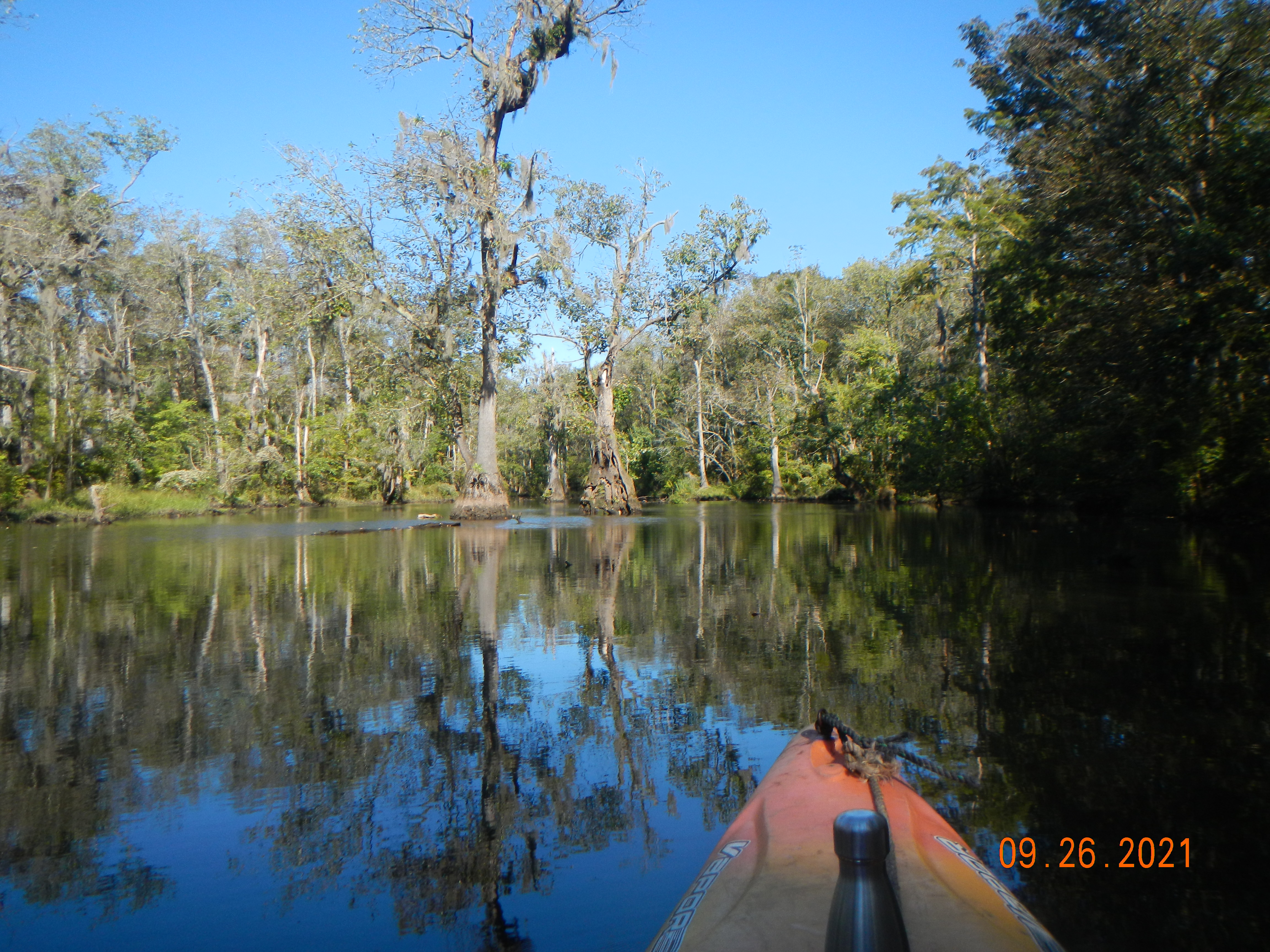
Argillic horizons are subsoil layers that are enriched in silicate clays. I have long been interested in soil morphology as it relates to argillic horizons. First, it was with respect to soil erosion. As these horizons are by definition formed below the surface, their exposure at or near the ground surface indicates removal of overlying soil. To the extent soils have a characteristic depth, or range of depths, to the top of the argillic horizon, then variations in DTA (depth to argillic) can indicate erosion or deposition. I used this to study soil erosion in the North Carolina coastal plain and piedmont in the late 1980s and 1990s, and in the Ouachita Mountains of Arkansas in the 2000s and 2010s.

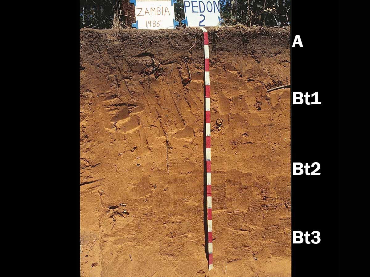
Multiple argillic horizons in a Kandiustult in Zambia (source: https://www.uidaho.edu/cals/soil-orders/ultisols).

Soils with argillic horizons, by implication, are vertical texture contrast (VTC) soils, where coarser surficial horizons overlie finer-textured subsurface horizons. Such soils, also called duplex soils, are globally common. Along with the erosion work, my studies of soil geomorphology, geography, and spatial variation piqued my interest in how and why argillic (often designated as Bt) horizons and VTC soils develop.

The conventional explanation is that they form due to vertical translocation by percolating water. This water physically washes smaller particles out from between the larger ones (often sand grains) and moves them downward, concentrating smaller, clay-size material in the subsoil. This process is called lessivage or argilluviation. The water can also dissolve material from the upper layers which precipitates in the subsoil.

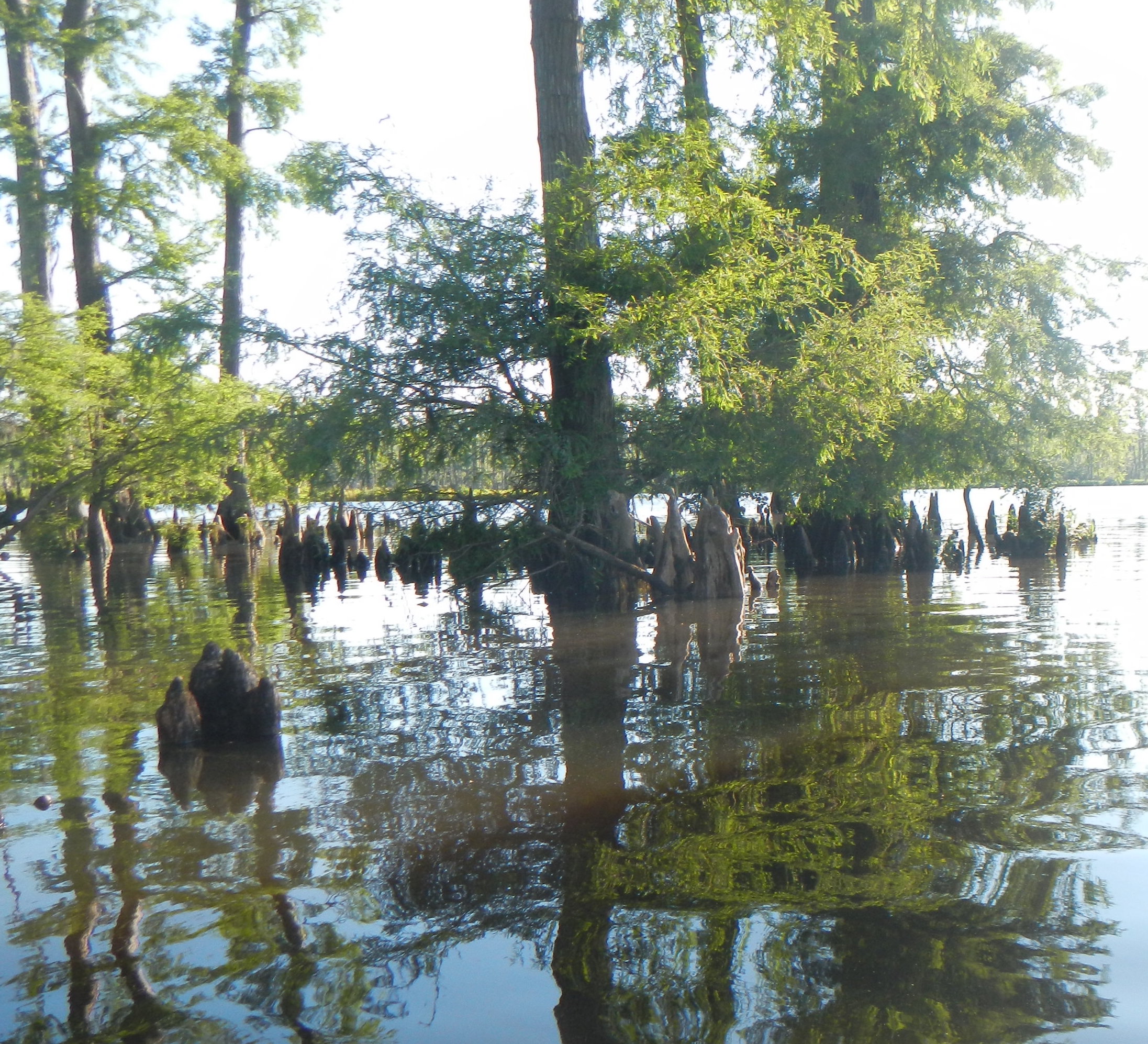
Vertical translocation by water most definitely occurs, and is in my opinion the single most important process for creating VTCs. But it is far from the only one! Preferential erosion of finer and/or deposition of coarser sediment at the surface can get the job done. Bioturbation often plays a key role, and texture contrasts can by partly or wholly inherited from parent material layering. In-place weathering and clay synthesis can produce silicate clays in subsoils, and upward movement of groundwater can lead to precipitation in the B horizon.

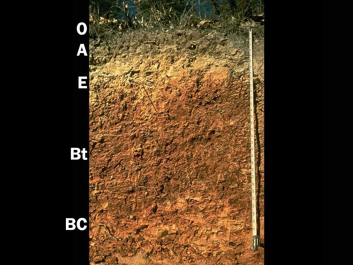
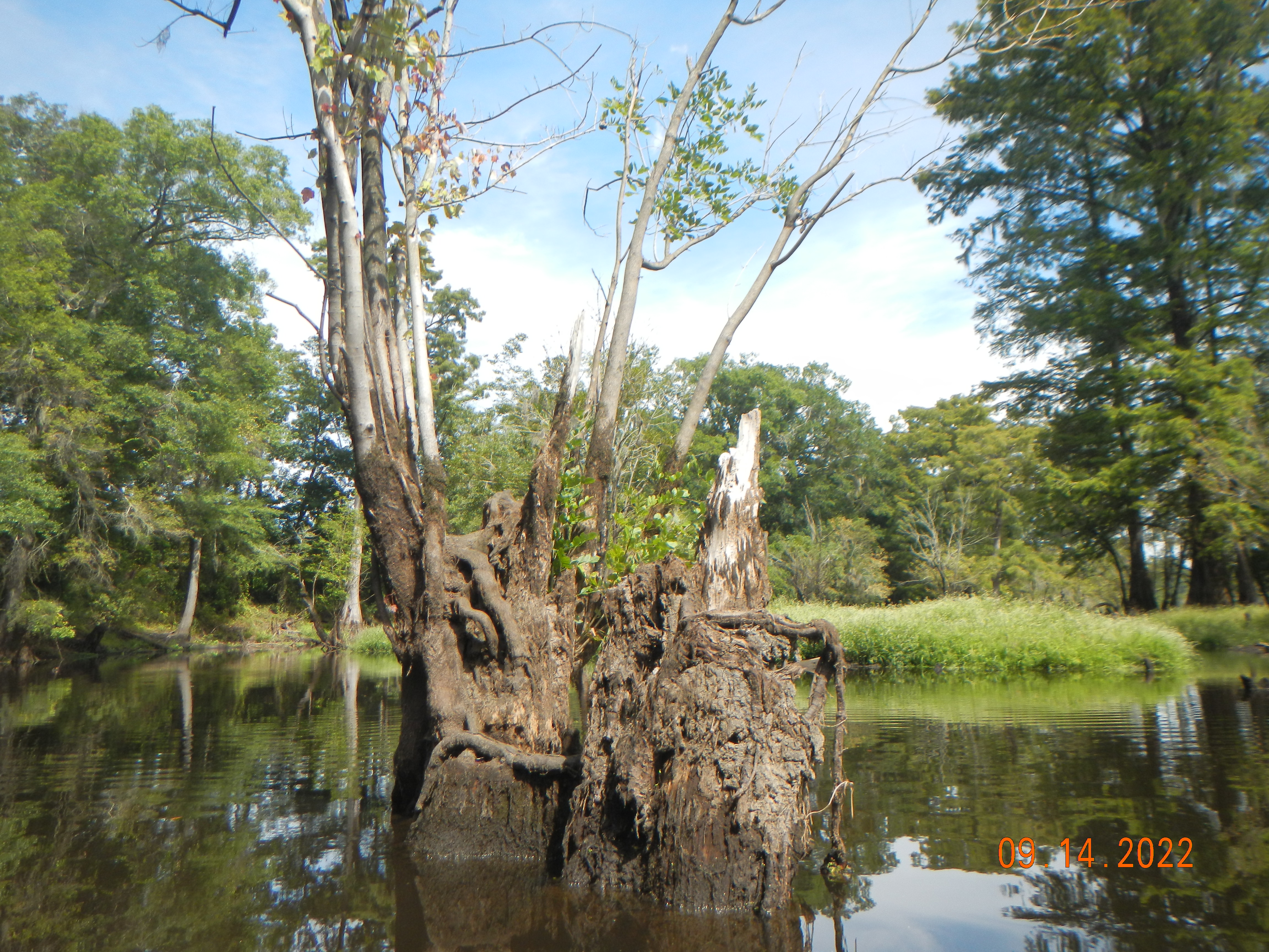
Vertical texture contrast Hapludult from the Ouachita Mountains, Arkansas. The argillic horizon is labelled Bt.

Three things in particular spurred my interest. One was my own findings of variations in DTA over short distances and small areas that could not be explained by any measurable variation in soil forming factors. This suggested to me that either something else in addition to vertical translocation by water was going on, and/or that the translocation process is characterized by complex, perhaps even deterministically chaotic, dynamics. Second was a series of papers from 1987 on into the 2000s by Don Johnson and colleagues showing the strong but often, at least traditionally, overlooked role of organisms in creating and changing soil morphology (e.g., Johnson, 1990). The third was the book Soils: A New Global View by T.R. Paton, Geoff Humphries, and P.B. Mitchell (Yale University Press, 1995).  In this book they challenged the prevailing approach to pedology, favoring a more geological and geomorphological viewpoint. They also specifically challenged the notion of vertical translocation by water as a ubiquitous factor in soil formation. I did not, then or now, buy all their arguments, but they definitely made a strong case for rethinking the conventional wisdom.

So, from 1993 to nearly the present I was involved in, and published a number of papers on, how VTC soils and weathering profiles are formed, complexity in pedogenesis, spatial variation of soils, and coevolution of soils, landforms, and ecosystems (shameless plug: See my book Landscape Evolution. Landforms, Ecosystems, and Soils, Elsevier, 2021).

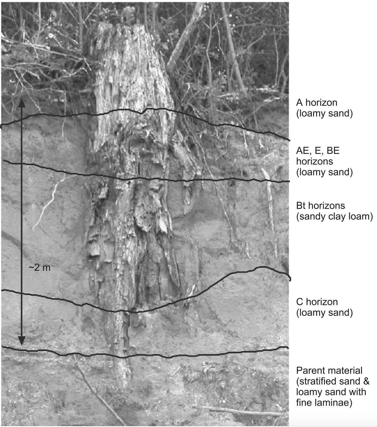
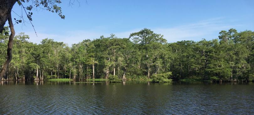
Soil profile from the North Carolina coastal plain (from Phillips, 2004).

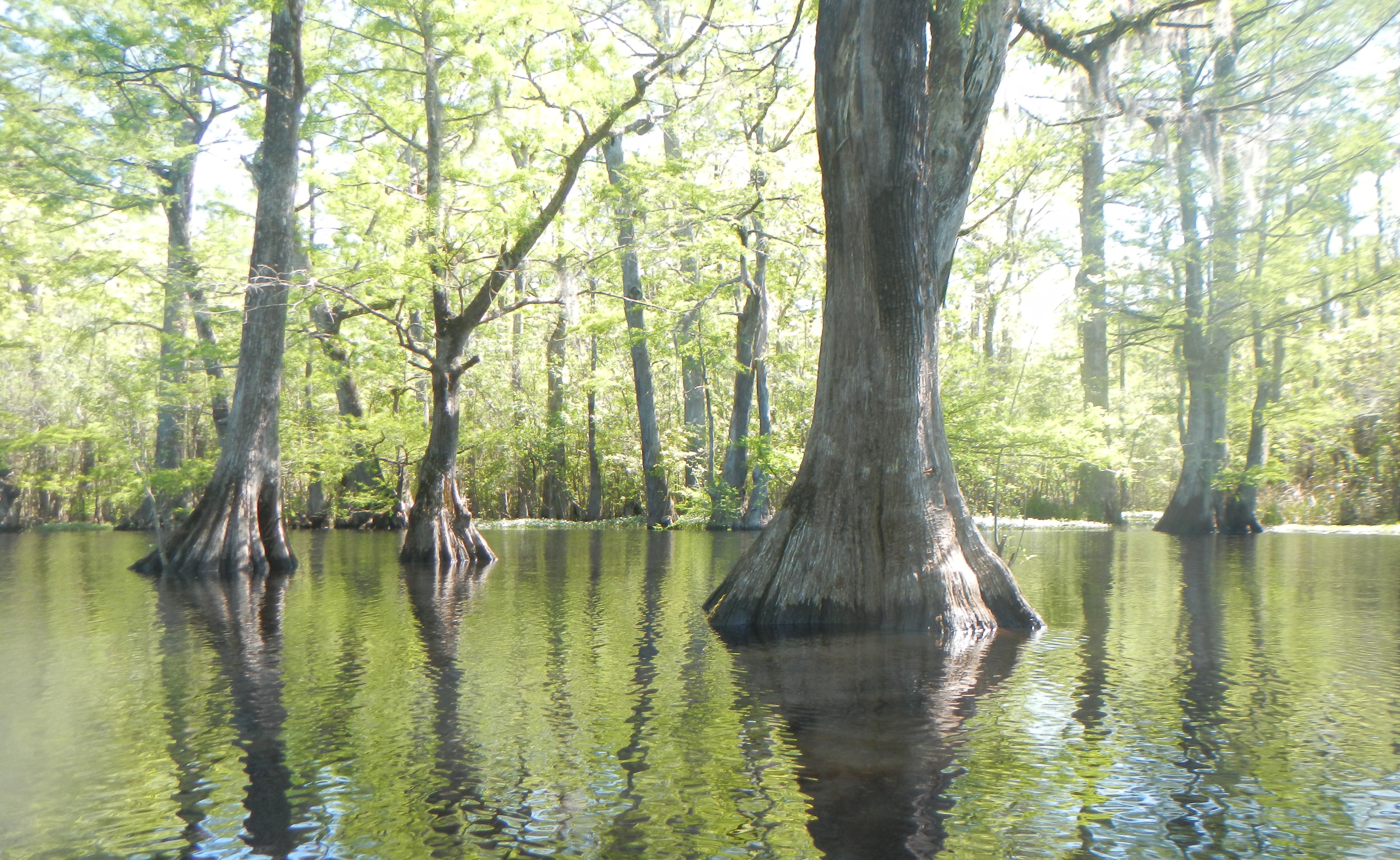
Now cut to the 2010s. I come across an article by William Verboom and John Pate (2013) on ecosystem engineering of soils by eucalyptus trees in western Australia—including the synthesis of clays in the root zone! This led me to some of their earlier work showing that vertical redistribution of water and minerals dissolved therein resulted in formation of dense clay layers. The lateral root systems of the trees were, in essence, forming a subsoil clay layer by bringing the raw materials for clay synthesis into contact with each other. Because these clay-rich horizons benefit the trees via their water and nutrient storage, this is an example of positive ecosystem engineering. Thus, in at least one environment, trees and woodlands, if not forests sensu stricto, can build claypans and argillic horizons. Could this be a more general phenomenon?

Around the same time, I recalled something I had read earlier in Greg Retallack’s masterful Soils of the Past (3rd ed. 2019, John Wiley)—that soils with argillic horizons (Alfisols and Ultisols in the U.S. Soil Taxonomy) do not appear in the paleosol (fossil soil) record until forests appeared in the Devonian. Coincidence? Unlikely. Deeper rooting depths of trees and effectiveness of weathering under forests likely play a role, but Retallack also noted the strongly tapering geometry of tree roots. These create large pathways for water movement in upper parts of the soil that taper down to nearly nothing at their tips, allowing translocated material to move down, but to start building up at the end of the root line, so to speak. This is broadly consistent with my own work, which showed that tree roots (and root paths following death and decay) and insect and other faunal burrows are important in maintaining translocation which might otherwise be reduced to negligible levels as low permeability clays accumulate and soil pores are blocked.

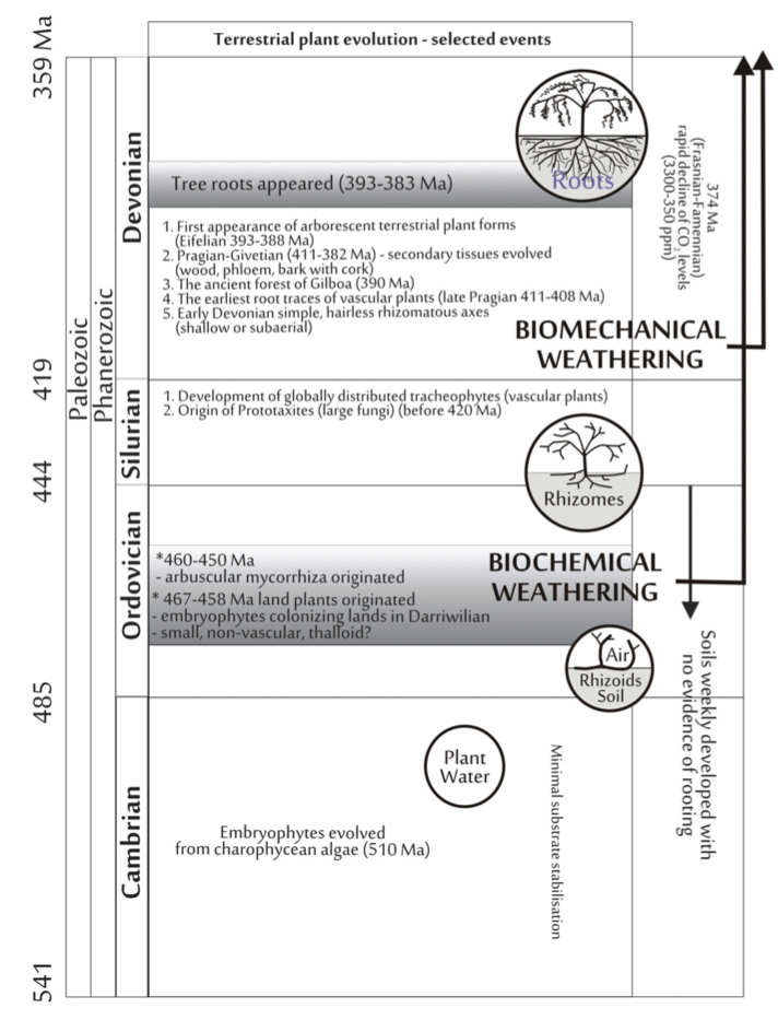
Key events in terrestrial plant evolution and root-soil interactions (from Pawlik et al. 2016).

Admitting that much of the biochemical, geochemical, and mineralogical details are at the edge of or beyond my expertise, I have not found any work other than Verboom and Pate’s and some of their coworkers that directly address the question posed in the title. However, I did come across Pierre Velde and Pierre Barre’s book: Soils, Plants, and Clay Minerals. Mineral and Biologic Interactions (Springer, 2010). Velde and Barre come from a school of thought that I was not much aware of before, that soil clay minerals are fundamentally different from those formed below the soil or prior to soil formation by primarily geochemical processes.

Independently of this perspective, however, they show the role of plants and vegetation-based soil organic matter in the formation and retention of phyllosilicate clays, both directly and via their bacterial and fungal symbionts. Particularly important is plant uplift (via water intake) of silica and potassium, key building blocks of silicate clays. An important point is that clay minerals are a necessary source of the critical nutrient K (potassium), so facilitating the formation of clays that can retain K is of great benefit to the vegetation.

Without plants, Velde and Barre assert, there would be no clay accumulation in surface layers. However, their book does not directly address the “can trees make argillic horizons” question. First, they are concerned with plants in general, and grasses may be more effective clay-formers than trees, at least when it comes to clay in A horizons. Second, much of their work is indeed concerned with A horizon clay—it is in these layers that most root mass occurs, after all. They are less concerned with clay migration to the subsoil, though they do note that loss of clays from the surface layer is highly probable in forest soils. Finally, the book has more to say about retention of clays and clay minerals than the (flora-assisted) formation thereof.

In subtropical savannas of south Texas, there’s a body of work on vegetation relationships to soils that doesn’t quite fit into the trees-make-argillic horizons framework. Large woody patches occur on soils without argillic horizons, whereas smaller patches with more herbaceous vegetation is found in adjacent sites in the same landscape where an argillic horizon is present (Midwood et al., 1998; Zhou et al., 2017). This could occur because the clayey layers restrict root penetration, favoring more shallow rooted grasses and shrubs rather than trees. One study showed that shrubs on argillic soils had less aboveground and greater belowground root mass than those on non-argillic soils. Root biomass and density on argillic soils was elevated at shallow (< 0.4 m) depths, whereas root density of the same species on non-argillic soils were skewed to depths >0.4 m (Zhou et al., 2019). Obvious relationships exist between the presence or absence of argillic horizons, root depth and biomass, vegetation-driven water use (including hydraulic lift), and soil hydrological properties (Zou et al., 2005), and similar results have been obtained in Australia (Yunusa et al., 2002). However, this body of work does not make it clear (at least to me) whether soil morphology is driving vegetation distributions, or vice-versa—or both, via reciprocal interactions. It is also possible, I think, that the argillic horizons may be inherited from earlier, moister climates (this is sometimes the case even in desert Aridisols), and poorly related to contemporary pedo-ecological dynamics with respect to argillic formation.

So, can trees & forests build argillic horizons? Yes, but . . . .

Yes, they have been shown to do so in specific situations, but this has not been demonstrated as a widespread, general phenomenon in forests.

Yes, plant uplift of water, nutrients, and Si can help retain or even form silicate clays. But, this is not restricted to trees or woody vegetation, and does not necessarily result in subsoil clay concentrations.

Yes, argillic horizons are strongly associated with forest cover, or with environments where the natural vegetation cover is mainly forest. But, VTC soils do occur in other environments, and clay synthesis is not the only mechanism by which forest cover could facilitate argillic horizon formation. Also, while forest soils (other than Histosols or other wetland soils) typically show evidence of vertical translocation, argillic horizons (even incipient ones) are not always found—sandy Spodosols or podzols are a prominent example.

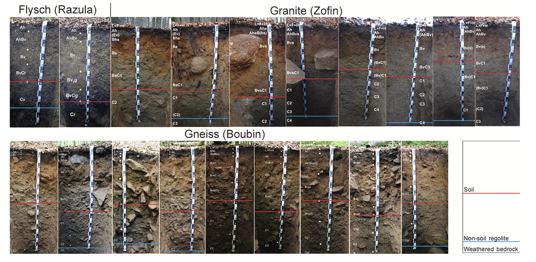
Forest soils from three forest preserves in the Czech Republic (from Šamonil et al., 2020).


Yes, VTC soils with argillic horizons were rare or absent before the Devonian advent of trees. But, clay synthesis by the trees may not have played a major role.

Yes, forest cover clearly facilitates formation of argillic horizons. But, if sufficient clay-size material is present in parent material, it can become concentrated in a Bt horizon without any clay synthesis (by trees or otherwise) in the soil—some of my own work in coastal plain soils showed this (Phillips, 2007).

Yes, formation of VTC soils with argillic horizons plays a role in the formation of store-and-pour soil hydrology structures that are advantageous to plants. Any role of plants in creating such morphology would by positive ecosystem engineering and niche construction or reinforcement. But, this is something I am still working on and thus somewhat speculative at the moment.

Do forests build vertical texture contrast soils with argillic horizons? Evidence strongly supports the possibility. But we still need some specific case studies to show that it indeed happens, and to shed more light on how. I’m betting the answer is yes, and look forward to others proving me right—or wrong.

References:

Johnson, D.L., 1990. Biomantle evolution and the redistribution of earth materials and artifacts. Soil Science 149, 84 – 102.

Midwood, A.J., Boutton, T.W., Archer, S.R., Watts, S.E. 1998. Water use by woody plants on contrasting soils in a savanna parkland: assessment with delta H-2 and delta O-18. Plant and Soil 205, 13-24.

Pawlik, L., Phillips, J.D., Šamonil, P., 2016. Roots, rock, and regolith: biomechanical and biochemical weathering by trees and its impact on hillslopes - A critical literature review. Earth-Science Reviews 159: 142-159.

Phillips, J.D. 2004. Geogenesis, pedogenesis and multiple causality in the formation of texture-contrast soils. Catena 58: 275-295.

Phillips, J.D., 2007. Formation of texture contrast soils by a combination of bioturbation and translocation. Catena 70: 92-104.

Šamonil, P., Phillips, J.D., *Danĕk, P., Beneš, V., Pawlik, Ł. 2020. Soil, regolith, and weathered rock: Theoretical concepts and evolution in old-growth temperate forests, central Europe. Geoderma 368, 114261.

Verboom, W.H., Pate, J.S., 2006. Bioengineering of soil profiles in semiarid ecosystems: the “phytotarium” concept. A review. Plant and Soil 289, 71e102, doi.org/10.1007/s11104-006-9073-8.

Verboom, W.H., Pate, J.S., 2013. Exploring the biological dimensions to pedogenesis with emphasis on the ecosystems, soils, and landscapes of southwestern Australia.Geoderma 211–212, 154–183.

Verboom, W.H., Pate, J.S., Abdelfattah, M.A., Shahid, S.A., 2013. Effects of plants on soil-forming processes: case studies from arid environments. In: Shahid, S.A. (Ed.), Developments in Soil Classification, Land Use Planning and Policy Implications: Innovative Thinking of Soil Inventory for Land Use Planning and Management of Land Resources. Springer, Dordrecht, pp. 329e344. https://doi.org/10.1007/978-94-007-5332-7_17.

Yunusa, I.A.M., Mele, P.M., Rab, M.A., et al. 2002. Priming of soil structural and hydrological properties by native woody species, annual crops, and a permanent pasture. Australian J. Soil Research 40, 207-219.

Zhou, Y., Boutton, T.W., Xu, X.B., Yang, C.H. 2017.  Spatial heterogeneity of subsurface soil texture drives landscape-scale patterns of woody patches in a subtropical savanna. Landscape Ecology 32, 915-929.

Zhou, Y., Watts, S.E., Boutton, T.W., Archer, S.R. 2019. Root density distribution and biomass allocation of co-occurring woody plants on contrasting soils in a subtropical savanna parkland. Plant and Soil 438, 263-269.

Zou, C.B., Barnes, P.W., Archer, S., McMurtry, C.R.  2005. Soil moisture redistribution as a mechanism of facilitation in Savanna tree-shrub clusters. Oecologia 145, 32-40.

Questions or comments: jdp@uky.edu