
geography

EMERGENT ECOSYSTEM ENGINEERING IN EPIKARST

Epikarst is defined as the uppermost zone of dissolution in karst, including whatever soil cover exists. The purpose of this analysis is to explore some of the interactions among geological controls, weathering, biota, moisture flux and soil accumulation in the regolith or critical zone of karst systems.

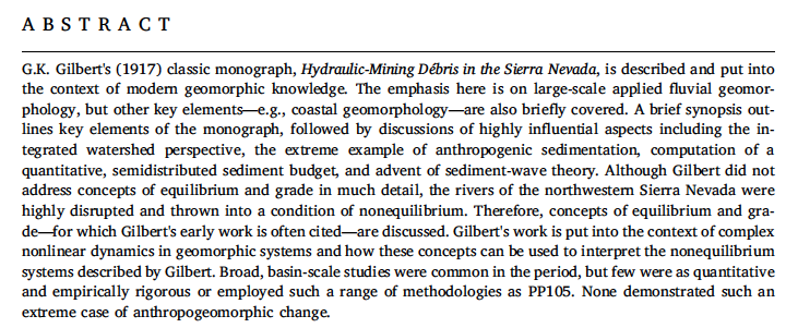
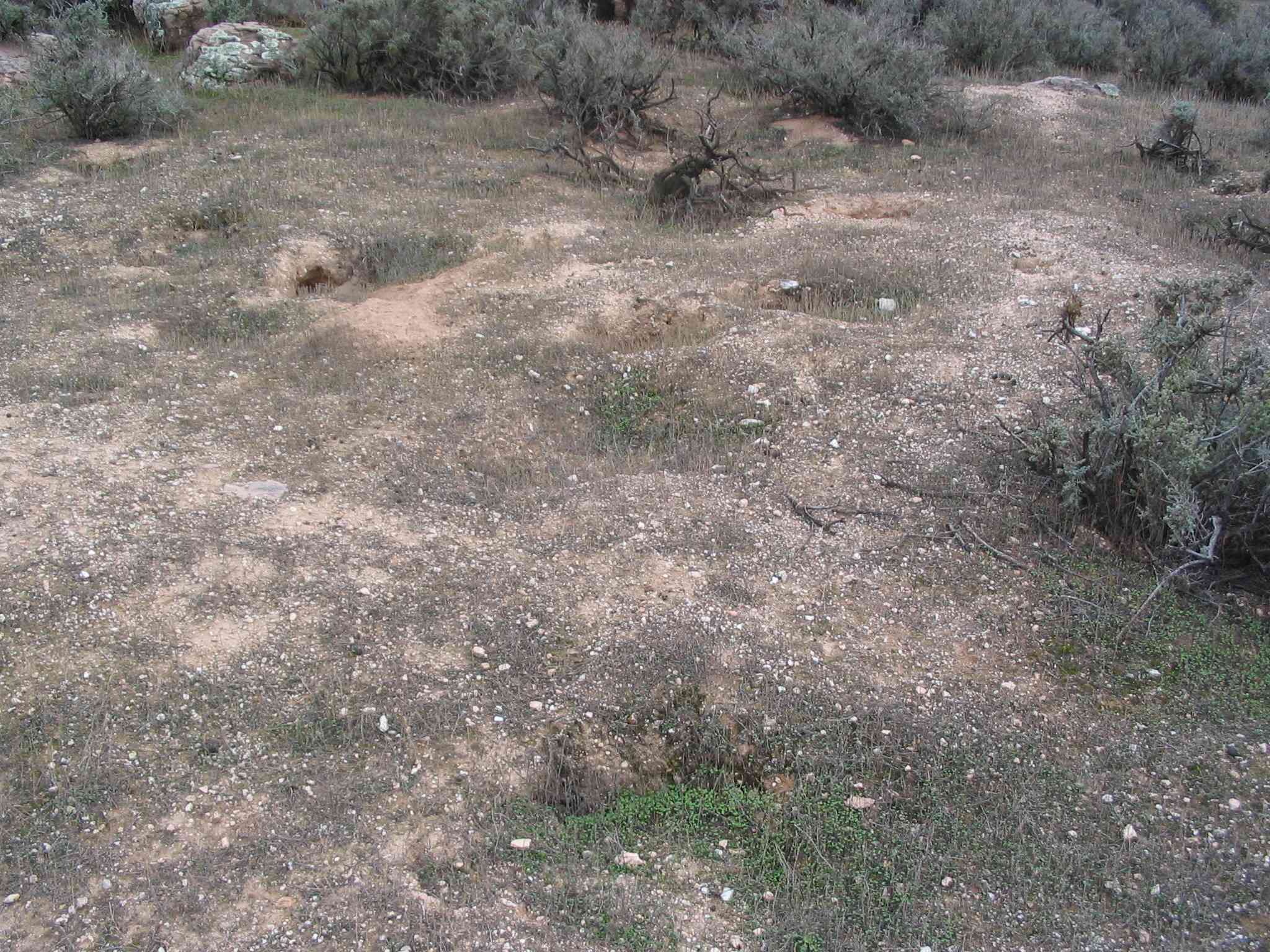
Epikarst exposed by gullying, Bowman's Bend, Kentucky

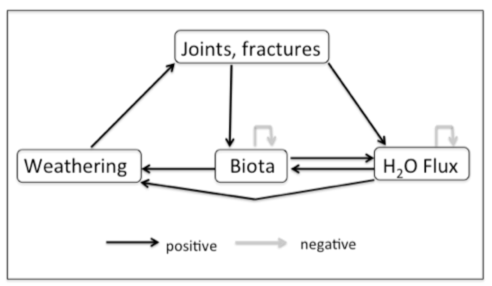
Figure 1 shows the interactions among geological controls (joints, fractures, bedding planes), weathering, subsurface biological activity, moisture flux, and soil accumulation the earlier stages of soil development in epikarst. The system is dominated by positive feedbacks because in early stages of epikarst development there is limited space for biological activity (e.g., roots), and moisture fluxes are limited by the size of joints, fractures, and incipient conduits. The other positive feedbacks reflect well established relationships among chemical weathering, enlargement of joints, etc., water availability, and organisms. I assume some external (to the system shown) limitations on biological activity and moisture flux.

ANTHROPIC FLUVIAL SEDIMENTATION

Geomorphology has just published a special issue on anthropic sedimentation in fluvial systems, in the centennial year following the publication of G.K. Gilbert's seminal Hydraulic Mining Debris in the Sierra Nevada. L. Allan James (AJ) edited the special issue, along with Scott Lecce and myself. Lots of good stuff in there, if I do say so myself. The issue includes an article coauthored by AJ, Scott and myself, titlled A centennial tribute to G.K. Gilbert's Hydraulic Mining Débris in the Sierra Nevada. The abstract is below, and you can download it here:

While Scott and I did enough work to deserve having our names on this, AJ really deserves most of the credit. He conceived the whole enterprise, recruited us to help, and was truly the lead author on the article above and the short introduction to the special volume. 

AGGRESSIVE PASSIVE RESTORATION

Years ago, in my days at East Carolina University, M.A. student Don Belk (now a planner with the N.C. Department of Commerce) and I worked on issues related to hydrological restoration of artificially drained wetlands in eastern North Carolina. Basically, we found that something closely approaching the pre-drainage hydrology could be achieved in most cases by simply not maintaining the drainage ditches and canals (see this, that, and the other). In this flat, wet topography and humid subtropical climate the anthropic channels quickly accumulate sediment, organic debris, and living vegetation, losing their conveyance capacity and essentially becoming linear detention ponds in a few years. Thus, except for some local water table drawdown during dry spells in the vicinity of the ditches and canals, and whatever peat may have oxidized when the artificial drainage was working, the hydrology can be passively restored. If you don't believe me, ask someone who farms artificially-drained land in the N.C. coastal plain--they'll tell you they have to clean out the ditches every two to five years.

BRAZOS RIVER FLOOD

As I write, the lower Brazos River west of Houston, Texas, has been in flood for more than seven days, and is likely to remain that way another week, minimum. The peak five days ago occur occurred at a gage height of 52.65 feet at the Rosharon gaging station (third highest ever, going back more than a century), and is still only about four inches below that, and not dropping appreciably. At the next gaging station upstream, at Richmond, TX, the stage was the highest on record. On August 31, near the peak at Rosharon and with water levels still above the designated major flood stage, U.S. Geological Survey personnel went to the site and measured the flow.

Location of the Brazos River Rosharon gaging site.

THE PERFECT PLANET

Did you ever wish you had a collection of these blog posts, all semi-organized in one quasi-coherent document? No? Well, you can get one anyway. My posts from the very first in May, 2014 up through June, 2017 have been collected in a single volume, called The Perfect Planet, now available here.

Wooooooo!!! At last!


There is, however, good news and bad news.

Good news: It is a rich compendium of my interpretations, speculations, and scientific opinions over a three-year period.

Bad news: How egotistical and self-important do you have to be to think anyone would want such a thing?


Good news: In The Perfect Planet you get JDP unfiltered by nit-picky grammar monkeys and uncensored by the scientific establishment.

Bad news: That’s because the “book” is self-produced, with no peer review and no professional copy-editing or production.


Good news: It is absolutely free (though in the form of a reduced-resolution compressed pdf file)!

HIERARCHIES & SCALE

The latest issue of Earth-Science Reviews contains a couple of articles where the issue of scale linkage is front and center.  Ma et al. (2017) review the past five years or so of research on hydropedology, focusing on soil-water interactions across spatiotemporal scales.  Walker et al. (2017) outline scale-dependent perspectives on geomorphic evolution of beach and dune systems, based largely on years of collaborative work on Prince Edward Island (Canada).

Beach and frontal dune at Prince Edward Island National Park (http://www.parkscanada.gc.ca/pei)

HOW I STOPPED WORRYING AND LEARNED TO LOVE CONTINGENCY V: CANALIZATION

Part IV

In genetics, canalization is the ability of a genotype to produce the same phenotype regardless of the environmental setting. In an evolutionary context, canalization (often spelled canalisation) is a manifestation of historical contingency. Once a successful genotype arises it tends to persist, and other evolutionary pathways are closed off. The evolutionary trajectory is in some senses confined to a "channel," the metaphor that produced the term canalization. The term, originally due to biologist C.H. Waddington, has since been used by others in a broader sense to refer to historical development phenomena whereby once a particular path is "chosen" there is an element of lock-in (the quotes are not only because Earth surface systems (ESS) lack intentionality, but also because the selection may be due to random chance or be highly sensitive to minuscule variations).

Canalization also has a more literal meaning, of course, associated with the construction of canals and channelization of rivers. This one is in the Netherlands.

HOW I STOPPED WORRYING AND LEARNED TO LOVE CONTINGENCY IV: INFINITE CONSTRAINTS

Part I              Part II             Part III

2 + 2 = 4.

That is non-contingent. Adding two and two gives the same result no matter who does it, how they do it, where they do it, or when. The same goes for expressions such as 2 + X = 4, or 27/X = 4, etc.

This four-play is a metaphor for the deterministic, Laplacian, non-contingent ideal of science, where the right tools and sufficient information always give the same, correct result under any circumstances.

But a better metaphor for the actual practice of geosciences and other historical, field-based sciences, is that you find, or observe (evidence of) a four. Mathematically, of course, there are an infinite number of numerical operations that could produce a four. Even if you know that the four arose from, say, subtraction or exponentiation, the possibilities are still infinite.

HOW I STOPPED WORRYING AND LEARNED TO LOVE CONTINGENCY III: PERFECTION

The “perfect storm” metaphor describes the improbable coincidence of several different forces or factors to produce an unusual outcome. The perfect landscape refers to the result of the combined, interacting effects of multiple environmental controls and forcings to produce an outcome that is highly improbable, in the sense of the likelihood of duplication at any other place or time (Phillips, 2007a). Geomorphic and other Earth surface systems (ESS) have multiple environmental controls and forcings, and multiple degrees of freedom in responding to them. This alone allows for many possible landscapes and system states. Further, some controls are contingent, and these contingencies are specific to time and place. Dynamical instability in many ESS creates and enhances some of this contingency by causing the effects of minor initial variations and small disturbances to persist and grow over time. The joint probability of any particular set of global controls (laws or non-contingent generalizations) is low, as the individual probabilities are <1. The probability of any set of local, contingent controls is even lower.

Subscribe to geography