
As I write, the lower Brazos River west of Houston, Texas, has been in flood for more than seven days, and is likely to remain that way another week, minimum. The peak five days ago occur occurred at a gage height of 52.65 feet at the Rosharon gaging station (third highest ever, going back more than a century), and is still only about four inches below that, and not dropping appreciably. At the next gaging station upstream, at Richmond, TX, the stage was the highest on record. On August 31, near the peak at Rosharon and with water levels still above the designated major flood stage, U.S. Geological Survey personnel went to the site and measured the flow.
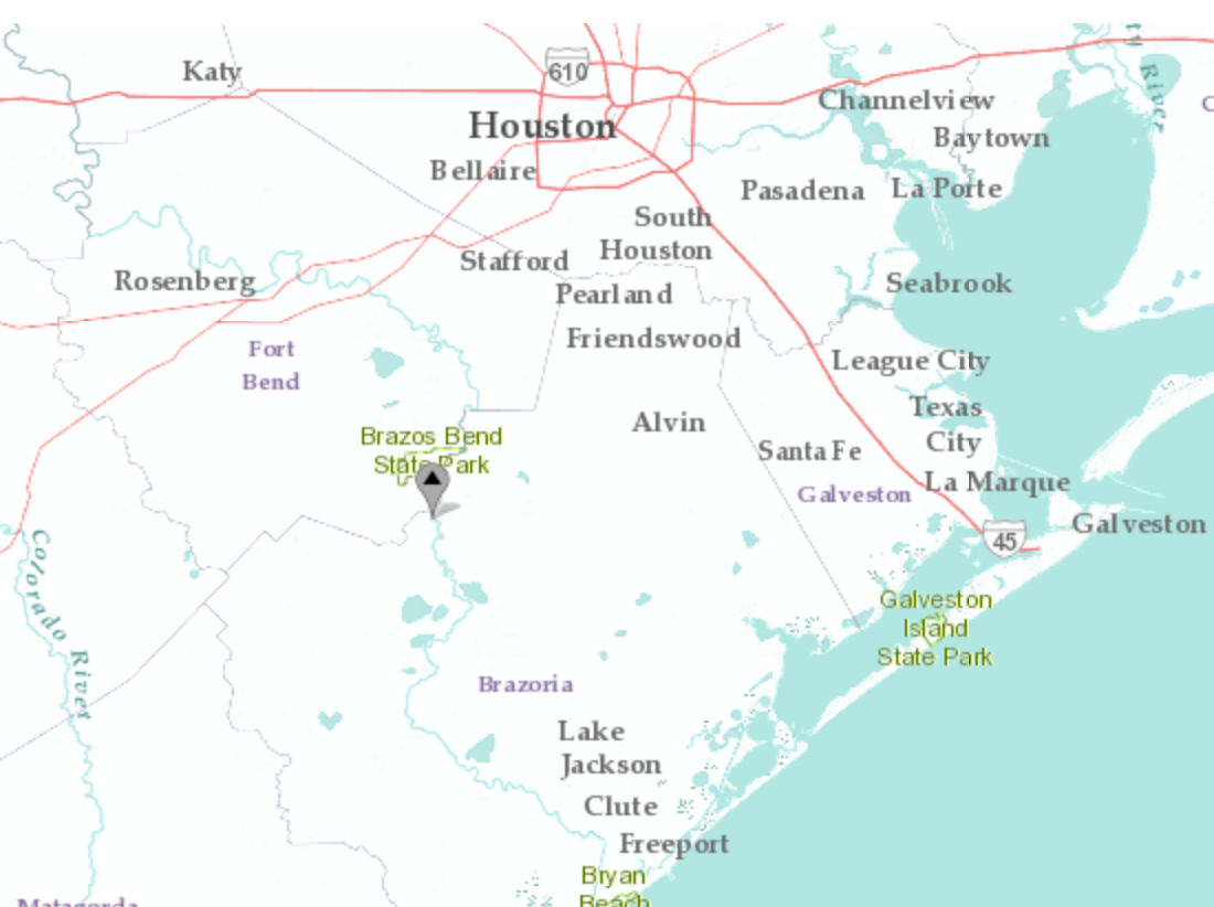
Location of the Brazos River Rosharon gaging site.
We've heard a lot about the various individuals and organizations doing the brave, difficult work associated with rescues after tropical storm Harvey unleashed 1000 to 1300 mm (40 to 50 inches) of rain on the Houston area. At first, getting out to collect some hydrological data, while commendable, may sound less important. But monitoring streamflows, forecasting floods, and issuing warnings that can save lives and property depends on these river gaging stations. The continuous monitoring of discharge is based on stage-discharge relationships, correlating water levels with flow rates. And, particularly in alluvial rivers such as the lower Brazos, these relationships change over time as the river channel naturally varies. Establishing, maintaining and updating the stage-discharge curves requires that somebody--usually USGS personnel--go into the field about a dozen times a year to measure velocities, widths, and depths. It is important to get these measurements across a range of flow conditions, including floods.
Fieldwork during a flood is at best difficult, and can be dangerous. Having done it myself during several floods much smaller than this one, I admire and appreciate this work. The August 31 set of measurements at the Rosharon site (not the only ones USGS did in the region near peak flows) are particularly interesting as well as important.
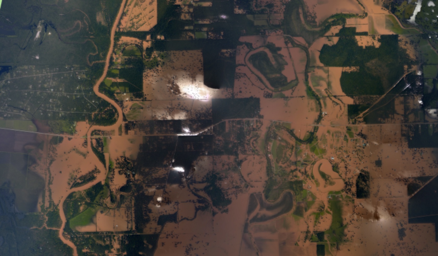
August 31 aerial photograph of the Brazos River valley near Rosharon Texas, from NOAA/USGS storm assessment (https://storms.ngs.noaa.gov/storms/harvey/index.html)
To capture the flow headed down the Brazos valley, they had to make 12 separate "channel" measurements. Channel is in quotation marks because in addition to the main channel and a couple of sub-channels the crew measured several overflow areas of subchannels, culverts, and flooded road and field areas (you can access the data here). They self-rated the measurements as "poor" because of the difficult conditions (among other things, there is a notation of "debris heavy"), but it's the best we've got.
Only about 68 percent of the total flow of 3,372 cms (119,000 cfs) passed through the main channel. The proportion flowing through other pathways varied from less than 1 percent in several cases to >14 percent. The width of the measured sections ranged from culverts 2 to 5 m wide to the main channel at 204 m to a section of floodplain 3627 m wide. Accordingly width/depth ratios were also quite variable, from <5 in the culverts to 30 in the main channel, to >2500 on the unchannelled floodplain. The highest velocities (> 2 /sec) were at the culvert sites, and 1.65 m/sec in the main channel. The slowest were at the sheet-flow-like floodplain sections, some of which were <0.1 m/sec.
If you solve the Darcy-Weisbach equation for f, the friction factor, you get f = f(1/V2). Using 1/V2 as a crude relative roughness index, roughness varied over four orders of magnitude. As you'd expect, it was lowest in the channels and culverts and highest in the unchannelled sections.
These results remind us that our binary of in-channel vs. floodplain (overbank or out-of-channel) flow masks a great deal of variability. Many valley bottoms are quite heterogenous even without human agency, and our activities may both accelerate and impede downvalley flow, both inadvertently and purposefully.
Some other notes from this event:
•In a study of key discharge thresholds on the Brazos, I estimated a discharge of about 1000 cms as the threshold of channel instability at Rosharon. This was clearly exceeded, and occurs well below the overbank flood discharge of 1546 cms. Here I mean mechanical instability, involving potential bed, bar, and bank erosion.
•Measuring or estimating the key parameters of geomorphic change, stream power and shear stress, requires the inclusion of energy grade slope, which is not included as part of normal field measurements by USGS or anybody else. In the study referred to above I estimated S based on channel slopes and on station-to-station water surface slopes during specific events. However, these methods (while commonly used) are not very precise, and undoubtedly mask a great deal of variability. This is, in my view, the major weakness in our analyses.
•If you look at a map of the lower Brazos and adjacent Colorado River watersheds, you will notice that both are unusually and unexpectedly narrow in the lower part. This is because both have experienced watershed fragmentation avulsions. These occur when an abandoned main channel maintains an independent path to base level (in this case the Gulf of Mexico), but not as a distributary channel or anabranch. Rather, the hydraulic connection with the new main channel is lost, creating a new watershed. About 1.5 Ka, the Brazos avulsed to its current path near San Felipe, TX, upstream of Richmond. There is no regular flow from the Brazos to the old channel, now designated Oyster Creek (Bessie's Creek in the upper reaches). However, at some high flood flows--the 2017 Harvey ones, for example--water moves across the Brazos floodplain into the Oyster Creek system. About 13 percent of the August 31 flow was being transported by Oyster Creek or its overflow.
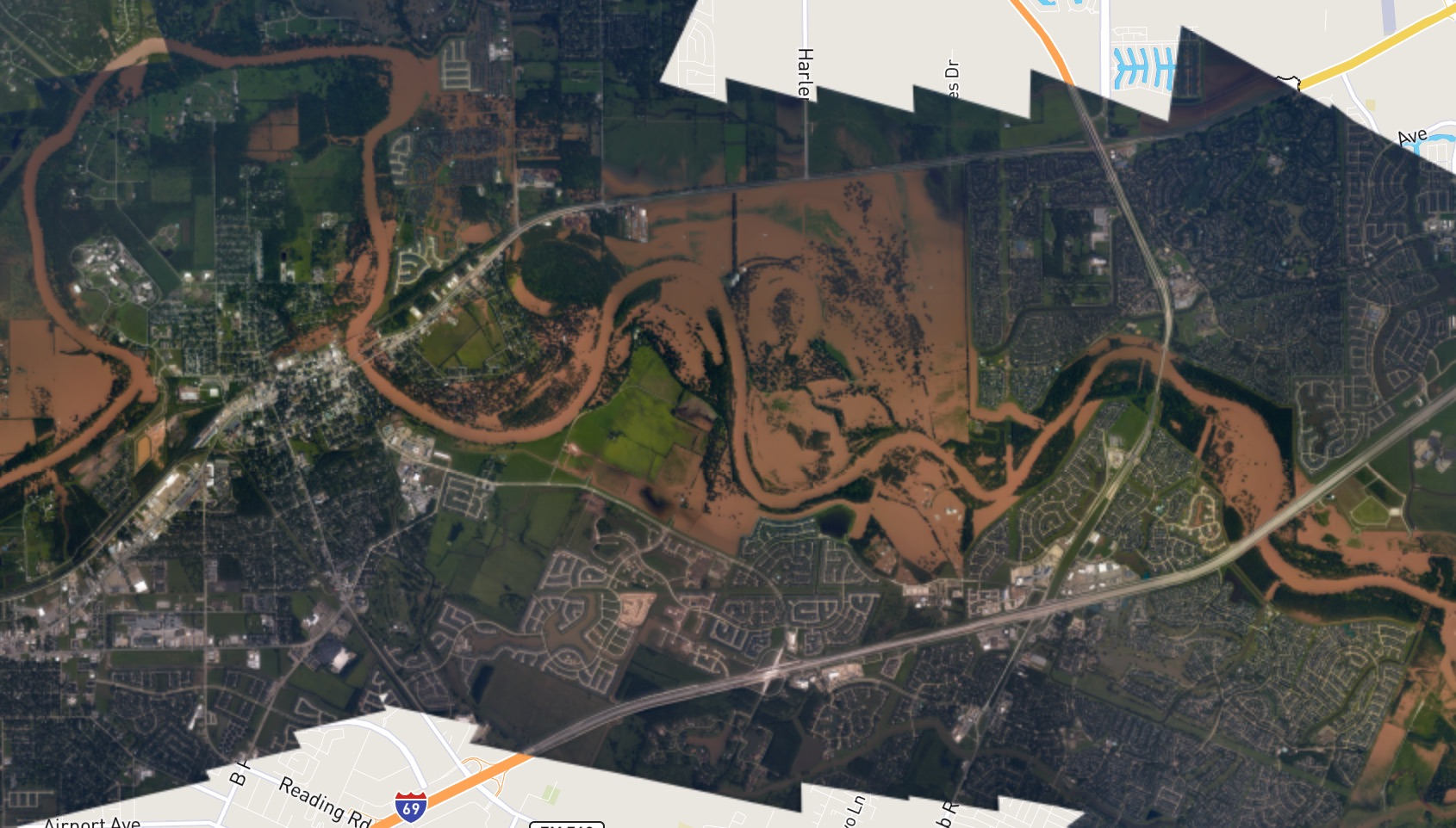
August 31 aerial photograph of the Brazos River valley near Richmond & Rosenberg Texas, from NOAA/USGS storm assessment (https://storms.ngs.noaa.gov/storms/harvey/index.html)
Posted 4 September 2017