
earth and environmental sciences

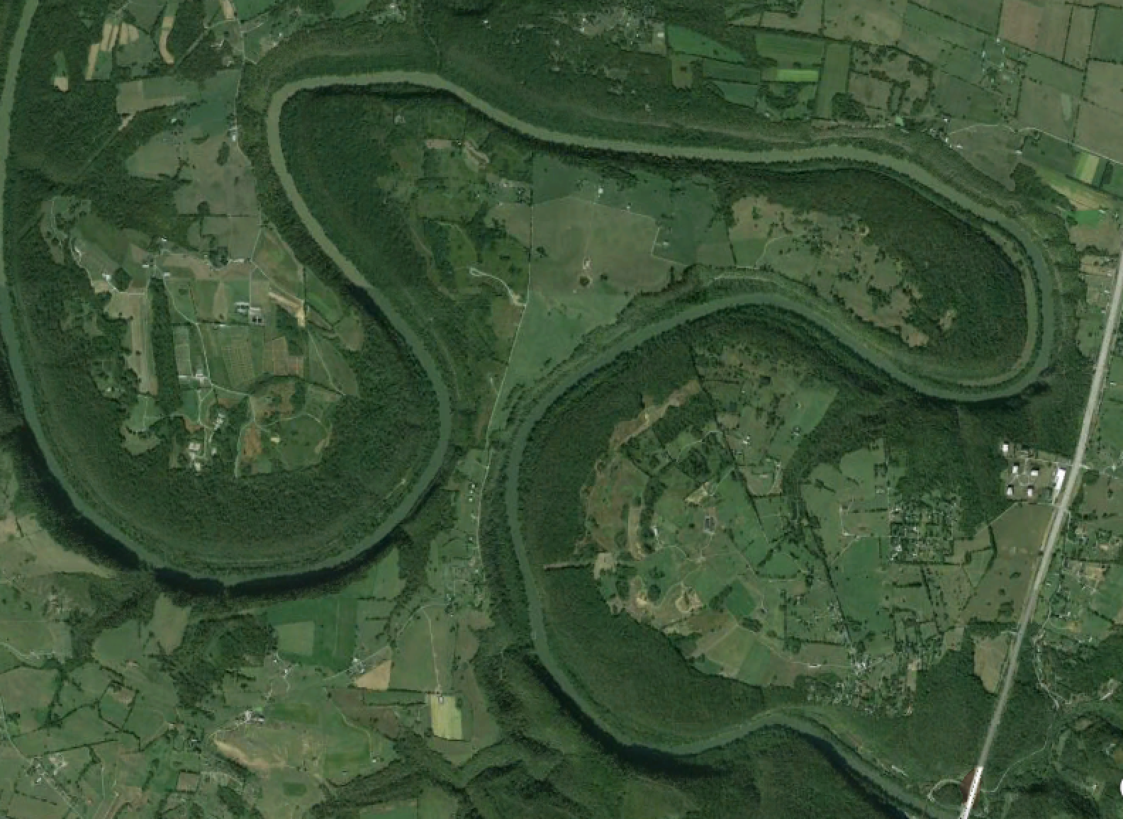
The Curious Expansion of Polly's Bend

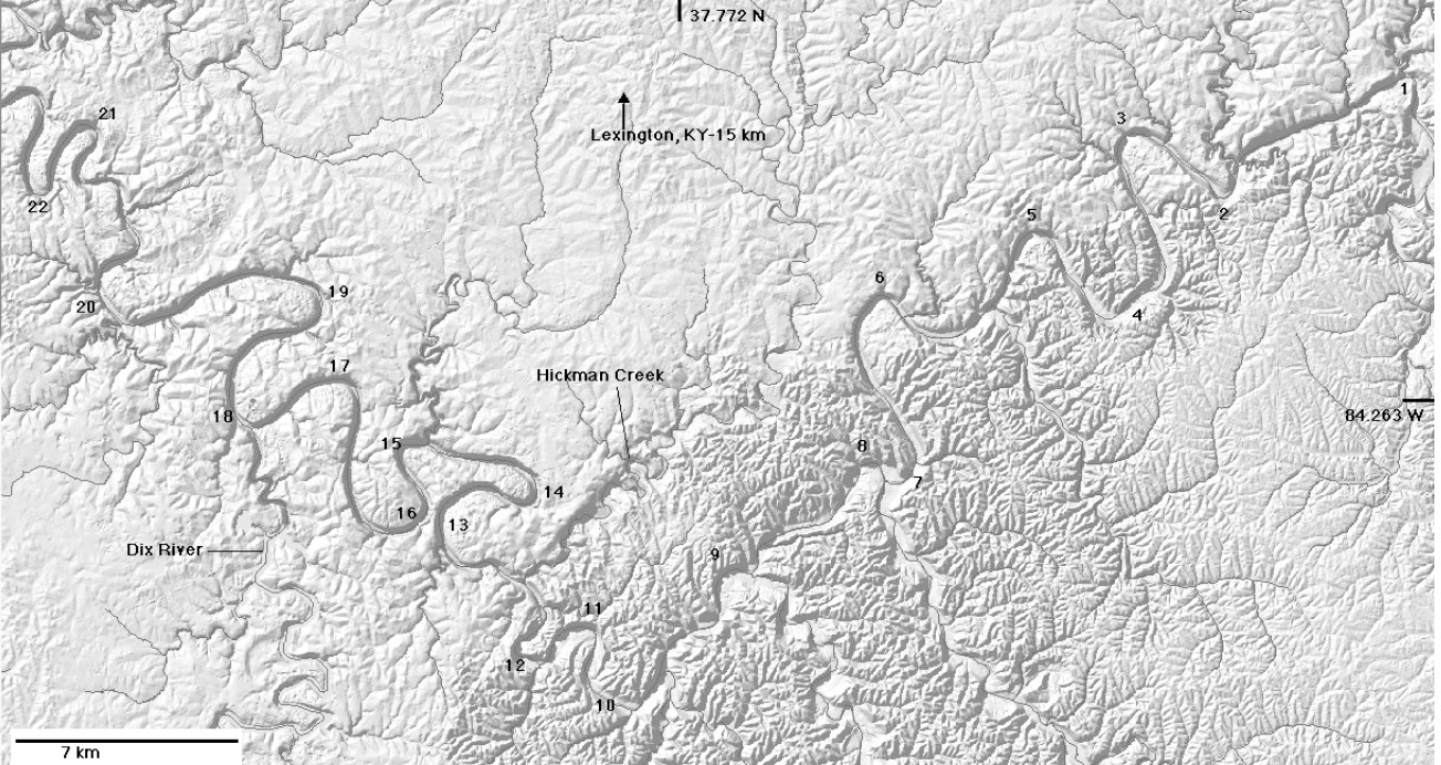
Though the meander bends in the Kentucky River gorge area are considered to be mostly inherited (i.e., they were there before the river began downcutting about 1.5 million years ago), they are not static features. This continues a previous post looking at Polly’s Bend.

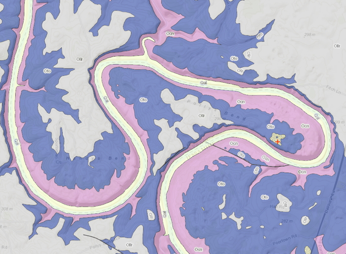
Geologic map of Polly’s Bend (from Kentucky Geological Survey’s Geologic Mapping Service). Ollr, Oto, Ocn are all Ordovician limestones. Qal is Quaternary alluvium, and the stippled pattern with the red + is Quaternary fluvial terrace deposits. Polly’s Bend is about 5 km in maximum width.

Polly’s Bend: Initial Conditions

South of Lexington and north of Danville, Kentucky, the Kentucky River makes a major turn from a generally SW to NW direction. Shortly downstream, there is a compound “gooseneck” meander bend called Polly’s Bend.

Google EarthTM image of Polly’s Bend. The maximum width from tip to tip is ~ 5 km.; minimum width of the neck is ~ 350 - 400 m. 

While not the norm, such tight bends are not uncommon in winding alluvial rivers, and will eventually be cut off during a flood, when the channel cuts across the narrow neck. Polly’s Bend, however, is entrenched in bedrock. The narrow neck (and the rest of the bend) has more than 100 m of solid limestone bedrock to cut through. So a classic meander cutoff, with flow going overbank across the neck and cutting a new channel; that ain’t gonna happen.

Landforms as Extended Composite Phenotypes

The online version of my new article exploring biogeomorphology from the perspective of niche construction and extended phenotypes is now out. The abstract is below. I appreciate my colleague Daehyun Kim encouraging me to stick with some of the more speculative and provocative ideas here. I was about to back off from them at one point, but he encouraged me to go for it.

Reference: Phillips, J.D. 2015. Landforms as extended compositive phenotypes. Earth Surface Processes and Landforms DOI: 10.1002/esp.3764.


Quo vadis, Physical Geography? Part 2

First part is here. 

An oversimplified, drive-by version of the changing role of physical geography includes these overlapping and not mutually exclusive stages:

1. Discovery and exploration—collecting basic data and observations on topography, geology, biota, meteorology, oceanography, etc., often in conjunction with surveying, mapping, and collection of anthropological and economic data. In this stage physical geographers are simply, but not exclusively, Geographers. They are also, in various cases, anthropologists, biologists, ethnographers, geologists, meteorologists, oceanographers, and surveyors.

2. Holding up the Earth and environmental sciences end of the integrated geographical analysis of places, regions, and various geographical systems (e.g., transportation and settlement patterns, trade networks, cultural landscapes, climate zones, biomes, agricultural systems, etc.). Physical geographers in this stage were either specialists in the physical side of the discipline, or broadly trained geographers with substantive physical expertise.

Trees Behaving Badly

I recently submitted a manuscript to Catena, entitled Hillslope Degradation by Trees in Central Kentucky. The reviews came back generally positive, and requesting minor to moderate revisions. I took care of those revisions, and resubmitted. The paper was then sent to a third referee, who pretty thoroughly trashed it. Catena's editor then rejected it (with option to resubmit). However, I am at an age & stage where I have to pick my battles, and this is not one I choose to fight. But I still think the paper has some worthwhile stuff in it, so I have posted it online. You can get it here

The abstract is below, but be forwarned that the third reviewer deemed it "quite poorly written", "hard to follow," and a "mishmash of various statements." I don't think it's that bad . . . .      


Quo Vadis Physical Geography?

The Canadian Association of Geographers recently held a special session on Changing Priorities in Physical Geography (I did not attend or participate; I was made aware of it by a Canadian colleague). The session description is given here. It got me to thinking about a piece I wrote more than a decade ago in response to a similar mandate, called Laws, Contingencies, and Irreversible Divergence in Physical Geography. I thought I would revisit what I published back in 2004 to see how it holds up. The paper focused on physical geography as science and scholarship, as opposed to the institutional politics of physical geography within geography as a whole, and relative to other disciplines. However, I did predict that physical geography—as geomorphology, climatology, biogeography, soil geography, and geospatial approaches to Earth & environmental sciences—would grow and thrive. However, I also expressed doubt that this work would continue to be called physical geography, and the extent to which it would be conducted under the institutional auspices of geography.

Plenty of Peneplains?


In the late 19th and early 20th century, William Morris Davis popularized the concept of the peneplain, an extensive low-relief erosion surface graded to sea level. Peneplains were strongly associated with Davis’ cyclical model of landscape evolution, which fell out of favor with most geomorphologists decades ago. By association, the discussion and study of peneplains also fell out of favor.

But peneplains are making a comeback. This is best illustrated by a report from the Geological Survey of Denmark and Greenland (Green et al., 2013), though the ideas and evidence are also laid out in a number of journal articles by the various co-authors. The report is concerned with development of elevated passive continental margins (think of, e.g., the Great Escarpment of Africa, the eastern Australian highlands, or the main subject of the report, west Greenland). The arguments are strongly dependent on the identification and interpretation of planation surfaces. As these planation surfaces are low-relief, regionally extensive, and are eroded across geological materials of varying resistance, and because the authors present evidence that they were originally graded to sea-level (they were subsequently uplifted), they can be legitimately referred to as peneplains.

Geoscience Metanarratives -- Part 2


This is a continuation of a previous post, and this one will be even less intelligible unless you read that one first.

So, even though we rarely use the term, geoscientists have our metanarratives. Metanarrative is something of a perjorative for postmodern (pomo) critical social theorists, but just because because a metanarrative doesn’t really explain everything, even within its domain, doesn’t make it wrong, useless, or even hubris-y. As long we don’t make claims or insinuations, or have expectations, of a “theory of everything,” overarching theories or explanatory frameworks can be evaluated on their own merits or lack thereof—that is, whether a construct can be considered a metanarrative or not is independent of its utility and value.

Geoscience Metanarratives


At my job I am housed in a building occupied mostly by social science and humanities scholars, many of whom are postmodern, post-structuralist, “critical” social theory oriented. The “critical” is in quotes not to cast aspersions, but because these folks use the term somewhat differently than do scientists, for whom all well-conceived legitimate work is critical in the sense of skepticism, testability, and the potential for falsification.  Anyway, my office location ensures that I am exposed to a good deal of the concepts and jargon of that community.

One of those is metanarrative. According to the Sociology Index web site:

Subscribe to earth and environmental sciences