
Though the meander bends in the Kentucky River gorge area are considered to be mostly inherited (i.e., they were there before the river began downcutting about 1.5 million years ago), they are not static features. This continues a previous post looking at Polly’s Bend.
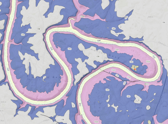
Geologic map of Polly’s Bend (from Kentucky Geological Survey’s Geologic Mapping Service). Ollr, Oto, Ocn are all Ordovician limestones. Qal is Quaternary alluvium, and the stippled pattern with the red + is Quaternary fluvial terrace deposits. Polly’s Bend is about 5 km in maximum width.
The bedrock into which the Kentucky River is cut is overwhelmingly limestone and dolomite—certainly it does not contain any quartzites or sandstones. However, the upper portions of the Kentucky River watershed does contain those rock types. Therefore rounded pebbles of quartzite and sandstone cannot be derived from the local or underlying rock; they can only have been transported by water from elsewhere. The presence of such rounded gravels is what was used to map the Quaternary high fluvial terrace deposits (high relative to the modern river) such as the one shown in the figure above.
However, these exotic, fluvially-transported gravels well above the modern river level are a lot more common than the geologic maps suggest. The photo below shows such gravels about 70 m above the river in the downstream (NW) corner of Polly’s Bend, where no fluvial terrace deposits are mapped. Throughout this area you do not have to look very hard to find them, either.
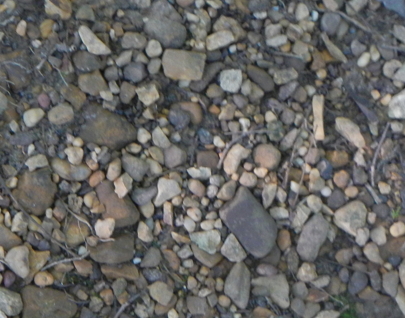
Rounded sandstone & quartzite gravels on upper slopes near the northwest corner of Polly’s Bend.
I also noticed a lot of sand in the soils. You don’t get sand from limestone or any of the local rocks; that also has to have been transported in. That sent me to looking at the soil maps for the area (through the USDA’s Web Soil Survey). Sure enough, many of the soils on the uplands within Polly’s Bend are part of map units that include the Chenault series. This soil type is described as forming on old alluvium deposited on soils derived from weathering of underlying limestone. What I observed is sandier than you’d expect in the Chenault, but entirely consistent with the concept of a soil derived from alluvial sediments over limestone. The soil mappers most likely used the rounded gravels as an indicator.
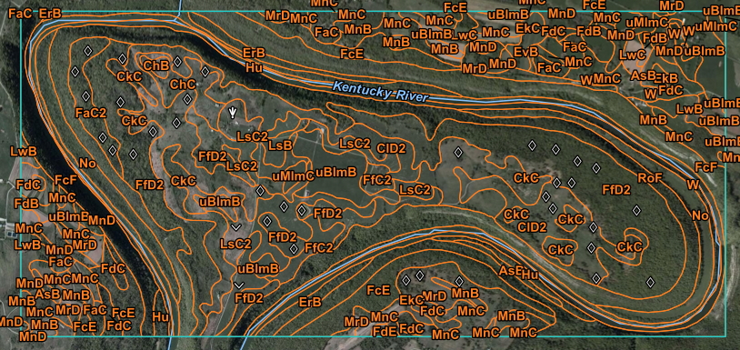
Soil map of Polly’s Bend. All the map unit symbols beginning with “C” are dominated by the Chenault series. Hu, ErB, AsB, and No symbols indicate younger alluvial terrace and floodplain soils.
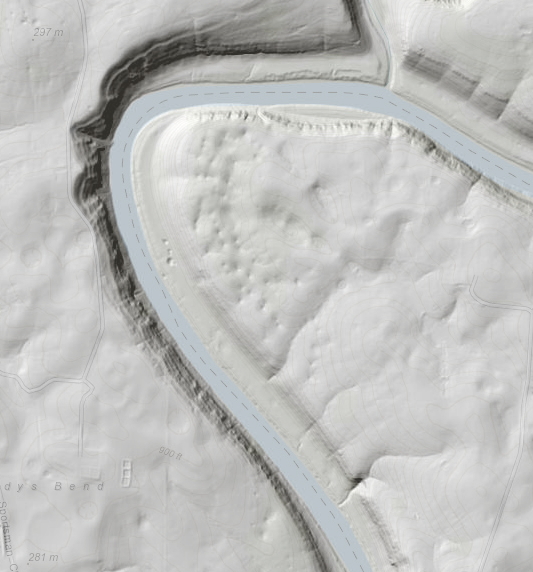
Taking into account the old alluvium represented by rounded gravels and the Chenault soils, the slip-off slope topography (see the previous post) and the location of the more modern alluvial and terrace soils, one can estimate the former channel position pre-incision:
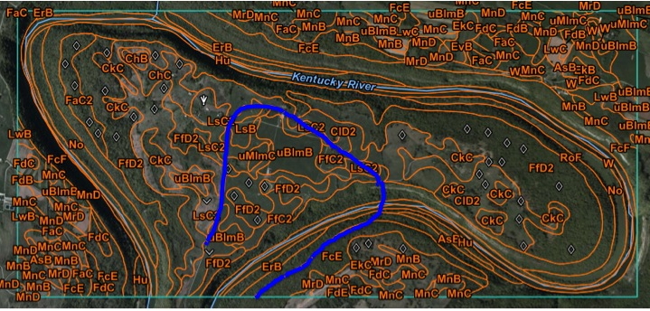
Thick blue line shows estimated pre-incision Kentucky River channel.
The former and current channel positions indicate that some portions of the channel have migrated laterally by as much as 1.5 to 2 km! This seems like a lot for a bedrock channel, but only requires a mean rate of roughly a centimeter a year, so it is entirely plausible. But what caused a fairly typical bend for this stretch of river (in terms of its geometry) to develop into an increasingly tight, complex, gooseneck meander? Geomorphic processes rarely operate at a steady rate, either. Most likely the migration has occurred in fits and starts, with a few episodes of relatively rapid movement separated by periods of little or no migration. What kind of events might these have been, and what triggered them? And what do all those dolines (sinkholes) tell us?
Surface relief of NW Polly’s Bend—note the small depressions, which are karst sinkholes (dolines; indicated by diamond symbols on the soil maps).
I’ll explore these later on, as time allows. Could be a few days or a few months, depending on whatever else comes up to suck up my time or sidetrack my easily-distracted attention.