
South of Lexington and north of Danville, Kentucky, the Kentucky River makes a major turn from a generally SW to NW direction. Shortly downstream, there is a compound “gooseneck” meander bend called Polly’s Bend.
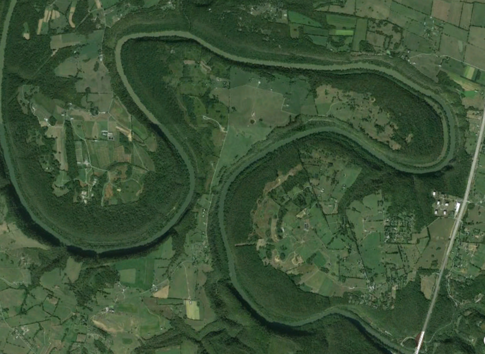
Google EarthTM image of Polly’s Bend. The maximum width from tip to tip is ~ 5 km.; minimum width of the neck is ~ 350 - 400 m.
While not the norm, such tight bends are not uncommon in winding alluvial rivers, and will eventually be cut off during a flood, when the channel cuts across the narrow neck. Polly’s Bend, however, is entrenched in bedrock. The narrow neck (and the rest of the bend) has more than 100 m of solid limestone bedrock to cut through. So a classic meander cutoff, with flow going overbank across the neck and cutting a new channel; that ain’t gonna happen.
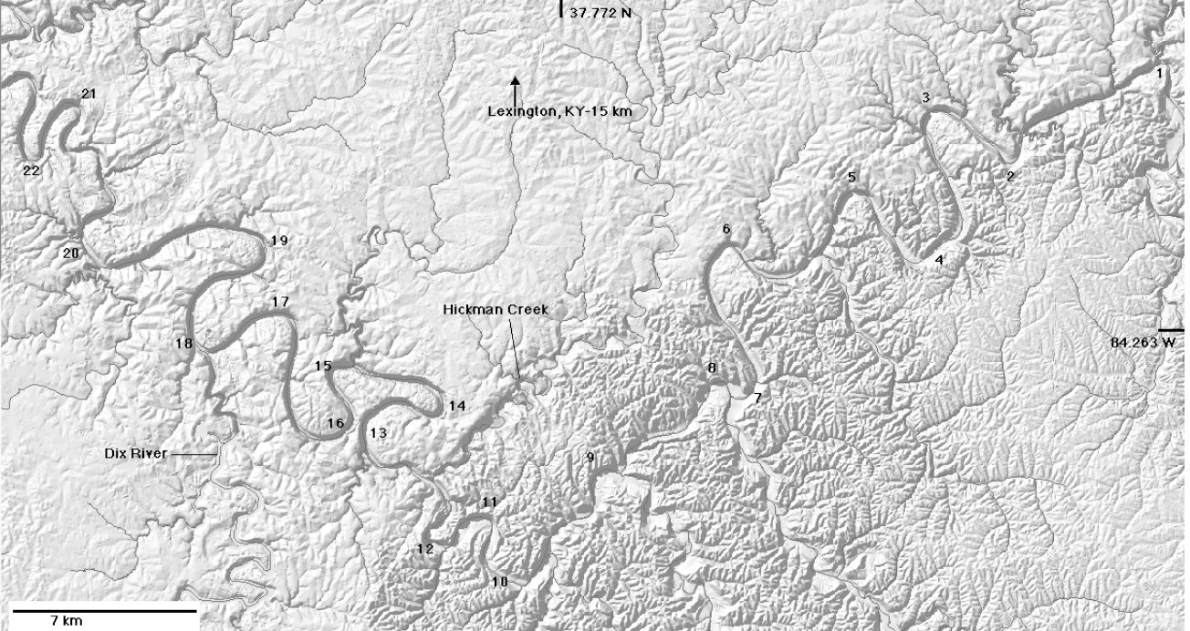
Shaded relief map of the Kentucky River gorge area in central Kentucky, from an earlier report on evolution of meander bends in this area. Bends 13-16 comprise Polly’s Bend.
Entrenched bedrock meanders are not unique to the Kentucky River, by any means. The San Juan River, Utah, for example, is famous for its entrenched gooseneck meanders. “Normal” alluvial meander bends are formed by laterally migrating streams capable of eroding their banks fairly readily. That’s not the case with Polly’s Bend or other entrenched bedrock meanders. The conventional wisdom—at least partly true—is that the river had developed the meander bends when it began downcutting, and the channel incision basically locked the bends into the bedrock.
This, however, implies that the bends (at least with respect to their planform geometry) are pretty much static—that is, even as the channel incises, it does not move laterally. That is not the case, however. While they are nowhere near as dynamic as alluvial meanders, these entrenched meanders can be dynamic, extending even as the river downcuts.
W.M. (Drew) Andrews of the Kentucky Geological Survey worked out the geomorphic evolution of the Kentucky River in his 2004 dissertation. Basically, the downcutting that created the Kentucky River gorge started 1.3 to 1.8 Ma, triggered by glacial rearrangement of the ancestral Ohio River system. Sedimentological and topographic evidence shows where some of the pre-incision channel existed (e.g., Quaternary fluvial terrace deposits), so it can be shown that some of the meanders have extended, or even developed, during the downcutting (see figure below).
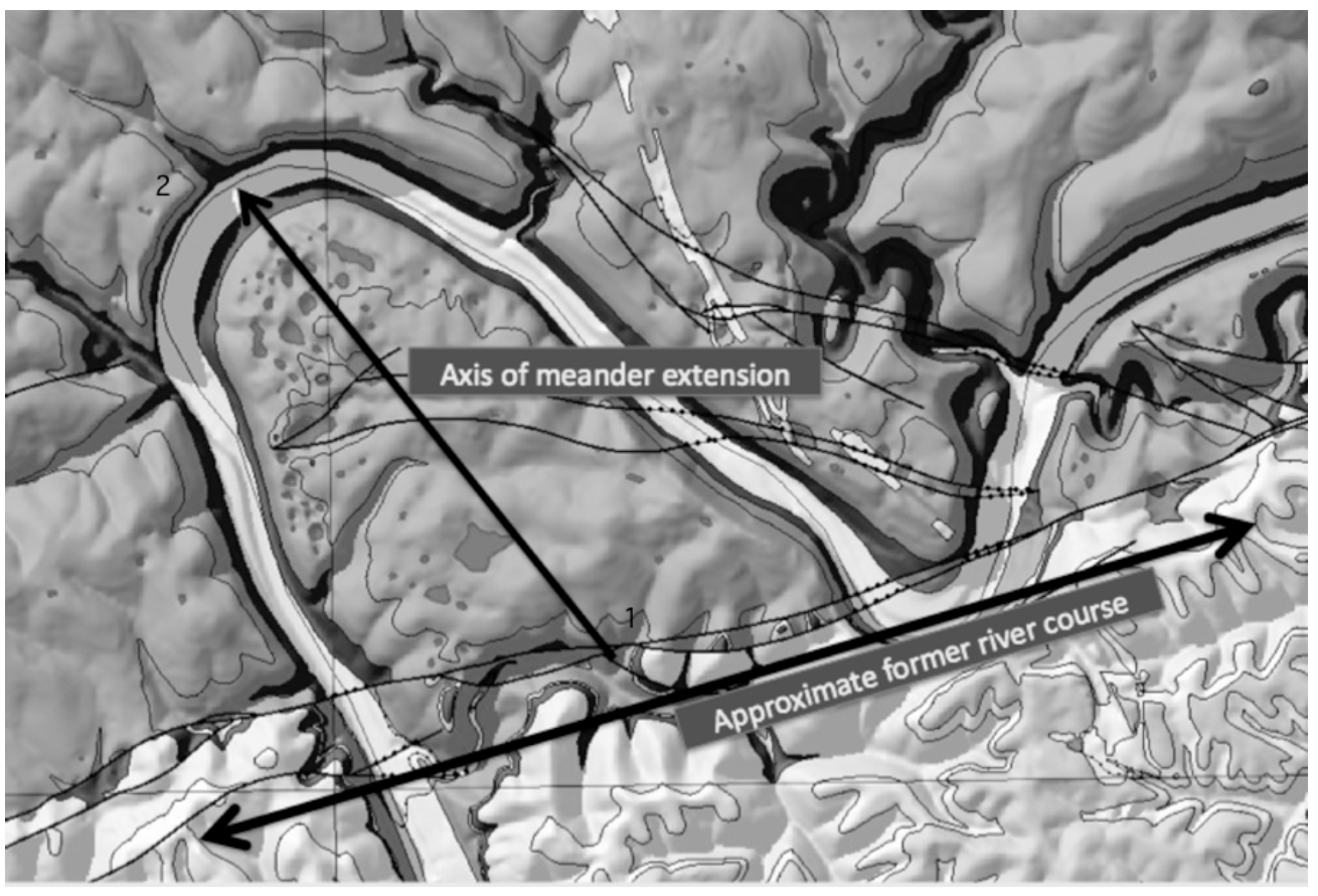 Kentucky River meander bend near Winchester, KY, chosen because high- level Quaternary terrace deposits here allow the approximate local pre-incision course to be identified. As the meander extends as shown, the direction of runoff from location 1 to the river is reversed, and the distance increases. At location 2, the distance to the river is decreased and the local slope steepened. Background tones on the image indicate the karst potential of the mapped geological formations, with darker colors indicating greater potential (Figure 2 from this report).
An alluvial meander grows or extends due to erosion on the outside of the bend (cutbank) coupled with accretion on the inside (point bar). In an entrenched bedrock meander, there is erosion (much of it due to slope processes) on the outer bend, though far more slowly than the bank erosion in alluvial channels. On the inside of the bend, there is a so-called slip-off slope, as the ground is beveled off by the lateral movement of the channel. You can see the slip-off slope on the inside of two of the Polly’s Bend loops in the figure below.
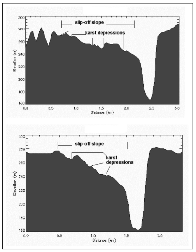
Topographic cross-sections across the apex of two of the Polly’s Bend meanders.
Polly’s Bend seems to have been growing during the incision of the Kentucky River gorge. In the next installment I’ll take a look at additional evidence of the growth of the bend, and exactly how much it seems to have grown.