Why Them? Why There?
In Johnson County, Kentucky, today, lots of people along Patterson Creek are wondering “why me?” A flash flood Monday (July 13) tore through that eastern Kentucky community, leaving three people dead, a dozen missing at one point, and destroying about 150 homes and who knows how many cars, barns, etc. (news story).
As a Kentuckian, and as a veteran of a couple of hurricanes back in 1996 in North Carolina, I sympathize with wondering why you, or your community, got hit while others didn’t. As a geomorphologist and hydrologist who was worked on flash flooding in the southern Appalachians, I also wonder about the scientific aspects—why the severe flood event in this particular location?
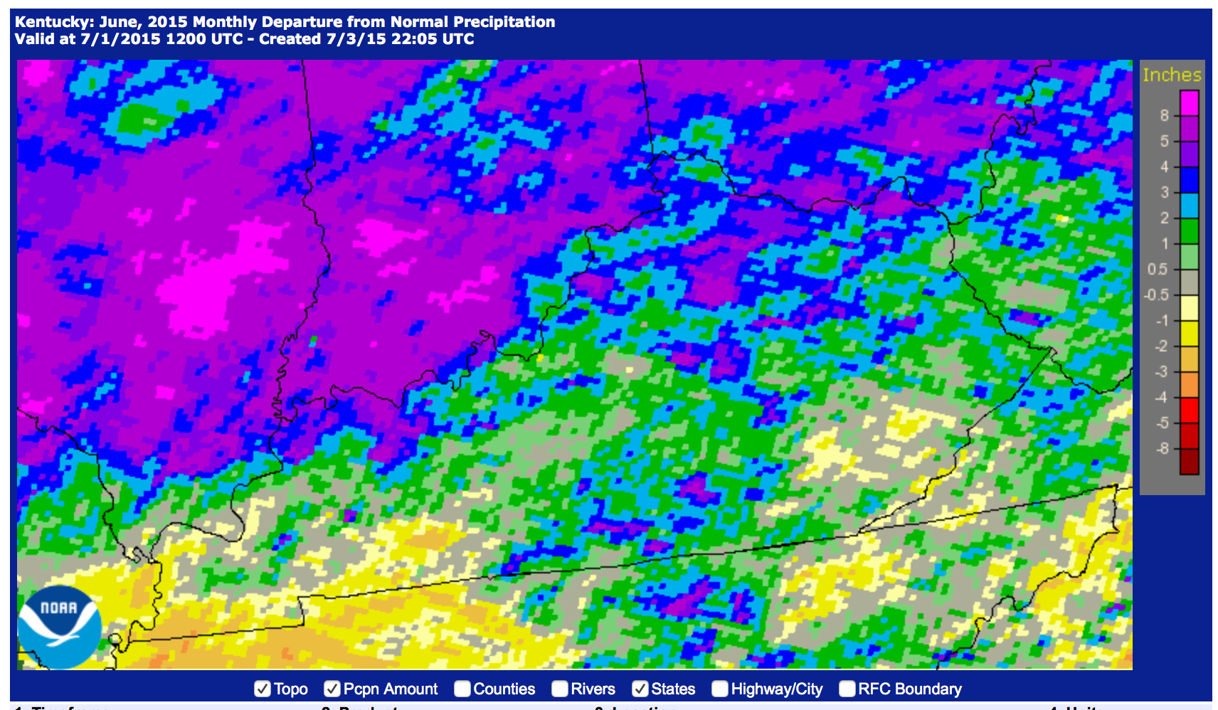
Make no mistake—the area around Flat Gap is not the only one in Kentucky that has gotten a lot of rain recently, and high water, runoff, soil erosion, and filled-up sinkholes are common lately throughout eastern and central Kentucky. But why the much more severe flooding at Patterson Creek?
Did they get more rain?

 No, not like this.