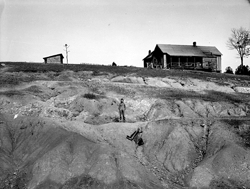
The Dialectics of Geomorphic Complexity

Nearly 10 years ago, while pondering complex nonlinear dynamics in geomorphic systems, I was struck by how often we reduce problems to the interplay of opposing forces (e.g. uplift vs. denudation; soil formation vs. soil erosion, etc). I began to wonder how the concept of dialectics might be applicable in Earth sciences, or maybe I just wanted to increase my pseudo-intellectual street cred by using "dialectics" in an article. Anyway, I started work on a manuscript with the working title shown above, and then dropped it. I rediscovered it on the hard drive recently, and while I still can't convince myself it is journal article material, I do think there's some potentially interesting ideas there. 

What you see below is what I wrote in early 2006 (thus the absence of reference to work since then), unmodified except for putting in a few graphics to relieve the visual tedium.

1. Introduction

The title begs at least three questions: what do I mean by dialectics, how am I defining complexity, and how do I propose to link them?

1.1.  Geomorphic Complexity

The Dubious Power of Power Laws


Everyone knows the classic normal distribution—the “bell curve,” where most observations cluster around the mean, and the frequency falls off toward either end, with well known statistical properties. Lots of things in nature are more-or-less normally distributed, but lots of things are not. In some cases distributions are “heavy-tailed,” such that for example there are many of the small ones, and increasingly fewer as size increases. Famous examples are the distribution of earthquake magnitudes, rank-size distributions of cities, and the distribution of wealth in societies.

Models of avalanche size distributions in (mathematically-simulated) sand piles were seminal in developing ideas about self-organized criticality and power laws, both in geomorphology and in general. Unfortunately even real sandpiles, much less more complex systems, are not necessarily well described by the models.

Convergence, Divergence & Reverse Engineering Power Laws

Landform and landscape evolution may be convergent, whereby initial differences and irregularities are (on average) reduced and smoothed, or divergent, with increasing variation and irregularity. Convergent and divergent evolution are directly related to dynamical (in)stability. Unstable interactions among geomorphic system components tend to dominate in earlier stages of development, while stable limits often become dominant in later stages. This results in mode switching, from unstable, divergent to stable, convergent development. Divergent-to-convergent mode switches emerge from a common structure in many geomorphic systems: mutually reinforcing or competitive interrelationships among system components, and negative self-effects limiting individual components. When the interactions between components are dominant, divergent evolution occurs. As threshold limits to divergent development are approached, self-limiting effects become more important, triggering a switch to convergence. The mode shift is an emergent phenomenon, arising from basic principles of threshold modulation and gradient selection.

Circular Reasoning

Scientists, including geographers and geoscientists, are easily seduced by repeated forms and patterns in nature. This is not surprising, as our mission is to detect and explain patterns in nature, ideally arising from some unifying underlying law or principle. Further, in the case of geography and Earth sciences, spatial patterns and form-process relationships are paramount.

Unfortunately, the recurrence of similar shapes, forms, or patterns may not tell us much. Over the years we have made much of, e.g. logarithmic spirals, Fibonacci sequences, fractal geometry, and power-law distributions—all of which recur in numerous phenomena—only to learn that they don’t necessarily tell us anything, other than that several different phenomena or causes can lead to the same form or pattern. The phenomenon whereby different processes, causes, or histories can lead to similar outcomes is called equifinality.

Center pivot irrigation in Kansas, USA (USGS photo).

Compressed Course: "Mapping Variation: An Introduction to the Use of Geospatial Tools for Linguistic Analysis" (A&S 500-003)

This one-week, one-credit compressed course focuses on mapping variation through the use of geospatial tools like GIS.  The course, offered as A&S 500-003, will take place from November 9-13 from 5-8pm each day in the Oliver Raymond Building, room C226.  As a 500-level course, it is open to both graduate and undergraduate students.

Dr. Montgomery's research investigates ways of integrating techniques used in geography with those traditionally used in dialectology.  His specific focus in the use of GIS technologies is innovative in the field of linguistics, and his presence on UK's campus will expose the community here to some of the most recent endeavors in these kinds of digital humanities research methodologies.  Despite a focus in linguistic variation, this class will present methods that could be applied to many of the social sciences and humanities, wherein the questions deal with societal patterns, variations in those patterns, and the geospatial presentation and analysis of data related to those patterns.  If you have any questions about this course, please contact Dr. Jennifer Cramer (jennifer.cramer@uky.edu).

Date:
-
Location:
Oliver H Raymond Building, Room C226
Tags/Keywords:

Disturbing Foundations

Some comments from a reviewer on a recent manuscript of mine dealing with responses to disturbance in geomorphology got me to thinking about the concept of disturbance in the environmental sciences. Though the paper is a geomorphology paper (hopefully to be) in a geomorphology journal, the referee insisted that I should be citing some of the “foundational” ecological papers on disturbance. These, according to the referee, turned out to be papers from the 1980s and 1990s that are widely cited in the aquatic ecology and stream restoration literature, but are hardly foundational in general.

Consideration of the role of disturbance goes back to the earliest days of ecology, and is a major theme in the classic papers of, e.g., Warming, Cowles, and Clements in the late 19th and early 20th centuries. A general reconsideration (“reimagining” is the term many would use, but I’ve grown to hate that overused word) of the role of disturbance in ecological systems was well underway by the 1970s, and the last five years or so have seem some very interesting syntheses of these emerging ideas (two I especially like are Mori, 2011 and Pulsford et al., 2014).

Bank Full Of It

Fluvial geomorphologists, along with hydrologists and river engineers, have long been concerned with the flows or discharges that are primarily responsible for forming and shaping river channels. In the mid-20th century it was suggested that this flow is associated with bankfull stage—the stage right at the threshold of overflowing the channel—and that this occurs, on average, about every year or two in humid-climate perennial streams. If you have to choose just one flow to fixate on—and sometimes you do, for various management, design, and assessment purposes—and have no other a priori information about the river, bankfull is indeed the best choice. But, of course, nature is not that simple.

Subscribe to