
Charmaine Chua: Fast Circulation, Slow Life: The Racial Fix of Logistics
Fast circulation, slow life: The racial fix of logistics
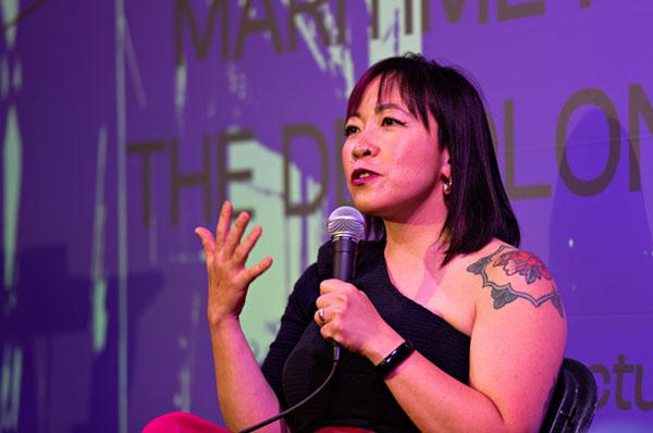
by Charmaine Chua, Ph.D.
Mainstream understandings of “race” and racism often fail to examine the relationship between race and class. Such approaches often insufficiently understand the horizon of racial equality to be the inclusion of the previously excluded into the market, positing the economy as fundamentally race-neutral.
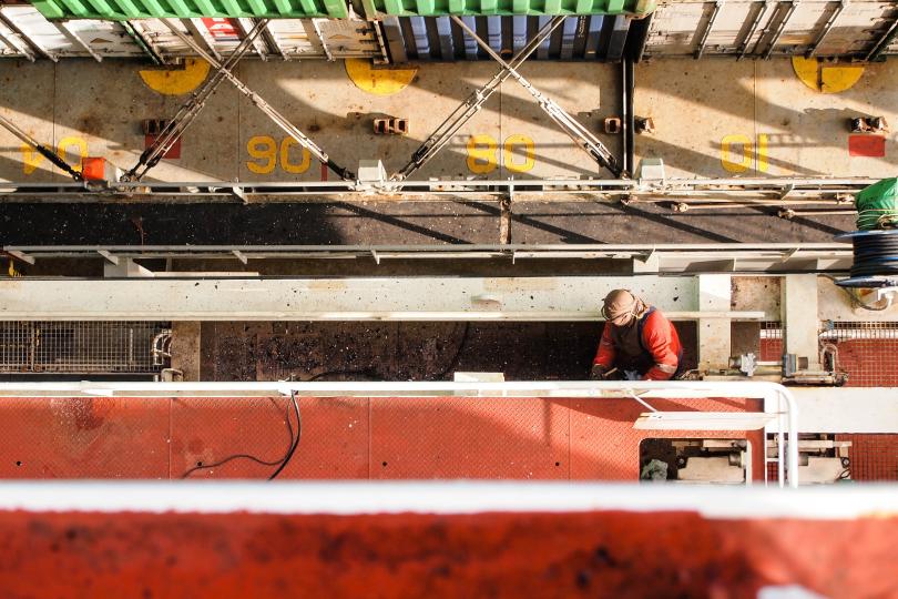
In this paper, I argue that racial inequality is not only reproduced through capitalist markets but constitutes and structures the rules of the logistics industry through a "racial fix." I make this argument through an interrogation of the racialized structures of seafaring labor. Drawing from ethnographic field work on board a container ship, I show that racism structures burgeoning and accelerating global supply chains in three ways:
- Through the colonial legacy of market-based contracts.
- Through states’ own promotion of racialized stereotypes of its people.
- Through the self-exploitation of logistics workers who internalize racialized rationalizations of their capacity to work.
Taken together, my ethnography accounts for an understanding of the racial capitalism structuring the logistical movement of global supply chains as a racial fix, structuring global subcontracting relations not only through the geographical expansion of the global supply chain but also through structural and subjective forms of racialized exploitation. In this way, I argue, logistics capitalism reproduces racial capitalism as a “technology of antirelationality” (Melamed 2015).
Charmaine Chua, Ph.D., is a Singaporean scholar, organizer and writer and acting associate professor of geography at the University of California, Berkeley. Her interdisciplinary research focuses on Marxist political economy, postcolonial development, and technological change, with a specific interest in how the rise of the logistics industry has reconfigured the contemporary relations between supply chain capitalism, race, and empire.
Her first book, "The Logistics Counterrevolution," is forthcoming from University of Minnesota press in 2027. She is also at work on a second book, "How to Beat Amazon: The Struggle of America's New Working Class" (co-authored with Spencer Cox). Her work has been published in Society and Space, The Review of International Studies, the Socialist Register, Theory and Event, Antipode, The Boston Review, The Nation and Jacobin, among other venues.
She co-directs the Marxist Institute of Research, serves as the current chair of campus organizing with the Council of UC Faculty Associations, organizes with the Logistics Workers League and No Harbor for Genocide, and is a research fellow at the Transition Security Project, where she works on tracing military supply chains.
In 2023, she was named a Marguerite Casey Foundation Freedom Scholar in recognition of movement leaders who participate in academia with a demonstrated commitment to supporting social movements.
Date:
-
Location:
Gatton Business and Education Bldg. - Rm. 191
2024-2025
FALL 2024
FRI AUG 30, 3pm, TBD || “Where Did Geography Take You This Summer?”
WED SEPT 6, 3-5pm, CPB 139 || "Prison Captial: Mass Incarnation and Struggles for Abolition Democracy in Louisiana" || Book Launch: Dr Lydia Pelot-Hobbs (UK GEO)
FRI SEPT 13, 3pm, CPB 222 || "Geopolitics As Agrarian Geography: Notes for Agricultural Policy Co-Analysis" || Dr Garrett Graddy-Lovelace (American U)
Solar infrastructures begin in the mine: legacies of colonial extraction and local governance of renewable energy in Morocco
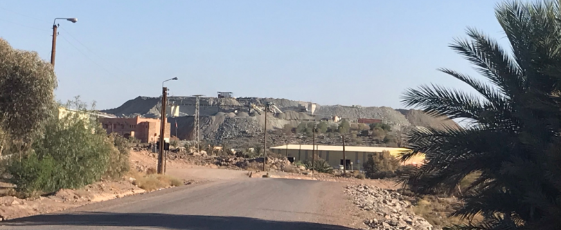 What does it mean to be a company town? While popular imaginaries offer ready images of how company towns take shape under conventional extraction regimes like coal, these mining legacies also have implications for territorial governance under renewable energy regimes. This seminar examines colonial archives and contemporary dynamics around cobalt mining in the Moroccan desert to examine continuities in local governance dynamics between conventional extraction and renewable energy across time and space. I describe the daily political contestations over who is in control when both state and corporate authorities in mining and solar energy zones assign responsibility for local development to one another. Ambiguities over jurisdiction and authority highlight fundamental questions of sovereignty—who owns the sun as well as the sub-surface—raised by energy transition initiatives in marginalized rural spaces around the world.
Karen Rignall is a cultural anthropologist and associate professor at the University of Kentucky. Her research examines just energy and economic transition in rural mountain zones, with a focus on agrarian change, rural politics, land rights and natural resource governance in both North Africa and the central Appalachian region of the US. She has conducted ethnographic fieldwork and multi-disciplinary collaborations informed by economics, political ecology, and critical energy studies. Dr. Rignall is currently doing community-based research comparing the social dynamics of mining and renewable energy in Morocco; this work is transitioning into the establishment of a natural resource observatory in coalition with community members and civil society networks. Her work on energy and economic transition in the Appalachian US also addresses the legacy of mining for renewable energy transitions, supporting grassroots networks rooted in rural communities and their visions for vibrant, egalitarian futures.
Date:
-
Location:
Gatton B&E Room 191
The Sweet Promise: Letters to Mrs. Cornelia
In May of 2015, with her mind still on freedom and transforming the soil that her enslaved ancestors were forced to work, Mrs. Cornelia Walker Bailey, a well-known Saltwater Geechee activist, writer and storyteller brought together her son Maurice, and a Professor from the University of Georgia named Nik, to help her grow numerous varieties of Gullah Geechee heritage crops; she did so in an effort to mobilize a vision for preserving her community. By summer of 2017, she, Maurice and Nik started to see her vision begin to manifest through the clearing of land, erecting of fences, installing of irrigation, planting of crops and pulling of weeds; lots of weeds. But then in September 2017, Hurricane Irma engulfed the Hogg Hummock community in a violent storm surge; one of the largest/most intact remaining Gullah Geechee communities left in the country was under six feet of water including the initial crop of Purple Ribbon sugarcane they had grown together. As the storm waters receded and the crops dried out, a month later, Mrs. Cornelia suddenly passed away. Nik, who had promised Mrs. Cornelia that he would do all he could to help Maurice make her vision a reality the last time they spoke, two weeks before her passing amidst the havoc wreaked by Irma, realized that promise took on life-changing meaning in her death; it felt like a mandate that could never be renegotiated. This epistolary talk will chronicle the travails, tribulations and little triumphs the Hogg Hummock community has experienced since Mrs. Cornelia’s passing. The talk will also chronicle Maurice and Nik’s work together to make her vision a reality since her death, through letters written to her.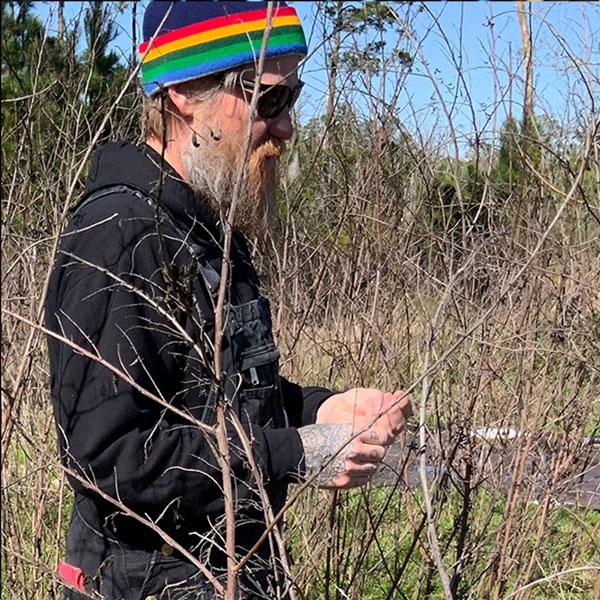 Nik Heynen is a Distinguished Research Professor in the Department of Geography at the University of Georgia and a Visiting Scholar in Food Studies at Spelman College. His research interests sit at the intersection of economic, environmental and racial justice. For just over a decade he has been working with members of the Saltwater Geechee in the Hogg Hummock community on Sapelo Island on the restoration of traditional agricultural practices and flood mitigation made necessary as a result of descendants losing their land to development pressure and increasing sea-level rise. Through this work he co-directs UGA’s Cornelia Walker Bailey Program on Land, Sea and Agriculture with Maurice Bailey. He is also the Director of Education and a board member for the Athens-based oyster shell recycling non-profit organization Shell to Shore.
Date:
-
Location:
Gatton B&E Room 191