THE RESILIENCE TRIANGLE

The state of an Earth surface system (ESS) is determined by three sets of factors: laws, place, and history. Laws (L=L1, L2, . . . , Ln) are the n general principles applicable to any such system at any time. Place factors (P=P1, P2, . . . , Pm) are the m relevant characteristics of the local or regional environment. History factors (H = H1, H2, . . . , Hq) include the previous evolutionary pathway of the ESS, its stage of development, past disturbance, and initial conditions. Geoscience investigation may focus on laws, place, or history, but ultimately all three are necessary to understand and explain ESS. 

I first started using the law-place-history (LPH) framework as a pedagogic device in my teaching, and as a sort of aide memoire framework in my research. Eventually I began invoking it more explicitly in my research and writing, and expressing it formally, as in the passage above lifted from Phillips, 2018. 

THE SONGS OF LANDSCAPE EVOLUTION

My approach to the study of the structure, function, and evolution of Earth surface systems (landscapes) is based on the premise that they are controlled and influenced by three sets of factors, summarized as laws, place, and history. Law represents laws per se, such as the conservation of mass, energy, and momentum, and also for other generalizations and representations that are independent of location and time. Place represents the environmental context in which laws operate – ‘other things’ that are rarely equal. Path-dependent, historically contingent aspects of landscapes comprise the history. These may include sensitivity to initial conditions, previous evolutionary or developmental pathways, stages of development, disturbance histories, and time available for system development or evolution. 

My work and my approach also emphasize multiple possible evolutionary pathways and outcomes, the sensitivity of many Earth surface systems to seemingly minor variations and disturbances, and the amazing variety of landscapes resulting therefrom. These are discussed in fascinating/excruciating detail in my to-be-published-any-day-now book, Landscape Evolution.

FLOW PARTITIONING & SOIL GENESIS

Preferential flow occurs at all scales and in all phenomena in hydrological systems. By this we mean that rather than more-or-less uniform sheets of runoff moving across the ground surface, or more-or-less uniform bodies of water soaking into and seeping through soils and groundwater aquifers, most flow is concentrated in preferential flow paths.

Preferential flow of surface water—the universal tendency for flow to become channelized and form channel networks—is so obvious that it has been more or less taken for granted, though the mechanisms, and resulting structures and fluxes remain a highly active area of research. In soil and regolith, preferential flow has long been recognized, but its ubiquitous importance has only been widely recognized in recent decades. There are two main reasons for this, I think. Some forms of preferential flow, in soil pipes, large root channels, conduits, etc. are obvious, but other forms, such as macropore flow, are not readily recognized in the field. Second, a Darcian approximation of flow through porous media as a uniform mass often works fairly well, even where this type of flow is not necessarily dominant—presumably because the local preferential flow variations tend to average out in the aggregate.

THE SUBCRITICAL EASE OF BREAKING ROCKS

Several years back when I was working on the energetics of landscape evolution, focusing on the biological subsidy to geophysical energy sources, I tried to get my head around the energy required to turn fresh rock into transportable debris by weathering. I looked at factors such as the chemical activation energy of rocks, and various strength/stress measures (tensile & compressive strength, etc.). My geochemistry and rock mechanics background is/was too feeble for me to get very far with this beyond drawing two very broad conclusions:

1. It takes a lot of energy to break down rock.

2. There has to be more to it than the basic force/resistance principles (for example shear stress vs. shear strength) that I am familiar with, and that work perfectly well in some contexts. 


Breaking rocks the hard way

INSTABILITY & COMPLEXITY IN BANK EROSION

River and stream bank erosion is normally assessed—including studies I was involved in--by reaches. That is, the erosional (or stable or accreting) status is assessed along sample reaches of a certain length (e.g., 100 m long segments), or lengths of shoreline are classified—e.g., a 40 m erosional stretch, a 120 m stable stretch, 30 m accreting length, etc. Or, where rates are measured, they are presented (not illogically) as mean or characteristic values for a reach.  They are also generally averaged over time—so, for example, if the bank retreated 1 m in a decade, a rate of 0.1 m yr-1 is reported. Again, in many cases that is entirely reasonable, as (depending on the study design) there is often no way of knowing for sure if the erosion occurred at a more-or-less steady rate, all in one flow event, or somewhere in between. For some alluvial streambanks, there also exists uncertainty as to whether the observed retreat represents nothing but erosion, as opposed to net erosion—for instance, 1.5 m of retreat over 10 years, offset by 0.5 m of accretion somewhere during that time.

Eroding banks, Old River, Louisiana.

BIOGEOMORPHOLOGICAL DOMINATION

Just published in Geomorphology, with Pavel Šamonil: Biogeomorphological domination of forest landscapes: An example from the Šumava Mountains, Czech Republic.

This paper originated from a more general study of forest biogeomorphology in unmanaged forests of the Czech Republic. In higher elevations and upper slopes mainly in the Šumava National Park, we noticed an almost complete lack of stream channels and surface runoff, except on or near roads and associated drainage features (and in the valley bottoms).

Pavel Šamonil (right) and yours truly.

Thanks for the (Soil) Memories

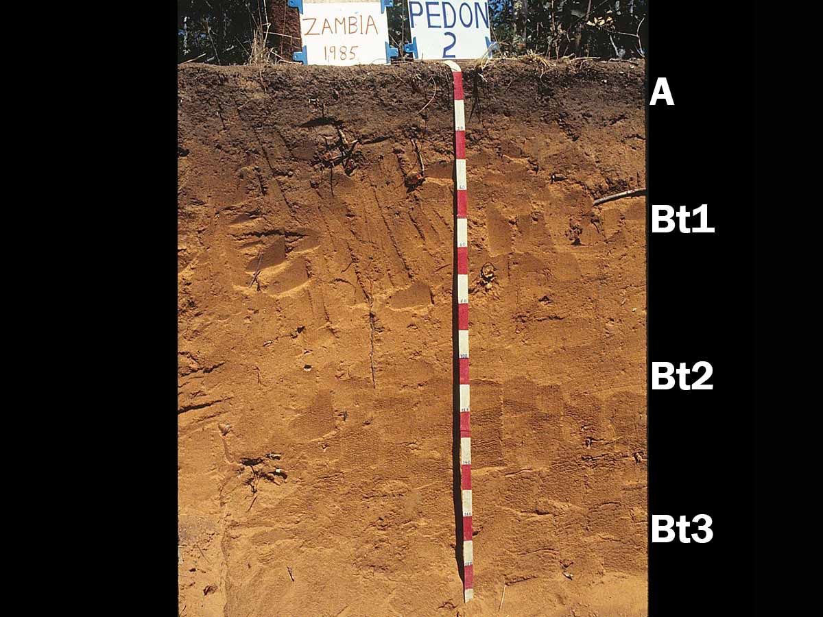
In my own work on pedology, soil geography, and soil geomorphology, there are at least three overlapping concepts of soil memory (or pedological memory) that at least generally, if clumsily, parallel the pedological literature as a whole.  

One is based on the fundamental idea of soils as products of the environment, reflecting the combined, interacting influences of geological (or other) parent material, hydrological and geomorphological processes, climate, biota, all changing over time, and affecting each other and affected by the soil itself.  This is the factorial or state factor model of soils going back to Dokuchaev and Jenny, and the conceptual basis of soil geography, surveying and mapping. Inverting the logic—soils as evidence of the environment rather than the environment as an explainer of soils—is the basis of paleopedology and paleoenvironmental interpretations of paleosols. This concept of soil memory is that soils “remember” the environmental factors influencing their genesis and development.

Carsten Lorz has used the memory of soils such as this one in Saxony, Germany, to reconstruct Quaternary pedogenesis. 

Subscribe to