Blogs

Reducing Reductionism

In many of my writings I advocate an alternative to reductionist approaches to science. By alternative, I mean a complementary, different way of doing things, not a replacement for reductionism. Many excellent reviews of scientific approaches, viewpoints, and methodological stances exist by historians, philosophers and sociologists of science, and by scientists themselves. I do not intend to review or critique these various approaches here. Further, I have no intent to deny the value or necessity of reductionist science. The crux of my argument is that a reductionist approach, by itself, is inadequate or incomplete for understanding Earth.

The American Heritage Dictionary defines reductionism as an attempt or tendency to explain a complex set of facts, entities, phenomena, or structures by another, simpler set, and provides a quote from John Holland:

For the last 400 years science has advanced by reductionism ... The idea is that you could understand the world, all of nature, by examining smaller and smaller pieces of it. When assembled, the small pieces would explain the whole.

Some Observations on Observation

The characteristics of a place or system can be factors that are measurable or observable, or those that are not observed or observable. Of the observable phenomena, there are (at least) two different classes. First, there are those whose detection and interpretation does not vary among observers (allowing, of course, for the fact that among us there are humans exceptional in various ways). But the vast majority of humans beyond infancy will recognize, say, a rock, and will not be inclined to argue about whether or not the boulder in question is a rock or not. Suitably trained observers (e.g., geologists) may further agree that the rock is, say, granite.

The Principle of Gradient Selection

Flows of mass and energy occur along the steepest gradients of potentials or concentrations.  The principle of gradient selection is simply that features associated with these gradients persist and grow. Take, for instance, the redistribution of excess (i.e., more than the ground can absorb or retain) surface water. Hydraulic selection principles favor the most efficient paths, which we can generally interpret as the fastest pathways. Thus the steepest slopes and/or the routes with the lowest resistance to flow attract more water. The most efficient paths persist and prevail; less efficient options dry up.  For example:

Standard flow resistance equations are of the general form

V = f(RaSbf-c)

where R is hydraulic radius (cross-sectional area divided by wetted perimeter; typically roughly equal to mean depth), S is slope (hydraulic gradient), and f is a roughness or frictional resistance factor. The exponents a, b, c < 1. For example, the D’Arcy Weisbach equation is

V = 8g R0.5 S0.5 f-0.5

Threshold Modulation vs. Steady-State

Threshold modulation

Upper and lower limits

In terms of mass balances or budgets, geomorphic systems have three fundamental states, whereby losses or removals are either greater than, less than, or roughly equal to inputs or gains (i.e., steady-state). Thus a regolith cover, for instance, is either thinning, thickening, or maintaining steady-state relative to the rates of mass losses and inputs, and weathering and regolith formation.

The principle of threshold-mediated modulation holds that thresholds limit development on both ends (negative or positive mass balance), and that exceeding the thresholds may initiate development in the opposite direction. For instance, vertical accretion on alluvial floodplains is limited by an elevation at which regular flooding no longer occurs, thus limiting further accretion. In addition, confinement of flows within the channel may increase stream power and shear stress, thus ultimately resulting in stripping of the alluvium.

The Balance of Nature, and the Nature of Balance

If Mother Nature has plans, those plans are flexible. She keeps her options open, allows for more than one route to a given location, and we cannot assume that the same circumstances will always produce the same outcome. To digress for a moment: accepting this need not challenge religious or philosophical beliefs about a creator. Nothing in the bible, for instance, specifies exactly how the Judeo-Christian God goes about his/her business, or specifies any single pathways or mechanisms. As a protestant minister I knew well used to say: “Religion is concerned with the ‘why’ questions, and science addresses the ‘how.’”

Indeed. 35 years in the geoscience research business has shown me that that there is no single “right” or “natural” way for the world to be. Any human notions of singular, immanent norms or optima are tied to needs, goals, or perceptions, not scientific laws or relationships. And—again—there is nothing wrong with having such goals, desires, or expectations for nature, any more than there is anything wrong with a farm or a garden. The key is to realize that there is not much point in expecting Earth surface systems to evolve toward and maintain a single specific condition, any more than we would expect a garden to maintain itself without some guidance and intervention.

Talking Climate

In 1997, world leaders met in Kyoto, Japan to discuss how to confront, combat, and adapt to climate change. Eighteen increasingly warmer (on average) years later, a new set of climate talks start in Paris (France, not Kentucky) today (30 November), and continue for 12 days.

Some U.S. politicians have already courageously declared that the U.S. will do nothing, no matter how compelling the evidence, how severe the problems, or what the rest of the world thinks. As we get a new round of public commentary during and after the Paris talks, two recent studies—one journalistic and one academic—are worth considering.

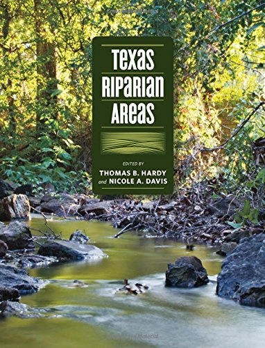
Texas Riparian Areas

Texas A&M University Press has recently published Texas Riparian Areas. According to TAMU Press's blurb: 

Riparian areas—transitional zones between the aquatic environments of streams, rivers and lakes and the terrestrial environments on and alongside their banks—are special places. They provide almost 200,000 miles of connections through which the waters of Texas flow. Keeping the water flowing, in as natural a way as possible, is key to the careful and wise management of the state’s water resources.


Texas Riparian Areas evolved from a report commissioned by the Texas Water Development Board as Texas faced the reality of over-allocated water resources and long-term if not permanent drought conditions. Its purpose was to summarize the characteristics of riparian areas and to develop a common vocabulary for discussing, studying, and managing them.

If I Had a Hammer

For the past five years or so, I have been working on adaptations of algebraic or spectral graph theory to study geomorphic, pedological, and ecological systems. My most recent development (unpublished, for reasons that will become clear in a moment) is some methods for measuring the complexity of historical sequences in Earth surface systems.

The idea is that a historical sequence represents a series of different states or stages—for example, vegetation communities along a successional trajectory; river channel morphological states; different soils in a paleosol sequence; depositional environments in a stratigraphic sequence, nodes of phylogenetic trees in biological evolution, etc.  These are treated as directed graphs. The states or stages are the graph nodes or vertices, and the historical transitions are the edges or links between the nodes.

Connecting the Dot Factors

The standard conceptual model for pedology, soil geomorphology, and soil geography is often called the “clorpt” model, for the way it was portrayed in Hans Jenny’s famous 1941 book The Factors of Soil Formation:

S = f(cl, o, r, p, t) . . . .

This equation states that soil types or soil properties (S) are a function of climate (cl), biotic effects (o for organisms), topography (r for relief), parent material (p), and t for time, conceived as the age of the surface the soils are formed on, or the time period the soil has been developing under a given broad set of environmental controls. This factorial approach, considering soils as a function of the combined, interacting influences of environmental factors such as geology, climate, and biota, was originated by V.V. Dokuchaev in Russia in the 1880s, popularized in English by C.F. Marbut in the 1920s and 1930s, and developed by Jenny into the familiar clorpt form.

The Dialectics of Geomorphic Complexity

Nearly 10 years ago, while pondering complex nonlinear dynamics in geomorphic systems, I was struck by how often we reduce problems to the interplay of opposing forces (e.g. uplift vs. denudation; soil formation vs. soil erosion, etc). I began to wonder how the concept of dialectics might be applicable in Earth sciences, or maybe I just wanted to increase my pseudo-intellectual street cred by using "dialectics" in an article. Anyway, I started work on a manuscript with the working title shown above, and then dropped it. I rediscovered it on the hard drive recently, and while I still can't convince myself it is journal article material, I do think there's some potentially interesting ideas there. 

What you see below is what I wrote in early 2006 (thus the absence of reference to work since then), unmodified except for putting in a few graphics to relieve the visual tedium.

1. Introduction

The title begs at least three questions: what do I mean by dialectics, how am I defining complexity, and how do I propose to link them?

1.1.  Geomorphic Complexity