

LOCAL ANOMALY OR CULTURAL SHIFT?
In my experience, beer cans and bottles discarded as litter in the kinds of places where I recreate and do field work are about 80 percent Bud Light, 17 percent other undrinkable watery American light beers, and 3 percent all other brands combined. Recently, however, at a site along the Neuse River, North Carolina, the two dozen or so trash bottles I saw on the ground included NO Bud Lights!
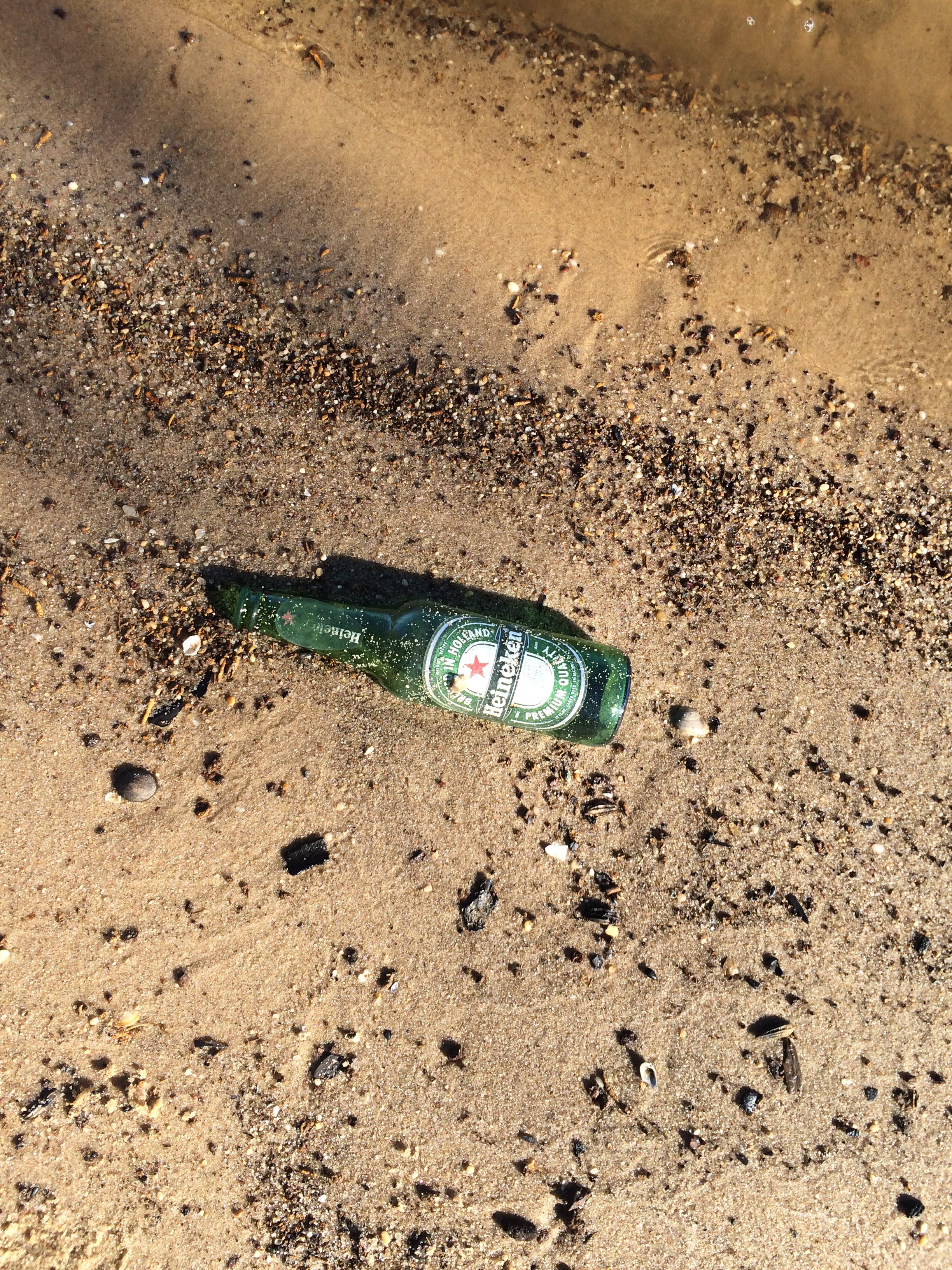
I am not well versed enough in contemporary cultural or economic geography to speculate as to whether this is a local anomaly, a shift in taste preferences for the kind of sh*tbag Bud Light drinkers who trash the countryside, or an expansion of litterbug behavior beyond the Lite beer crowd.
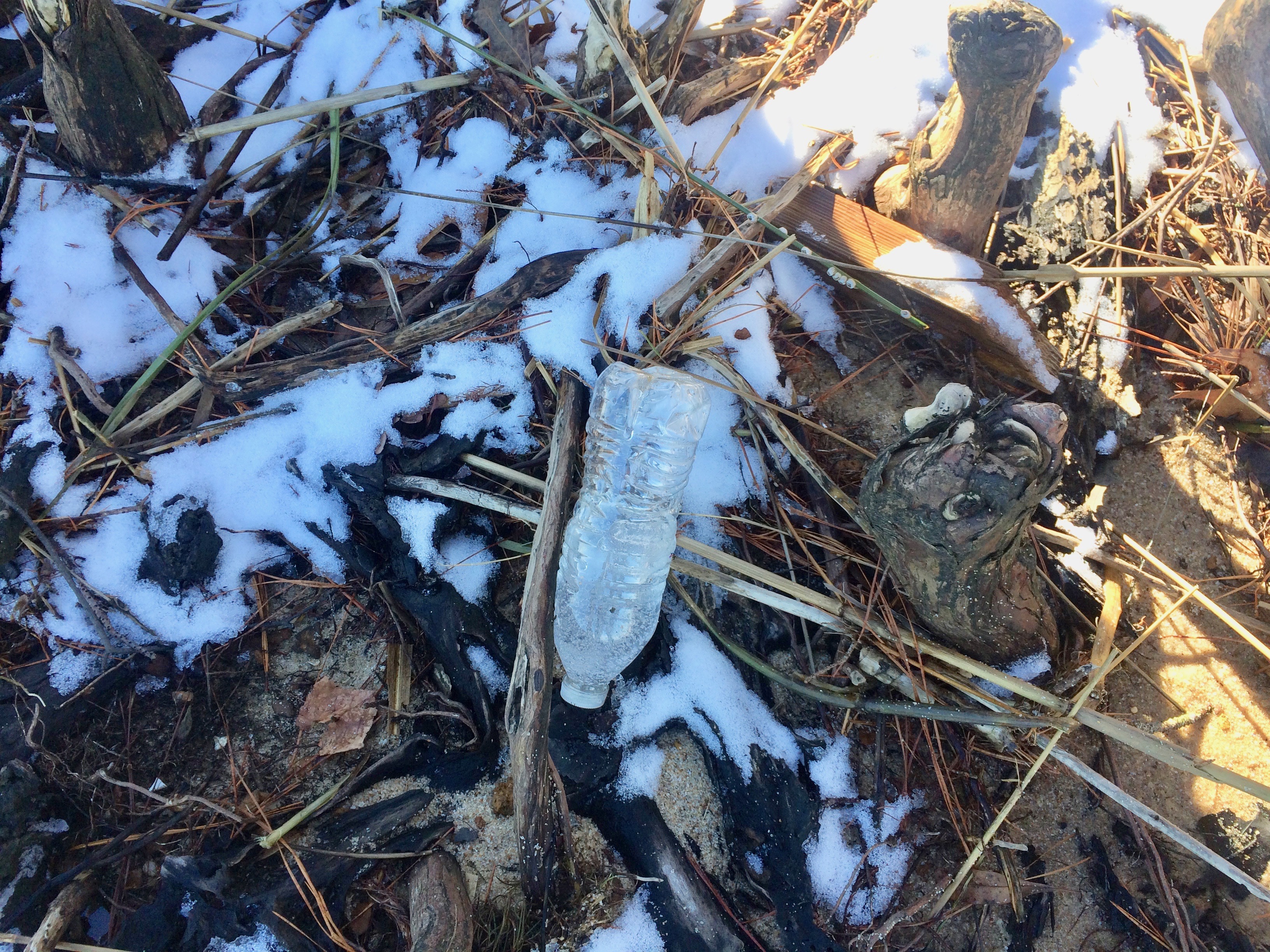
Of course, when it comes to beverage container trash, no brand of beer, soda pop, or anything else comes close to the mass or volume of plastic water bottles. Why don't you people use canteens, reusable bottles, or at least recycle these things?
Posted 22 January 2018
BIRTH OF FERRICRETES
Ferricretes are soil or sediments cemented together by iron oxides. In eastern North Carolina, reducing conditions often prevail on the broad, flat interfluves. Under these conditions Fe is reduced, and soluble. Groundwater flow from these areas toward the major river valleys transports this dissolved ferric iron. When the groundwater discharges along the valley side slope it comes in contact with oxygen, and the iron oxidizes to its ferrous form. These iron oxides coat whatever material exists at that location--sand, clay, etc.
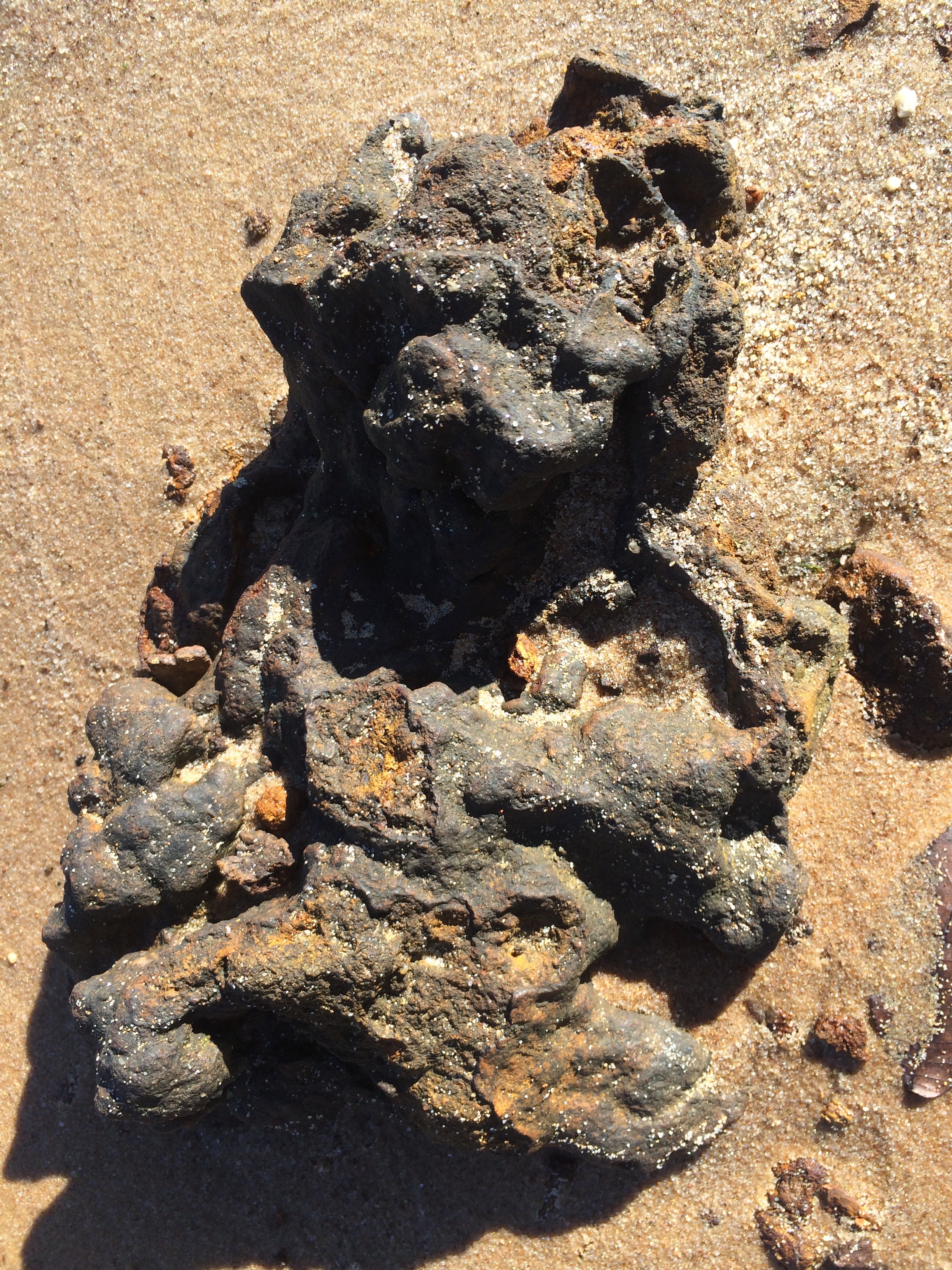
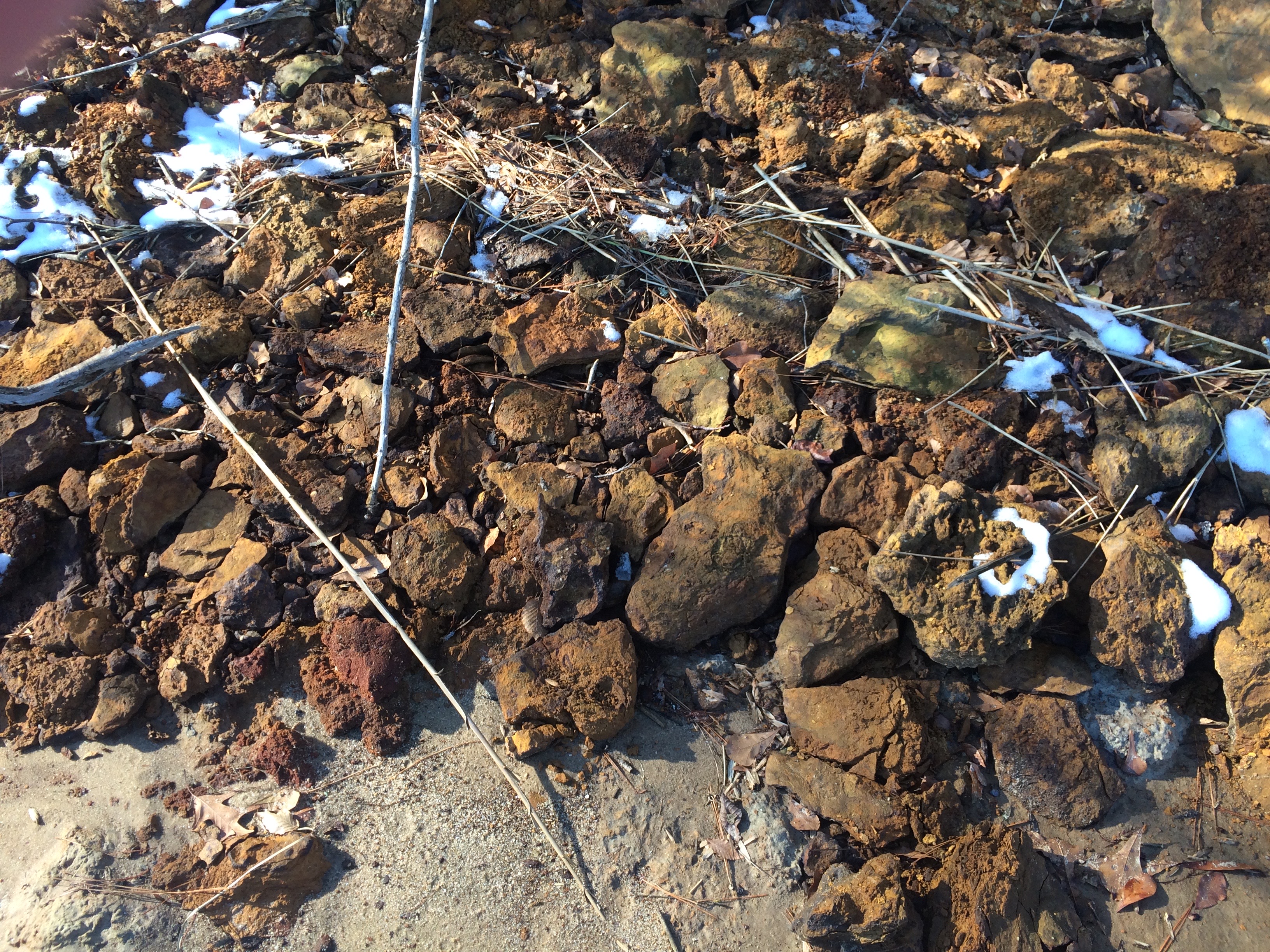
Limonite ferricrete at Fishers Landing, NC. The piece at the top is about 40 cm long.
When these iron-coated materials are exposed, typically by bank or shoreline erosion, they harden into rock-like ironstones--ferricretes. Once the Fe-coated material is exposed, it can harden very rapidly; within a year or two. They are hard enough so that geologists erroneously interpreted them as sandstone layers into the 1990s. When I read about a similar ferricrete formation process in Australia, I realized that the ironstone I'd been seeing might be formed the same way; some of them were very clearly NOT sandstones.
Love in the Eyes of Competitors: China's Mass-Mediated Loveland in the Neoliberal Universe
Date:
Location:
Room 334 Whitehall Classroom Building
Environmental Risk Reduction Research in Rural Communities: Tobacco and Radon Exposure
Date:
Location:
Room 334 Whitehall Classroom Building
HYDRAULIC UNIT RICHNESS & COMPLEXITY
Just published:
The abstract is below, and a preprint version is available here. 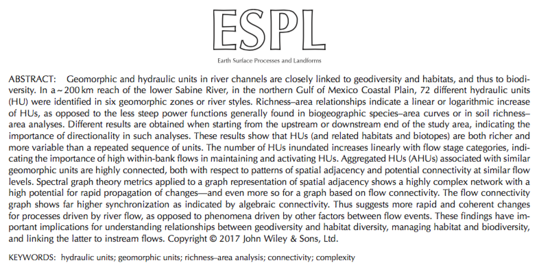
Posted 6 December 2017
PATH EXTINCTION & REINFORCEMENT
The development and change over time (evolution) of geomorphic, soil, hydrological, and ecosystems (Earth surface systems; ESS) is often, perhaps mostly, characterized by multiple potential developmental trajectories. That is, rather than an inevitable monotonic progression toward a single stable state or climax or mature form, often there exist multiple stable states or potentially unstable outcomes, and multiple possible developmental pathways. Until late in the 20th century, basic tenets of geosciences, ecology, and pedology emphasized single-path, single-outcome conceptual models such as classical vegetation succession; development of mature, climax, or zonal soils; or attainment of steady-state or some other form of stable equilibrium. As evidence accumulated of ESS evolution with, e.g., nonequilibrium dynamics, alternative stable states, divergent evolution, and path dependency, the "headline" was the existence of > 2 potential pathways, contesting and contrasting with the single-path frameworks. Now it is appropriate to address the question of why the number of actually observed pathways is relatively small.The purpose of this post is to explore why some developmental sequences are rare vs. common; why some are non-recurring (path extinction), and some are reinforced.
THE GEOMORPHOLOGICAL NICHE OF TREES
In a 2009 article I introduced the concept of a geomorphological niche, defined as the resources available to drive or support a particular geomorphic process (the concept has not caught on). The niche is defined in terms of a landscape evolution space (LES), given by
![]()
where H is height above a base level, rho is the density of the geological parent material, g is the gravity constant, and A is surface area. The k’s are factors representing the inputs of solar energy and precipitation, and Pg represents the geomorphically significant proportion of biological productivity (see this for the background and justification).
Geography in Practice
Boyd Shearer and Whitney Walker are graduates of the UK Geography program. They will be presenting on their work, and the opportunities for geographers and geographic education at UK and in Lexington.
Date:
Location:
204 Whitehall Classroom Building
Critical Race Theory: A Revolutionary Theory for Social Activism and Sport
Date:
Location:
106 Whitehall Classroom Building