
In Johnson County, Kentucky, today, lots of people along Patterson Creek are wondering “why me?” A flash flood Monday (July 13) tore through that eastern Kentucky community, leaving three people dead, a dozen missing at one point, and destroying about 150 homes and who knows how many cars, barns, etc. (news story).
As a Kentuckian, and as a veteran of a couple of hurricanes back in 1996 in North Carolina, I sympathize with wondering why you, or your community, got hit while others didn’t. As a geomorphologist and hydrologist who was worked on flash flooding in the southern Appalachians, I also wonder about the scientific aspects—why the severe flood event in this particular location?
Make no mistake—the area around Flat Gap is not the only one in Kentucky that has gotten a lot of rain recently, and high water, runoff, soil erosion, and filled-up sinkholes are common lately throughout eastern and central Kentucky. But why the much more severe flooding at Patterson Creek?
Did they get more rain?
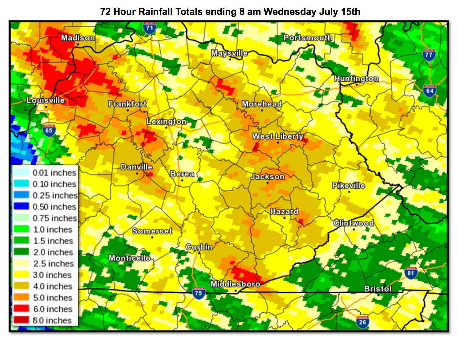
The eastern Kentucky climate division that includes Johnson County was recorded as having received 2.28 inches of rain July 13-15, and 3.21 in over the July 9-15 period (1 inch = 25.4 mm, the preferred SI unit for precipitation). This is about 2 inches over what would be considered normal for the period. The University of Kentucky Agricultural Weather Center’s (http://wwwagwx.ca.uky.edu) modeled precipitation maps based on observed rainfall shows the entire eastern Kentucky region with 3 to more than 4 times normal precipitation for the week ending at 19:00 (EDT) July 15. But note that some areas (Louisville vicinity, southern Ohio) are even higher:
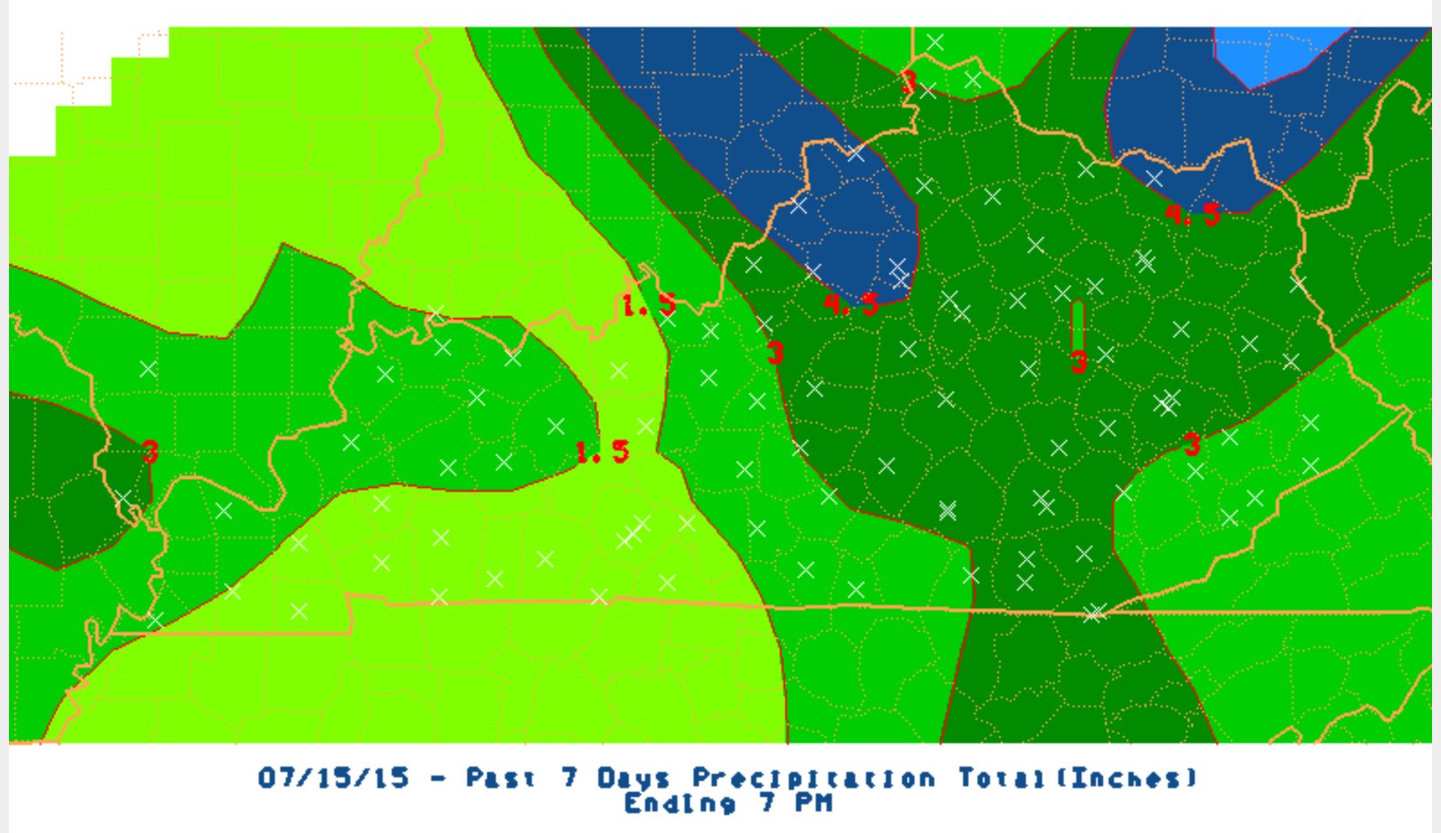
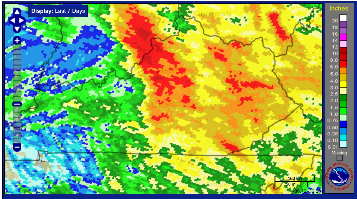
National weather service radar-based precipitation for 08:00 am July 12 to 08:00 July 15 shows a splotch of red, indicating precipitation of 6 inches or more, exactly where the Patterson Creek flooding occurred. The 7-day radar precipitation map also shows a big red streak that includes the NW corner of Johnson County. But also note that precipitation was equally high in a number of other sites in eastern and central Kentucky that experienced no more than nuisance flooding. It is also worth noting that creeks immediately adjacent to Patterson Creek did not experience catastrophic flash flooding.
Topography and soils?
In eastern Kentucky and the southern Appalachians flash flooding is relatively common. The regional climate is such that intense frontal or thunderstorm precipitation occurs now and then. Slopes are steep and soils are generally thin, both of which tend to increase runoff and the rapidity of runoff response. Thus the region is prone to occasional flash floods, which of course can be exacerbated when surface mining, logging, and other land uses which tend to increase runoff occur.
But the Patterson Creek watershed does not appear to be atypical of the region with respect to topography or soils.
Land use
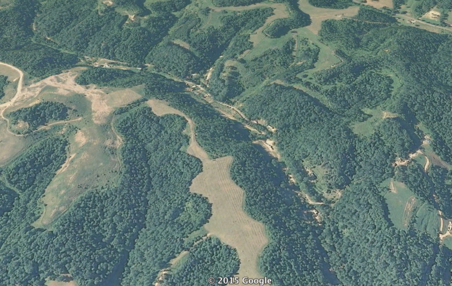
In the Google Earth image below, Patterson Creek valley is in the middle. The unforested areas you see on the ridgetops are former surface mine sites. The effects of surface mining on runoff and flooding in eastern Kentucky depend quite a bit on local details of soil, topography, vegetation, mining and reclamation practices, and local hydrology. However, the most common impact is an increase in the amount and timing of runoff, which contributes directly to flash flooding.
Patterson Creek is, alas, hardly unique within the region with respect to having been strip-mined for coal. So while the mined lands are a reasonable suspect in the recent flood, their presence alone does not explain why Patterson Creek flooded while others did not. Patterson Creek is also not unique in having residents along the valley bottom and thus vulnerable to flooding. Due to the steep slopes of the region, valley-bottom settlement is common in the region, and often the only practical option for farming or homesteading.
A perfect storm?
Likely the explanation is a combination of heavy localized precipitation (the spatial variation of which often occurs on scales too fine to show up in radar measurements) falling on already-soaked ground in an area predisposed to flash flooding, flowing into a creek which was probably running high to start with. Only detailed onsite work could even hope to settle the extent to which meteorological, topographic, soil, and land use factors contributed. Due to a relatively sparse network of rain gages, the coarse resolution of radar-based precipitation estimates, and no stream gages on Patterson Creek or any other smaller stream in the region, thus would be difficult to solve.
However, incidents such as this illustrate a broader point of the combined, interacting effect of environmental factors and history (from precipitation the previous few days to the legacy of land use) at a particular place and time to produce unexpected results. For risk and hazard management, perhaps this suggests the need to try to identify and map combinations of risk factors (such as active or reclaimed surface mines in low-order watersheds).