
geoscience

BIOGEOMORPHIC NICHE CONSTRUCTION BY UPROOTING

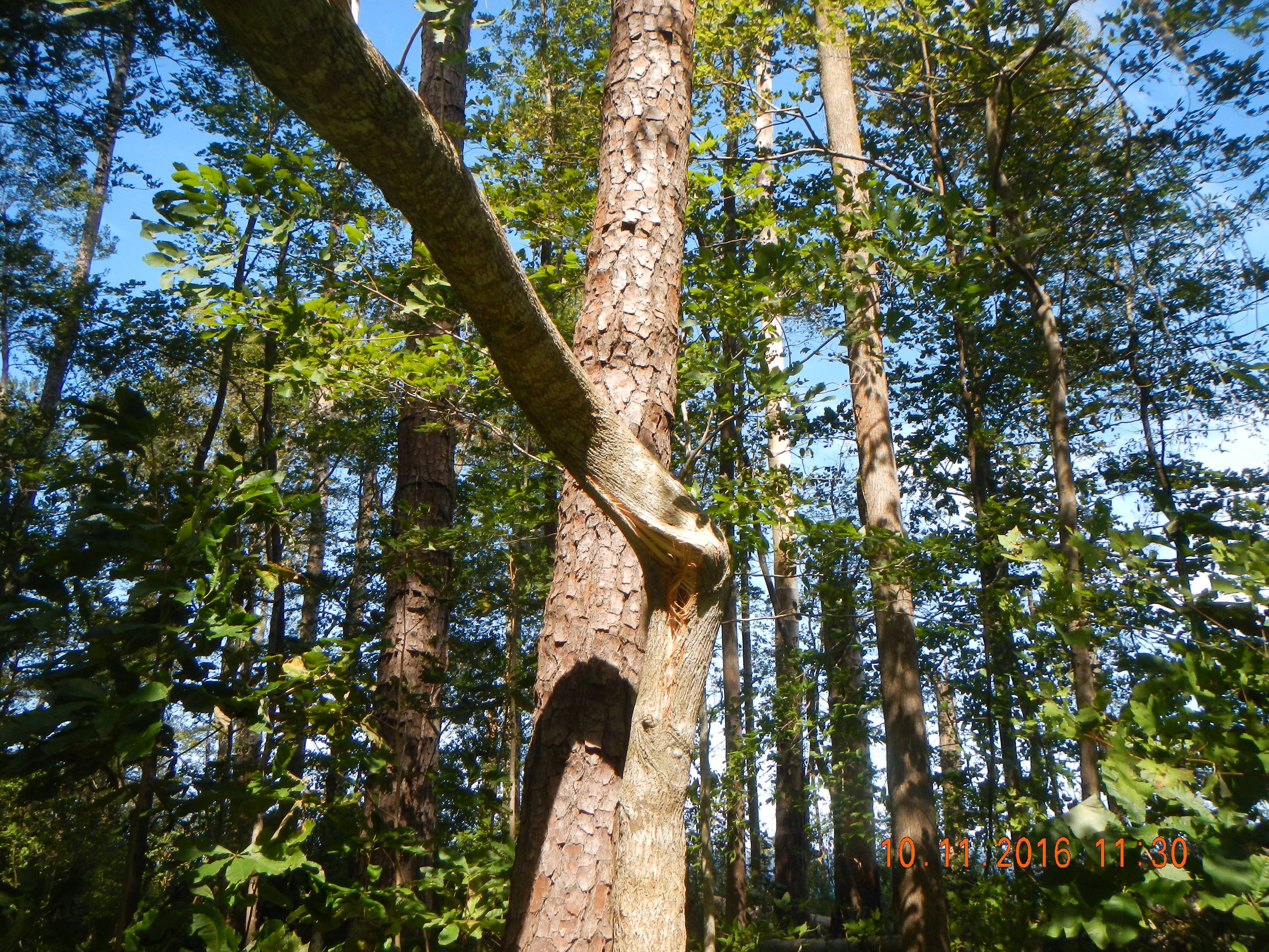
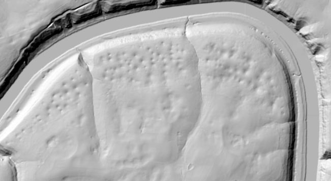
Tree uprooting in forests has all sorts of ecological, pedological, and geomorphological impacts. Those are not just related to disturbance--because of the time it takes uprooted trees to decompose, and the distinctive pit-mound topography created, those impacts may last decades to centuries (and sometimes even longer).  One discussion I've often had with colleagues who study this sort of thing has to do with ecosystem engineering and niche construction. Obviously uprooting is a major biogeomorphic process. Obviously it has important impacts on habitat. But do these impacts favor either the engineer species (i.e., the tipped over tree) or some species? Or are they more or less neutral, in the sense of modifying habitat but not necessarily in such a way as to systematically favor any given species?

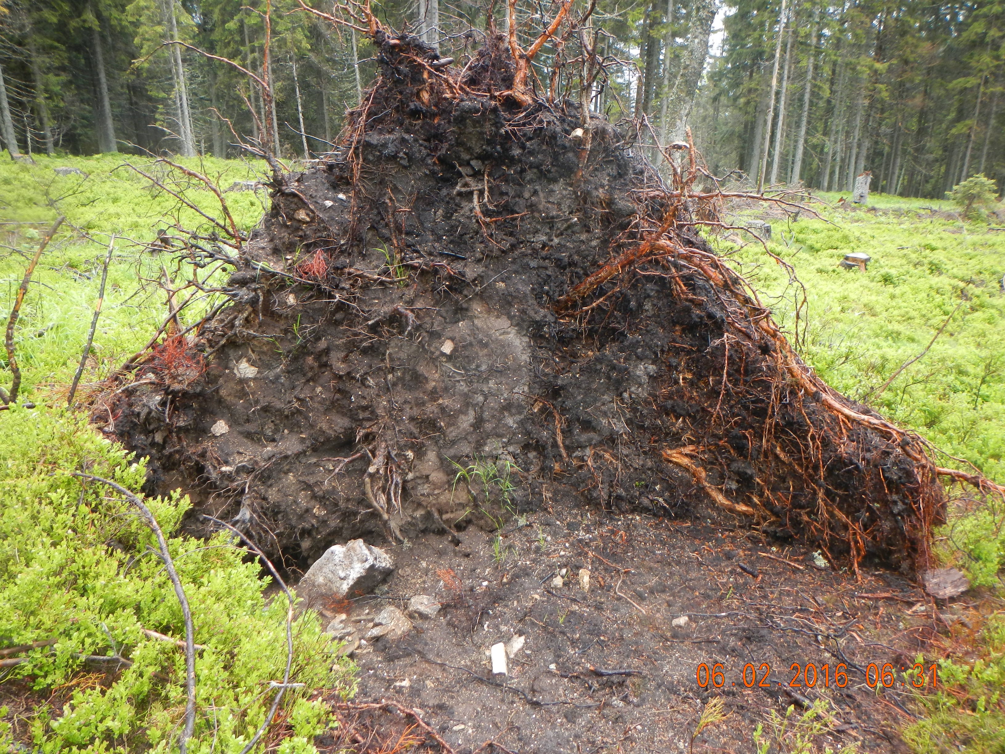
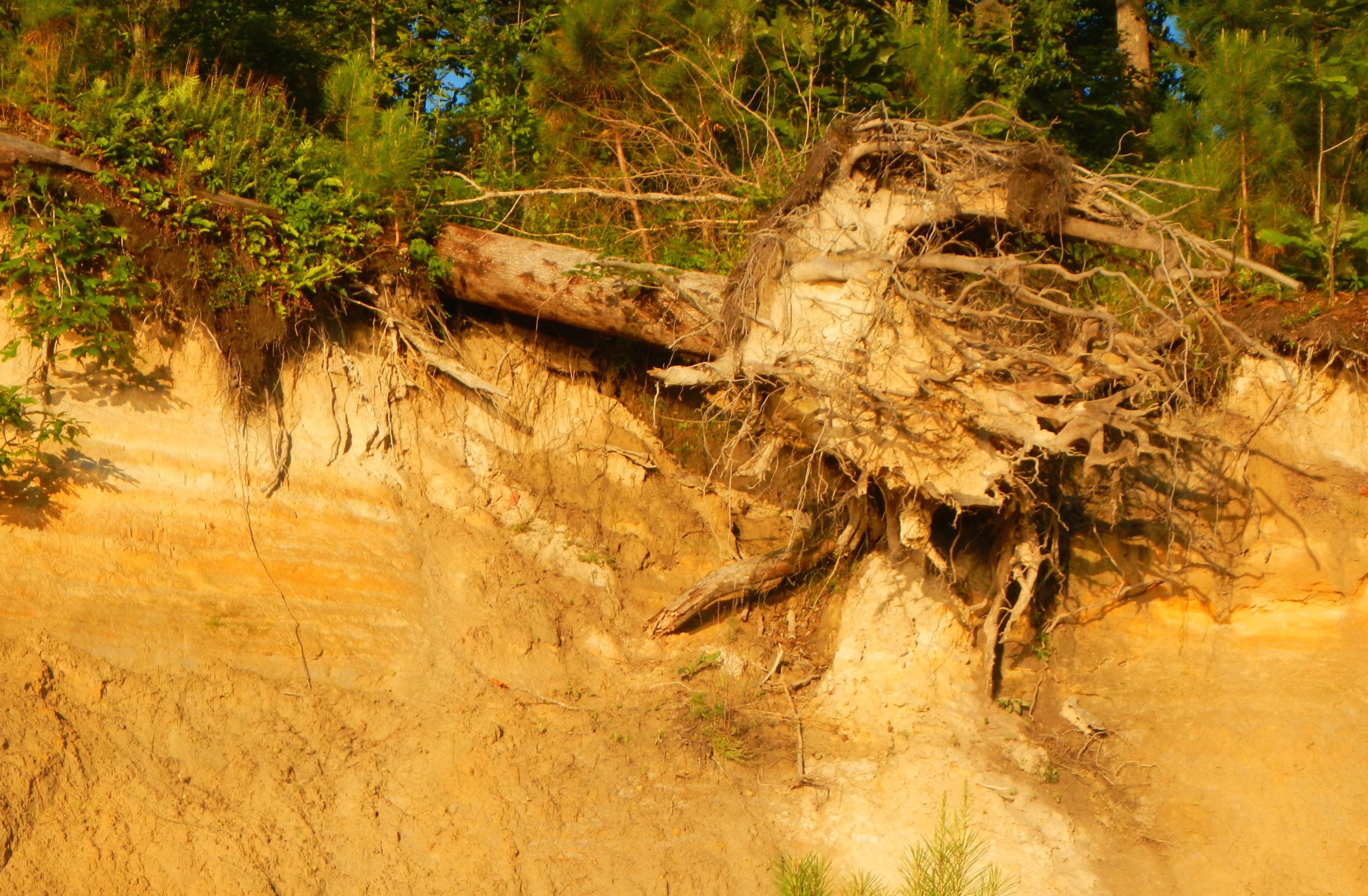
Uprooted Norway spruce.

STAGES OF BIOGEOMORPHIC EFFECTS

The biogeomorphic impacts of organisms may differ at different stages in the development of landforms, ecosystems, or the individual organisms. I was thinking about this recently here along the shoreline bluffs of the Neuse River estuary, North Carolina, where I have been both looking at some soil profiles and enjoying the coastline.

There are at least five distinctly different biogeomorphic roles trees play along this shoreline--many more if you wanted to get more specific within these categories. The specifics are probably of only limited applicability elsewhere, but the general principle--multiple effects, which vary at different stages of both landform and vegetation development--is widely valid.

Trees and other vegetation grow thick and fast in this moist subtropical climate.

Stage 1A Surface Bioprotection

Trees (including canopy, roots, and litter) protect the ground surface from erosion and add organic matter to soil.

A CHURNING URN OF BURNING FUNK

In studies of soil formation and landscape evolution, we often think in terms of a (over-) simplified "conveyor belt" model, where bedrock is weathered to create the raw material for soil formation at the base. Further up toward the ground surface, this weathered rock is progressively modified into soil. Thus, as you go from the base of the soil or weathering profile, material gets progressively more modified, and (in terms of soil rather than rock), older.

Anyone who's spent time in more than a few soil pits or road cuts knows that the conveyor belt is, at best, a loose approximation and often hardly applicable at all. Variations in properties of the rock or parent material, dynamical instabilities and positive feedbacks in weathering and other pedogenetic processes work in many cases to create increasingly variable and heterogeneous (both vertically and horizontally) regoliths over time. Critical processes operate in all directions (not just vertically), and moisture fluxes and biological activity follow preferential, self-reinforcing paths. Further, mass is added not just from weathering, but from deposition and organic matter, and removed by erosion, leaching, fire, and decomposition.

METANARRATIVES, EXTREMAL PRINCIPLES, & ANOTHER REJECTION

The attached paper (In Defense of Metanarratives:Extremal Principles, Optimality and Selection in Earth Surface Systems) was originally written in early 2015 and revised in April 2015, as an invited paper for a special issue of a geography journal. By mutual agreement with the guest editors, I withdrew the paper after deciding that I was unwilling/unable to satisfy some of the major recommendations of reviewers. The major, but by no means only, issues were that referees and guest editors felt I should more fully address history and philosophy of science issues and parse the definitions of principles, theories, narratives, etc. I felt that I could say what I was trying to say without getting into that stuff, which would have taken a lot of work on my part that would have seriously inhibited my studies on the (to me) far more interesting and important topics of how Earth surface systems actually work. After sitting on it for two years, and publishing bits and pieces of the ideas on optimality and selection in other contexts (but not the metanarratives part) I concluded that I am unlikely to ever resubmit it anywhere. But I did put a lot of work into writing the damn thing, so I am posting it online, for what it is worth.

BIOGEOMORPHOLOGICAL SELECTION

Biogeomorphology considers the impacts of organisms on surface processes and landforms (e.g., biological weathering, effects of burrowing animals), and vice-versa (e.g., the role of landforms as habitat, effects of erosion on biota). We are particularly concerned these days, however, with reciprocal interactions, such as sediment trapping by vegetation, and the feedback effects of this deposition on plants and their habitat. We are also learning a lot about biogeomorphic ecosystem engineering (BEE), whereby biota modify the abiotic environment in ways that influence habitat or resources (positively or negatively) for themselves or other species, and biogeomorphic niche construction, where BEE effects influence selection pressures and biological evolution.

REGOLITH MOBILITY

Some recent theoretical and modeling work on regolith and the so-called critical zone draws a distinction between the entire thickness of weathered material H and the mobile thickness h that is potentially (re)movable by erosion and mass wasting. As H > h this implies that in many cases there exists a subsurface immobile layer.

This distinction between a potentially laterally mobile and a fixed layer of weathered material is no doubt useful as a model assumption. It is also probably true, or close enough, for some very thick weathered mantles. And of course, the mobile:immobile distinction is self-evidently true during periods when a portion, but not all, of the regolith thickness is being transported.

Regolith in the flysch Carpathians, Czech Republic. Lighter upper layer is a landslide deposit. Lower material (the black layer is charcoal, apparently from a fire at some point) is weathered in place. It is all potentially mobile.

WE DON'T HAVE TO SHOW YOU ANY STINKIN' FACTS (1)

We are currently mired, at least here in the US, in a political and cultural milieu where truth, facts, and logic are not only ignored by many citizens and alleged leaders, but are actively resisted. (2)   This drives scientists especially crazy, as we are trained and wired to argue and act based on hard evidence and logic. Our efforts in this regard are wildly imperfect, but it is a universally agree upon ideal, and in our world, while facts can be modified and tested, they cannot be ignored or denied.

Alfonso Bedoya in the famous "no stinkin' badges" scene from the Treasure of the Sierra Madre.


For years there has been a great deal of (justified) hand-wringing over how scientists can and should communicate with the general public--how to translate complex and specialized concepts into understandable terms, without oversimplifying or trivializing them. These concerns have accelerated lately with respect to the deliberate obfuscation and politicization of issues such as climate change, sea-level rise, and environmental protection.

KARSTIFICATION AT BOWMAN'S BEND

As the Kentucky River in central Kentucky continues to downcut through Ordovician limestones in the Kentucky River gorge area, entrenched meanders grow. On the outside of these bends tributary streams are truncated, their slopes accordingly steepen, and fluvial dissection becomes more dominant. On the inner part of the bends, slip-off slopes develop that are far less steep than valley walls on the outer bends, but steeper on average than the adjacent uplands. These inner bend areas are hotspots for karstification, and are pockmarked with numerous dolines (karst sinkholes). Streams are few and small; larger tributary streams are apparently diverted away from the inner bends; in any case no tributaries with a surface drainage area of more than a few km2 join the river on the inside of a meander (at least in the gorge area). This article includes a section on the "Badass Bends" and their diverging karst vs. fluvial dynamics. This previous post discusses the expansion of the Polly's Bend compound meander.

LESSONS FROM ICICLE BEND

Last year, my fluvial geomorphology class investigated the origin of an unusual overhanging bedrock stream bank on Shawnee Run, Kentucky. Because on our first field visit the cliff above was festooned with large (up to 2 m long) icicles, we named it Icicle Bend. In the course of our fieldwork, we discovered what we eventually determined to be higher level paleovalley of Shawnee Run nearby. Stream channel changes by cutoffs, avulsions, and capture happen all the time. But, invariably, the new, "winning" channel represents a more efficient (i.e., more direct and steeper) path. In this case, however, the opposite appeared to have happened--a shorter, steeper path represented by the paleovalley was abandoned during general downcutting of the stream for the modern path via Icicle Bend. PhD student Tasnuba Jerin and I decided to further investigate this anomaly.

Subscribe to geoscience