
Every geomorphologist, soil scientist, farmer, backhoe operator or other person who digs holes in certain areas is familiar with them—floaters. I am not sure how widespread the terminology is, but the phenomenon is ubiquitous in areas where the regolith is derived mainly from underlying bedrock. Floaters are large rock fragments, unattached to underlying bedrock, within a soil or weathering profile.
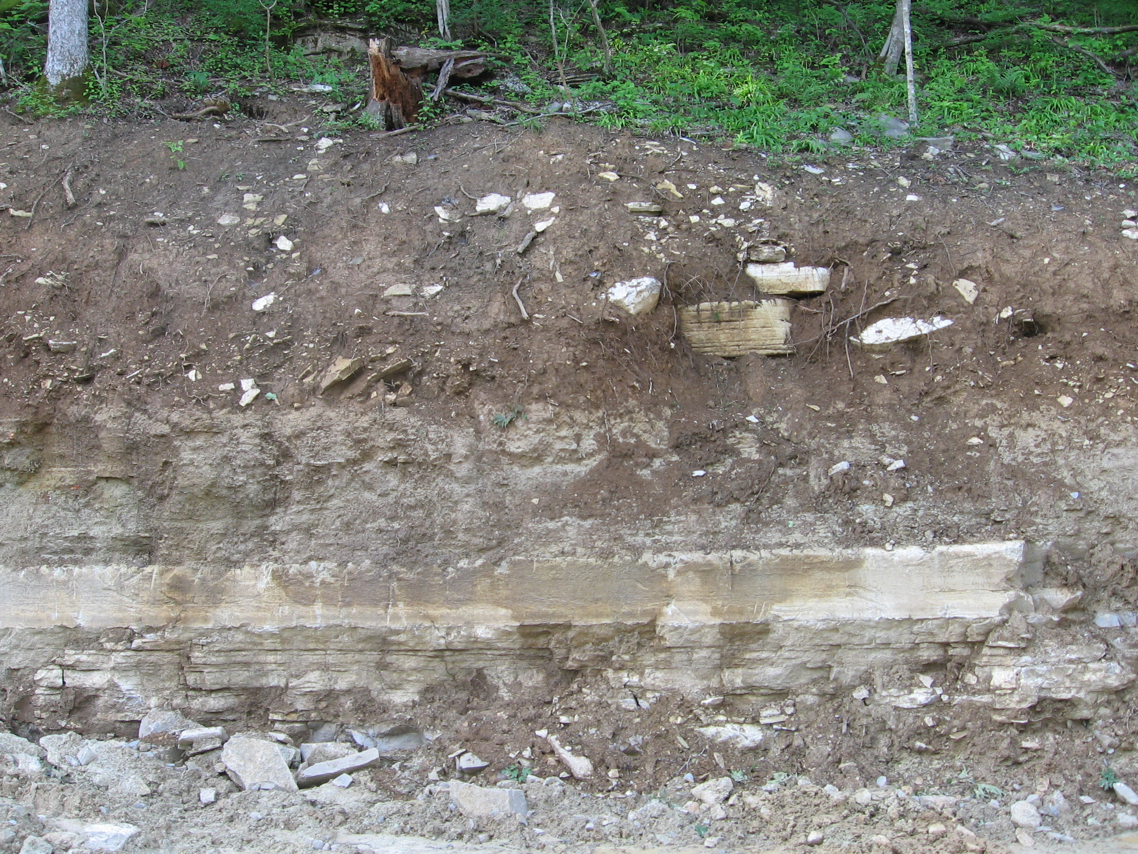
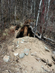
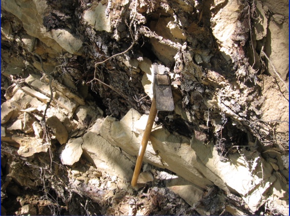
Floaters in a limestone weathering profile, central Kentucky.
For farmers and excavators, floaters are mainly an annoyance. For pedologists and geomorphologists they can also be an annoyance. This is not only due to the difficulties they pose for digging and sampling, but because—particularly with augers, probes, and core samplers—they can easily be mistaken for underlying bedrock, resulting in underestimates of the depth and thickness of soils, regoliths, and weathering profiles.
But can these floaters tell us anything about weathering profile, critical zone, and regolith evolution?
My unofficial definition of a floater is an isolated rock fragment of roughly boulder size or larger (diameter of 256 mm or a little more than 10 inches). Smaller ones can generally—though not always—be nudged aside or at least moved a bit by a soil auger (my auger has a 100 mm or 4 inch diameter). This lets you know, even when you can’t see them, that you haven’t yet hit bedrock.
I am also concerned here with floaters in situations where at least the lower part of the regolith is derived mainly from weathering of underlying rock, as opposed to, say, glacial till or debris flow deposits.
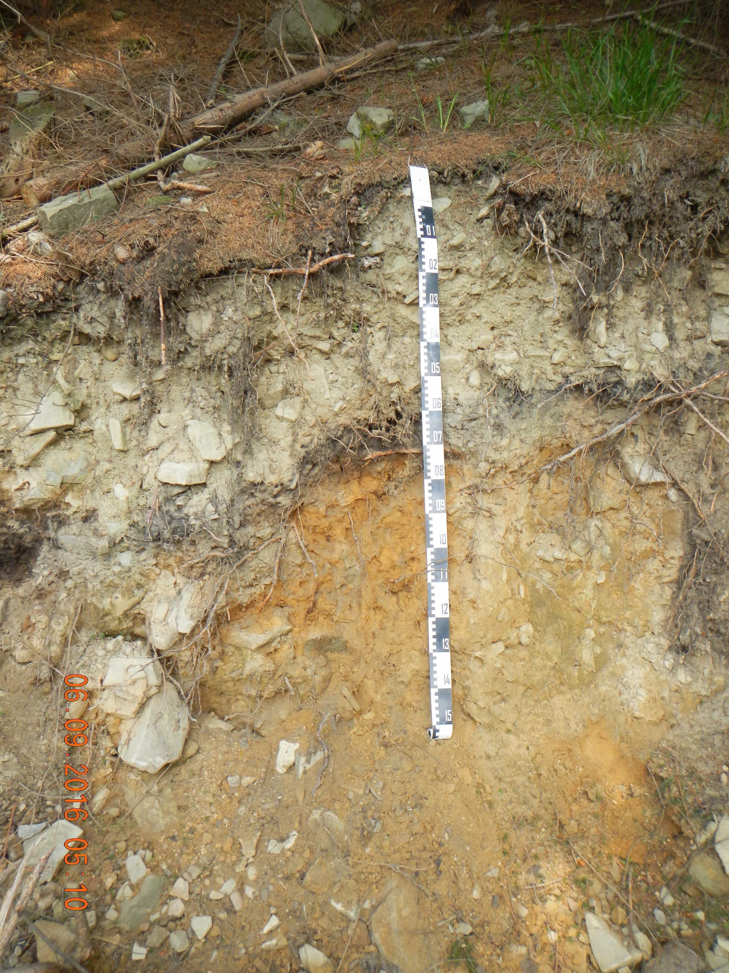
This soil, in the western Carpathian Mountains, Czech Republic, formed in landslide deposits. The floaters in this profile are not the sort I am concerned with here.
If we set aside cases where the parent material already contains large rock fragments (glacial drift, mass wasting deposits, debris flows, mine spoils, etc.), there are two general sources for floaters—the underlying bedrock, and upslope.
Bedrock
Rock weathers unevenly, particular by chemical weathering processes. Water follows preferential flow pathways into the rock along joints, fractures, etc., and water persists in certain physical settings within the rock. Weathering also tends to be self-reinforcing, often enhancing the variability in weathering. This can result in the persistence of unweathered or minimally weathered parent rock within a matrix of unconsolidated, weathered material. Some geomorphologists call these corestones, which is fine by me, but be aware that to some, corestone refers to a particular type of rounded rock formed by exfoliation weathering in granite.
Remnant unweathered rock left behind as the weathering front moves downward can also result from situations where more resistant rock is interlayered with less resistant, more easily weathered lithologies. Sandstone and shale in sedimentary sequences are often interlayered, for example, as in flysch and other settings. Rock decomposition may bypass the more resistant rock as the less resistant stuff is converted to saprolite or soil.
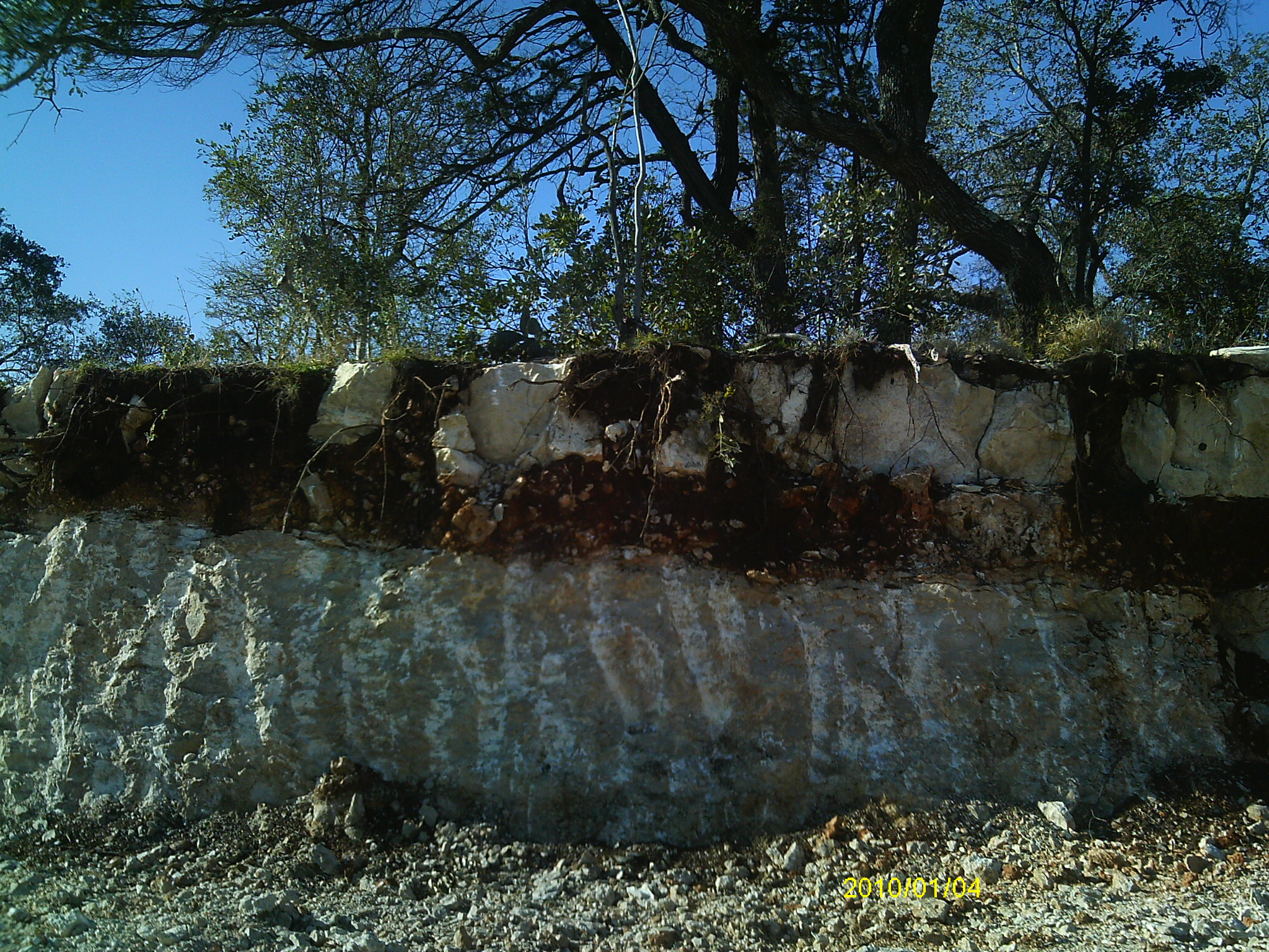
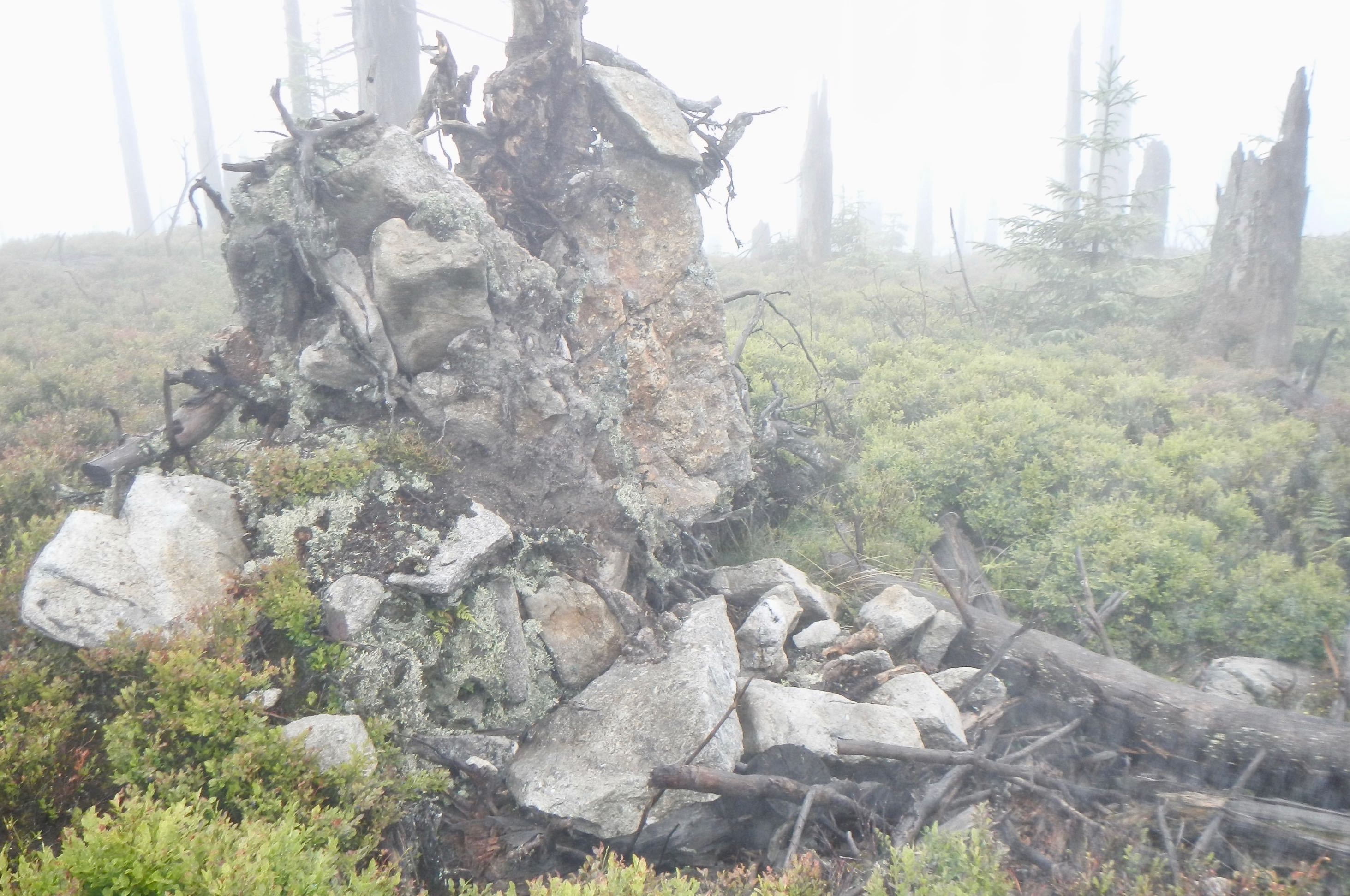
Minimally weathered bedrock remnants in a granite weathering profile in Union County, South Carolina.
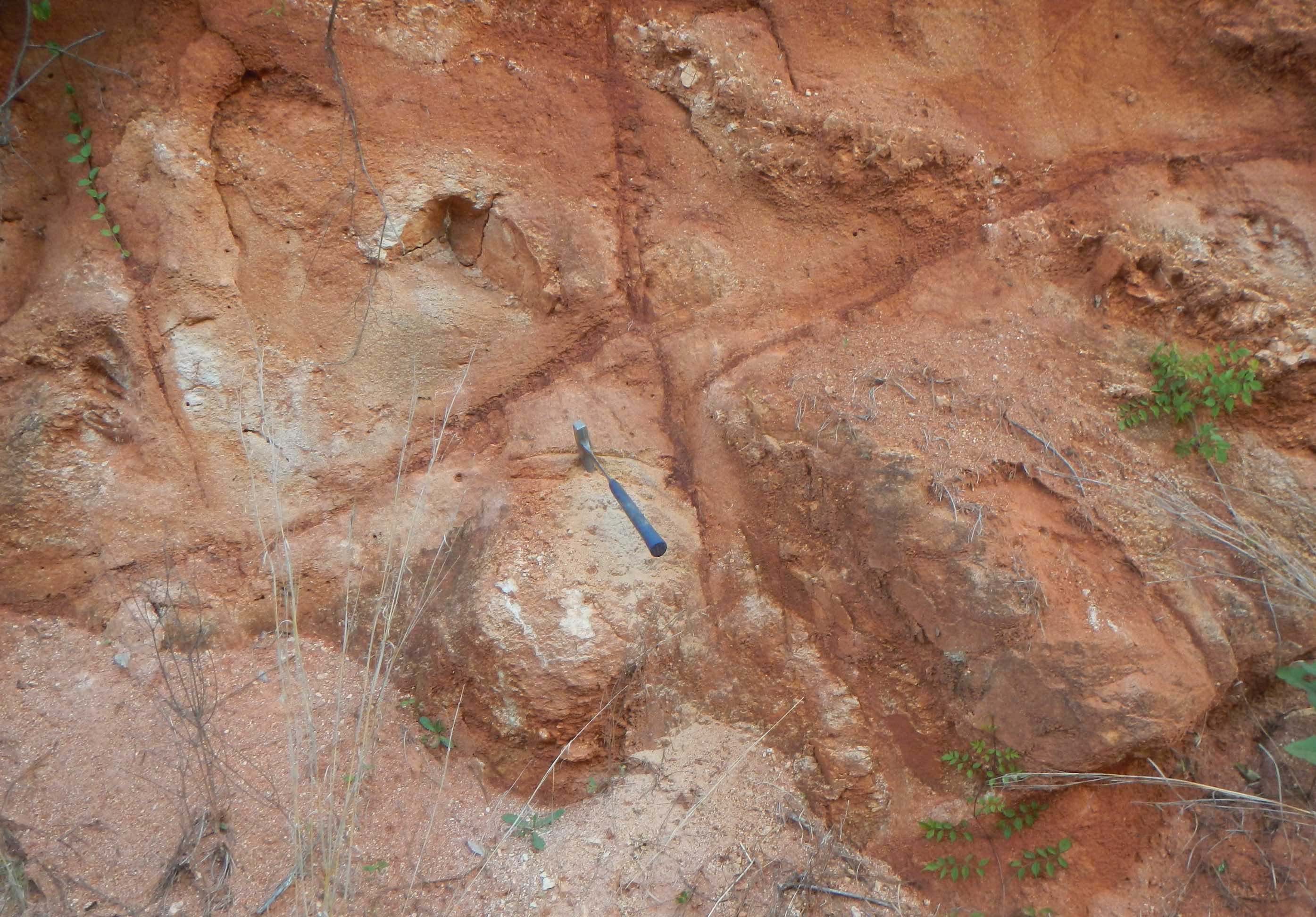
Easily-weathered claystone separates more resistant limestone layers in Comal County, Texas.
These corestones (or whatever you wish to call ‘em) are in their original location in the weathered rock mass, and have not been transported. But corestones, and bedrock from the weathering front, can be transported vertically (as well as laterally) within the regolith. Downward movement can occur due to gravitational settling, undermining by faunalturbation (digging and tunneling by insects, earthworms, mammals, etc.), and undermining by subsurface erosional processes such as sapping and pipe erosion.
Corestones can also be moved upward. Tree uprooting is the single most common cause in forested settings, and most likely in general. Rock fragments are often uplifted as part of the rootwad, and settle into uproot pits or on the surface at higher elevations than they came from. Freeze-thaw processes can move rock fragments upwards. Faunal excavation can obviously do so, too—most notably by Homo sapiens, but also by other species.
Black bear den in North America, showing large rock fragments excavated by the bear (bear.org).
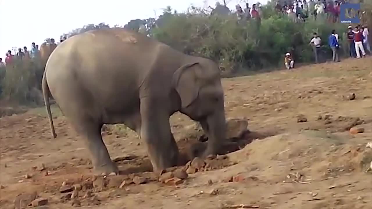
Elephant digging soil and rock fragments in India (Rumble.com).
Uprooting of trees rooted in soil with floaters, or in substrate including transported rock fragments, can move the rocks upward. In addition, tree roots can penetrate bedrock, and remove previously unattached fragments –a phenomenon called bedrock mining.
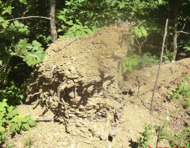
Top: Root wad of uprooted Norway spruce in the Sumava Mountains along the Czech-German border. Rock fragments may be from glacial or periglacial debris rather than plucked from bedrock. Middle, bottom: Uprooted shortleaf pines from the Ouachita Mountains, Arkansas. Intact bedding shows that these were mined from bedrock. The shale (middle) is rapidly weathering, and the bedding will not be evident long. The uprooted sandstone bedrock (bottom) will persist.
Transported floaters
Rock fragments can be transported to a site, and work their way downward, by the processes referred to above. Note that here I am referring to clasts transported to areas where the regolith is formed mainly by weathering of underlying bedrock, as opposed to colluvial or alluvial parent materials containing rock fragments.
Transportation in the post-industrial era may involve a number of mining, construction, and landscaping activities. Even earlier, though, humans (alone or with assistance from draft animals) transported stone for building structures and creating hearths and fire pits.
In other cases, the main source is transport from upslope. Even where rapid mass wasting events (e.g., debris flows, avalanches, landslides, etc.) have not occurred, rock creep may transport rock fragments produced by weathering of surface or near-surface bedrock outcrops downslope.
Floater interpretation
Assuming you have correctly identified a site where most of the weathering profile is formed by weathering of underlying bedrock (in most cases, if a site has not had recent erosion, it cannot be assumed that there is no material transported in), what do you look for? This is assuming, that at least for reconnaissance purposes, you have no resources available other than digging tools, and a geological hammer.
1. Can original bedding or structures be observed in the floaters? If so, this suggests in situ alteration.
2. Even if actual stratification cannot be observed, consistent vs. highly variable orientation of rock fragments indicates in-place vs. transported (vertical and/or horizontal) clasts.
3. What is the lithology (and other rock properties) of the floaters compared to that of the underlying weathered rock and bedrock? If the floaters are of a clearly different type, this proves transport.
4. Is there a possible, plausible, or likely upslope source for the floaters? That is, if the floaters and underlying rocks differ, does the floater geology occur upslope? Even better, are there weathered outcrops upslope?
5. Are uprooted trees, rootwads, or uproot pit-mound pairs present? If so, do they contain floater-sized fragments?
6. Are floater-sized rocks present in stumphole, tree uproot, or other pits or depressions?
7. Are rock fragments evident, and disproportionately concentrated on the upslope side of trees or other obstructions? Trees may displace rock fragments laterally as they grow, but clear concentration of rock on the upslope side indicates surface transport.
8. Does the underlying bedrock have layers of strongly varying resistance to weathering?
Some other, more general guidelines for interpreting weathering profiles is provided by Phillips et al., 2019 and Samonil et al., 2020.
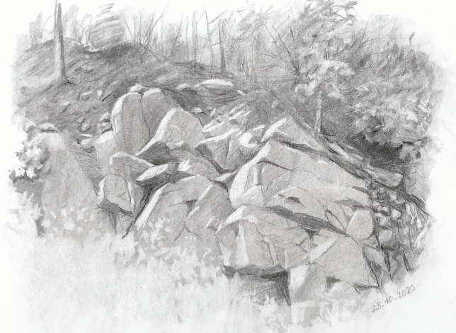
Field sketch of an outcrop in Moravia, Czech Republic, by Petr Mores. More information on artist Petr’s collaboration with scientists is here.
Example
In Phillips et al. (2005) we studied rock fragment distributions and how they relate to regolith evolution in the Ouachita Mountains, Arkansas. Based on the type of observations above, including 60 full-size walk-in soil pits, 400 posthole pits, and uncounted auger borings, we determined that in many cases soils on lower slopes were formed primarily in weathered shale or interbedded shale and sandstones. Upper slopes and ridgetops included many outcrops of more resistant sandstones, cherts, and novaculites with visible weathering features and detached clasts. These rock fragments are transported downslope, mainly via rock creep. Meanwhile, tree uprooting brings rock fragments to the surface, and (along with stumpholes) creates pits whereby transported fragments may become buried. The vertical distribution of rock fragments within the soils and regolith indicates bedrock mining by tree uprooting, and relative impoverishment of rock in subsoils and enrichment of the surface where the roots penetrated into sandstone layers. Overall, the floaters provided a pretty good picture of the combination in in situ weathering, slope processes, and biomechanical effects of trees in the evolution of regolith at those sites.
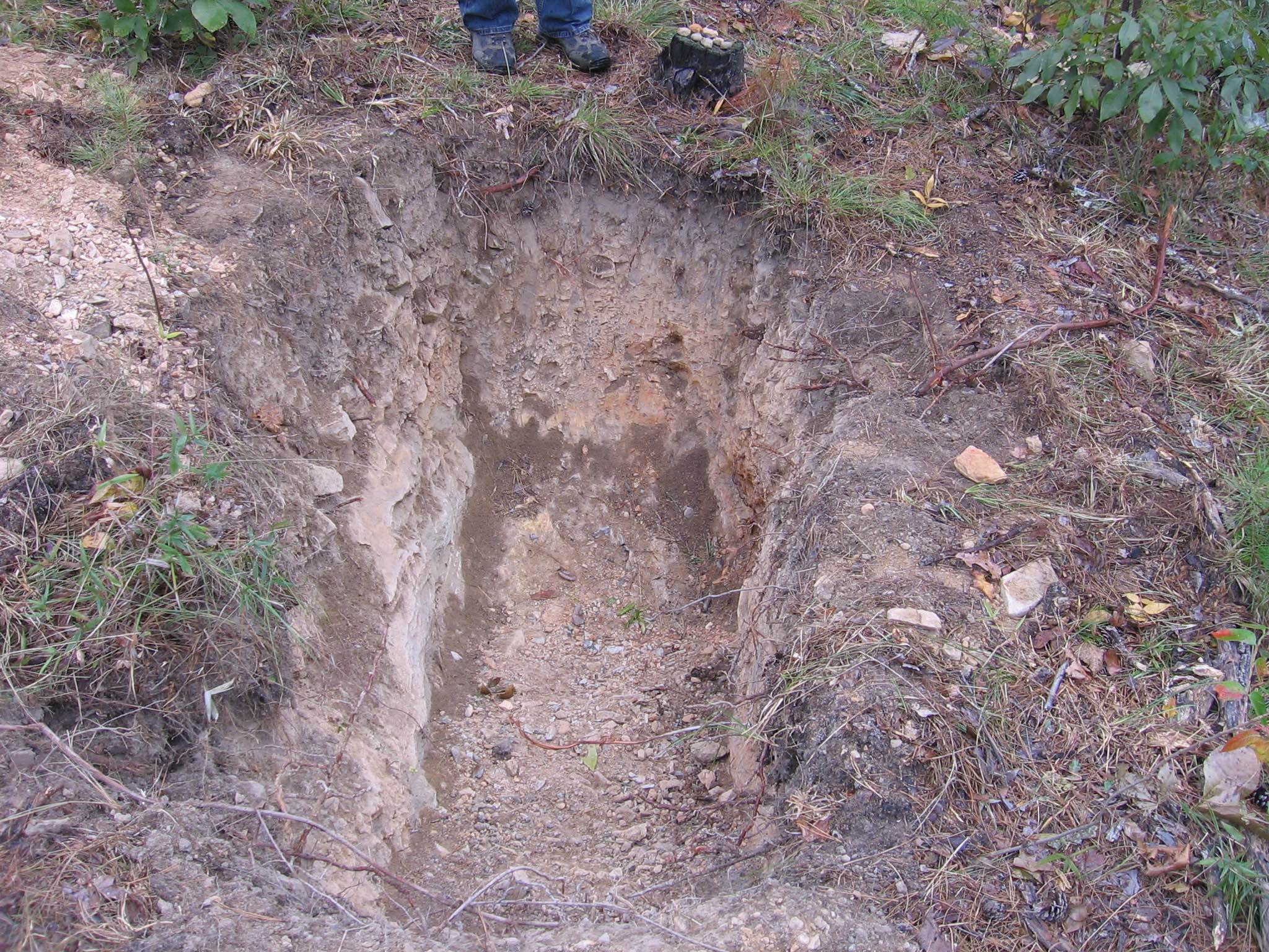
Ouachita soil pit.
Of course, the floaters also provided a number of curses, bruised knuckles, and sore muscles in the digging and sampling activities, as well as the tossing aside of posthole diggers, shovels, and augers to grab a pick-axe or pry bar. They also led us to a considerable amount of experience in the use of steer rebar and sledge hammers. Using auger holes to estimate depth to bedrock, when impenetrable rock was encountered we began hammering rebar into the ground nearby to determine whether the rock was an isolated floater or more extensive, suggesting bedrock. In the former case, we then sometimes used the hammer and rebar to try to break up the rock enough to auger past it.
References
Phillips, J.D., Luckow, K., Marion, D.A., Adams, K.R. 2005. Rock fragment distributions and regolith evolution in the Ouachita Mountains. Earth Surface Processes and Landforms 30: 429-442 (attached).
Phillips, J.D., Pawlik, L., Šamonil, P., 2019. Weathering fronts. Earth-Science Reviews 198: 102295 (attached).
Šamonil, P., Phillips, J.D., *Danĕk, P., Beneš, V., Pawlik, Ł. 2020. Soil, regolith, and weathered rock: Theoretical concepts and evolution in old-growth temperate forests, central Europe. Geoderma 368, 114261 (attached).
Questions/Comments: jdp@uky.edu
Posted 17 February 2021