
This post continues the story of a collaboration with artist Petr Mores to combine scientific and artistic perspectives to tell stories of landscape evolution.
One of the first issues we encountered was that Petr, while wonderfully experienced in depicting nature from the ground up, was not accustomed to representing underlying soils and geology. Pavel and I, on the other hand (like many other pedologists and geomorphologists) are quite familiar with showing soils, regoliths, weathering profiles, and parent rock in the form of two-dimensional profiles and cross-sections, either in highly simplified forms or in annotated photographs.
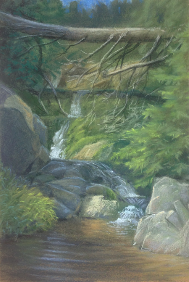
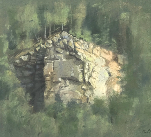
Mountain stream (Petr Mores)
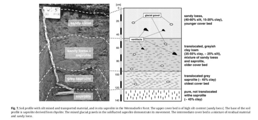
Typical two-dimensional representations of soil profiles (by Carsten Lorz, from Phillips & Lorz, 2008).
I sent Petr some examples of the latter from my own work, and some better examples from the work of others, highlighting what I thought were strong and weak points, and things I was interested in showing. Petr embarked on a multiple-weekend mission to examine, sketch, and render exposures in outcrops and quarries near his home base in Brno (CZ). This began an interesting exchange between us.
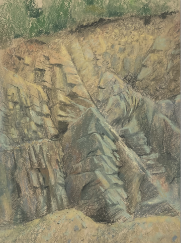
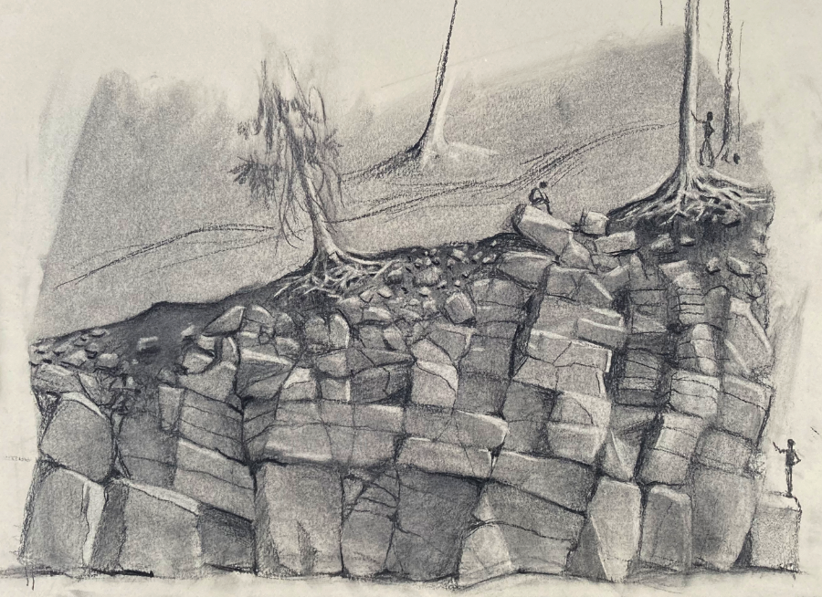
Quarry exposure near Brno (Petr Mores).
A professional geoscientist is trained, formally and by habit and experience, to notice certain features and attach particular meanings to them (though of course this varies between the geomorphologist, petrologist, pedologist, paleontologist, sedimentologist, and so forth). Obviously, there are great advantages to this, but it may lead us to focus immediately on, e.g., soil horizons or weathering features or joints and fractures or fossils to the possible slighting of other interesting aspects. Also, being trained to recognize, e.g., bedding planes or faults or krotovinas, we sometimes forget how mysterious these may appear to laypersons.
The eye of an experienced outdoorsman and nature artist such as Petr picks up every detail, at least when they are seeking to represent it. This includes items that I (or another geoscientist) might have overlooked or taken for granted, because we are preconditioned to look for particular things. It also includes aspects for which the explanation is known to a trained Earth scientist, but not too most “civilians,” even well-educated, experienced, and observant ones such as Petr.
One of Petr’s preliminary sketches
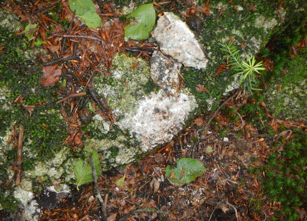
Common questions from Petr had to do with the identification and meaning of various partings and discontinuities in the rocks, leading me to an explanation of the differences and similarities among joints, fractures, bedding planes, faults, and so forth. Others dealt with what determines the shape of the rock blocks defined by the discontinuities or the boulders weathered out of the exposures. Still others concerned the variations in color revealed by the outcrops.
Discontinuities
In our back-and-forth, I was commenting on Petr’s sketches and using terms such as joints and fractures. Petr was curious as to how exactly I was using various terms to describe various partings and discontinuities. He also asked about the “leaning” of rocks in the exposures.
My response: Even geologists use terms such as joints & fractures kind of loosely sometimes. Thus, I revert to College Professor mode: Discontinuities (or partings) in a rock mass are categorized as fractures, joints, bedding planes, faults, and cleavage or foliation. The latter are thin layers that flake off due to weathering or impact and are unlikely to be mistaken for any of the others. Bedding planes are boundaries between different layers of sedimentary rock associated with the original deposition. Most other types of cracks or discontinuities are fractures; you are using the term correctly. Joints and faults (as structural features in the rock) are both types of fractures. Joints have experienced little or no displacement (that is, the rock on both sides has not moved relative to the other side). In a fault, some movement has occurred.
One of Petr’s research/training depictions.
“Leaning” of rocks is measured in terms of angle from the flat/horizontal and is called dip in sedimentary rocks. Where non-horizontal dips are observed in the intact rock mass and are not extremely localized, they are usually due to tectonic tilting. The orientation of fractures in igneous or metamorphic rock (e.g., granite, gneiss, basalt) is due to the physical stress field within the rocks, which can be affected by a number of different factors. At an exposed rock face, gravitational movements of weathered blocks can either exaggerate or obscure the fracture orientations in the original rock and create some displacement.
Shape
Though he had not previously focused on rock exposures (as opposed to depiction of rock outcrops at the ground surface), Petr quickly developed an aesthetic for them, even coining a wonderful term—the “shape language of rocks”. From one of his e-mails to me: I must say that I found this rock beautiful - its shapes are very aesthetically pleasing. It's not directly relevant for the subsurface study but I just like to train my eye and brain to see and remember the shape language of rocks in general. On the same day, I drew a rock face above the river (Malý Rabštýn), also a very handsome piece of rock! Moreover, I was fortunate about light when I was working there - drawing rocks when the light is not right can be nigh impossible. The trees are left to be an abstract mess. I tried to pay attention to color modulations with some orange spots. What are those, actually? I noticed that the rock was more fragmented towards the top but it did not seem that there was a whole lot of soil or regolith on top. I also find the very regular vertical lines on the left quite striking - the rest of the rock face was not as regular looking.
This got me to thinking about what determines the shape of rock masses and boulders. Some quick research—admittedly not too thorough—determined that the limited studies on this were focused on explaining or interpreting particular cases. I did not find any general overviews or reviews on determinants of shape.
In general, shape will be determined by the rock type (lithology), and the variations in composition (mineralogy and chemistry), and physical properties within a given lithology such as hardness, strength, and crystalline structures (no two slates, basalts, or granites, for example, are exactly alike). Structures within the rock mass—fractures, etc. as described above—are extremely important, as breaking and weathering are guided or controlled by these. Weathering processes can affect shape in other ways, too. For instance, spheroidal chemical weathering occurs in jointed bedrock, especially granites and granitoids—the water is able to “surround” an area and gradually remove the surrounding material, making what’s left increasingly rounded. When the weathered rock gets exposed, the weathered part tends to spall off one layer at a time—some call it “onion skin” weathering, which gives some idea. Boulders can also become rounded due to abrasion, if they have been transported, or if they are subjected to abrasion in situ by transported material.
The shapes exposed in a roadcut or quarry wall are also affected by how the rock was removed—dynamite, other explosives, excavators, bulldozers, pick-and-shovel, etc.
Colors
Unsurprisingly, Mr. Mores’ artistic eye took special note of color. As a geoscientist, I interpret color in two general ways. First, as an indicator of mineralogy—for example, various shades of red, yellow, orange, and brown as indicators of various iron oxides. Second, by comparing freshly exposed rock (for instance, what you see when you break a rock apart with a geological hammer) to exposed rock as an assessment of weathering or other modifications.
Chipped-off granite boulder in South Bohemia (CZ), showing contrast between fresh interior rock and weathered & biologically colonized exterior.
The color of rock exposed at or near the surface is influenced by the colors of the fresh rock, chemical weathering, deposition and adhesion of aerosols, and biological coatings, ranging from microbes to lichens and mosses.
Edge effects
The term “edge effects” was first coined in ecology to describe the unique processes and interactions that may occur along ecotones and other ecological boundaries. Back in 1999 I extended the concept to geomorphology. Edge effects in geomorphology produce features or processes along the boundaries between landscape elements, which are distinctly different from those of the adjacent elements. These effects are unique to the edge environment, as opposed to simply being transitional (Phillips, 1999). A more recent treatment is from Pawlik et al. (2019), and we also addressed edge effects in a review article on weathering fronts (Phillips et al., 2019). The latter is directly related to the kind of issues Petr was confronting in the field—that what is observed at an exposure is not always representative of the still-covered and concealed material behind it.
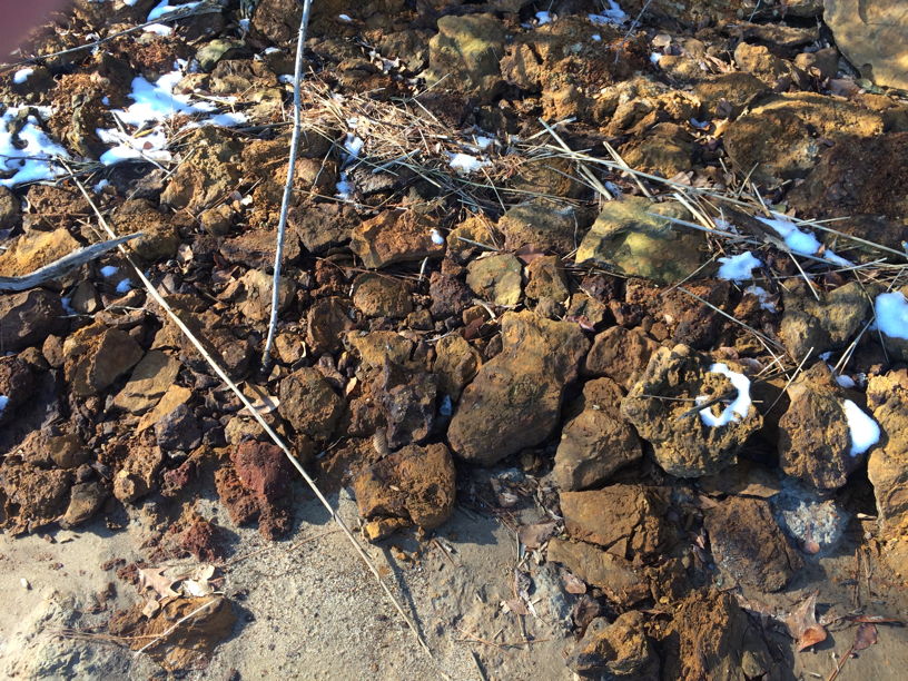
Ferricretes exposed at a valley side slope along the Neuse River at Fisher Landing, NC. Discharge of groundwater with dissolved iron at the eroding bluff results in precipitation of the iron when it encounters the air and cementing together of the surrounding material. These occur only at the bluff edge and do not extend into the interior.
However, there is no alternative to exposures (quarries, road cuts, mines, slope failures, eroding stream banks, excavation sites, etc.) to observe the lateral relationship and variations in regolith and subsurface geology. Simple exposure to air and meteoric water initiates, pretty much immediately, chemical weathering and biological colonization. These sites also become potentially subject to aerosol deposition, and in many cases, groundwater discharge in the form of seeps, springs, and driplines. Weathering changes may occur very rapidly and extensively, as for example when shale layers are exposed. Groundwater discharge may result in mineral precipitation to form materials that are not present in the interior of the rock. The removal of material from the exposed face decreases support and locally eliminates confining pressures, thus modifying the stress field of the rock mass. And, again, the process creating the exposure, be it explosives, excavators, or erosion, can affect the exposed rock.
Ideally, impressions gained from exposures will be supplemented by information from cores or boreholes (these do not provide a good impression of lateral relationships but can at least confirm or refute whether something observed at the exposure is present more widely vs. confined to the exposure zone), and subsurface geophysical exploration. The latter includes seismic profiing, ground penetrating radar, and electrical resistivity. These provide a coarse and incomplete picture of what is below the surface but do so without disturbing or exposing it. Luckily, in the region we are working in at present, we have such geophysical information (e.g., Samonil et al., 2020). Thus, Pavel Samonil and I are able to advise Petr on these issues.
Block diagrams
Our mission is to produce a three-dimensional representation of the landscape in a two-dimensional medium (actually four dimensional, as we also seek to convey a sense of change over time). There is a tradition of that in the form of block diagrams. U.S. Department of Agriculture soil survey reports also routinely included landscape block diagrams, though unfortunately more recent surveys typically lack them.
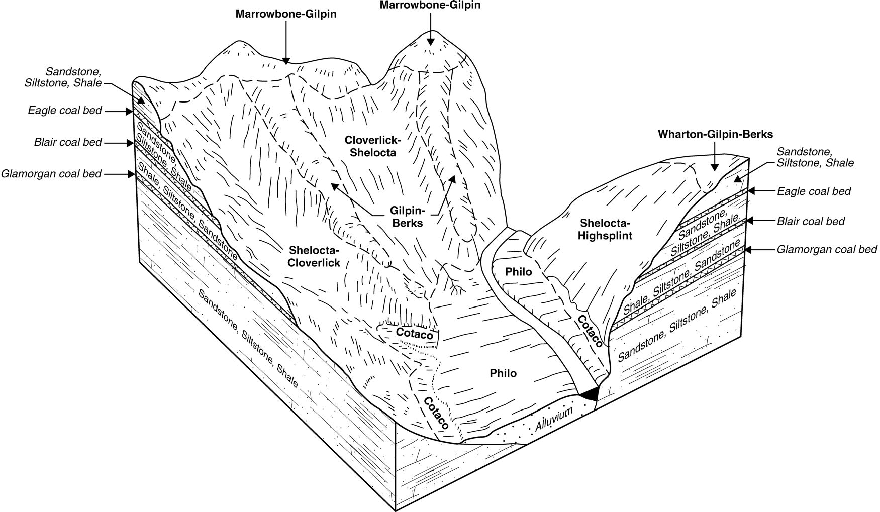
Block diagram from the Soil Survey of Buchanan County, Virginia.
However, I am not aware of any block diagrams that show both surface and subsurface at the scale and level of detail Petr is attempting.
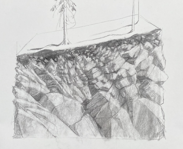
One of Petr’s preliminary planning sketches, with surface detail not yet included.
Cited References:
Pawlik, L., Šamonil, P., Malik, I., et al. 2019. Geomorphic edge effects in response to abiotic and anthropic disturbances in forest ecosystems of the Gorce Mountains, western Carpathians. Catena 177, 134-148.
Phillips, J.D. 1999. Edge effects in geomorphology. Physical Geography 20: 53-66.
Phillips, J.D., Lorz, C. 2008. Origins and implications of soil layering. Earth-Science Reviews 89: 144-155.
Phillips, J.D., Pawlik, L., Šamonil, P., 2019. Weathering fronts. Earth-Science Reviews 198: 102295 (attached).
Šamonil, P., Phillips, J.D., *Danĕk, P., Beneš, V., Pawlik, Ł. 2020. Soil, regolith, and weathered rock: Theoretical concepts and evolution in old-growth temperate forests, central Europe. Geoderma 368, 114261 (attached).
Posted 2 February 2021
Questions or comments: jdp@uky.edu
The artist: petr.mores@uh.cz