
FURTHER THOUGHTS ON TROPICAL CYCLONE DELUGES
This post is the third in a trilogy pondering the very real possibility that we have entered a “new normal” with respect to tropical storms and hurricanes, focusing in particular on relatively small storms on the Saffir-Simpson scale producing prodigious amounts of rain in the eastern Carolinas (part 1; part 2). Here I offer some additional thoughts.
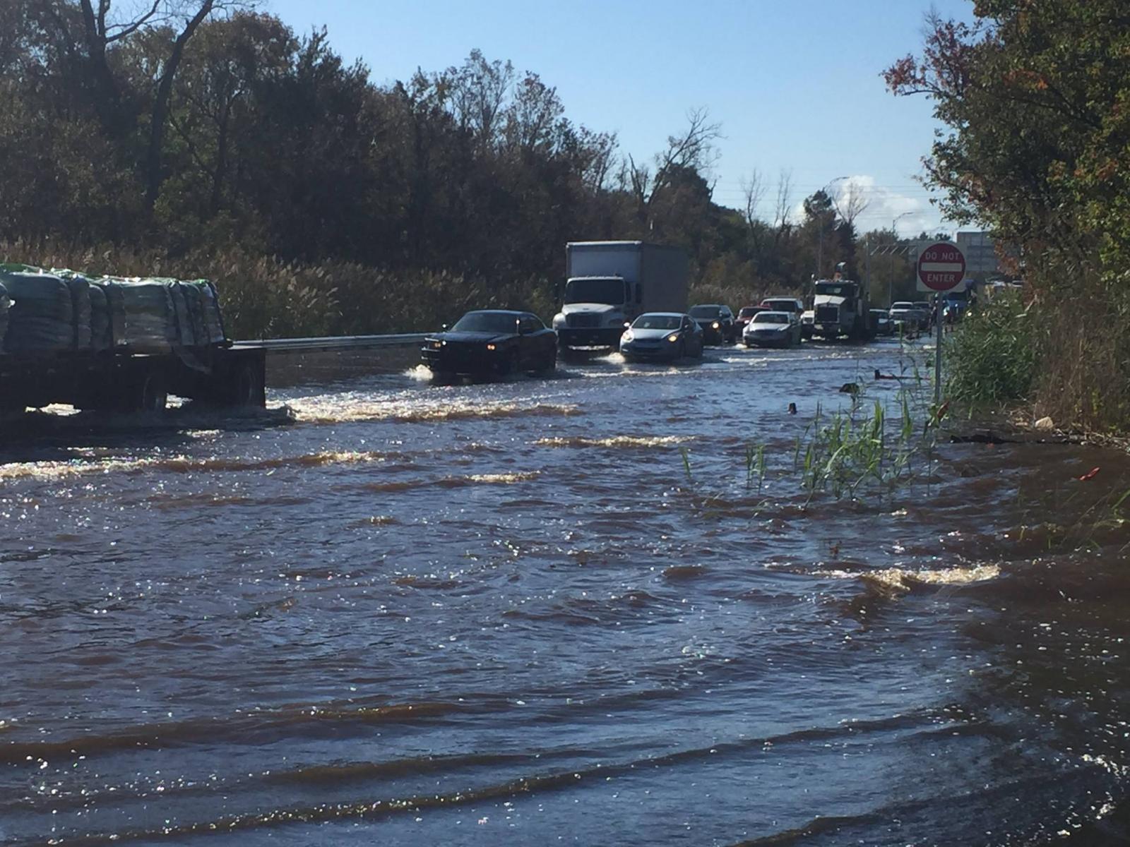
Flooding from Hurricane Matthew along U.S. 421 in Wilmington, NC (near the USS North Carolina Battleship Memorial)(Associated Press)
Compound flooding
Hurricanes Florence (2018) and Matthew (2016) both produced flooding due to record-high river flows from the massive rainfalls involved and flooding from storm surge. Gori and others (2020), noting that coastal flood risk models have traditionally only taken into account surge flooding, even though we know that rainfall and runoff are critical, examined the issues of “compound flooding” from tropical cyclones (TC). They focused on the Cape Fear River Estuary, NC, using case studies from two landfalling TCs coupled with physical modeling. Results show that intense outer rain bands falling over inland portions of the Cape Fear area can drive river‐surge compounding (increasing water levels by up to 0.36 m). Intense eyewall precipitation along the coast can result in localized compound impacts to coastal streams and tributaries, particularly if peak rainfall coincides with peak storm tide. These localized compound impacts can result in defined interaction zones, where neither storm tide alone nor rainfall‐runoff alone can fully explain the observed maximum water levels.
The case of Neuse River flooding around New Bern in 2018 has not been examined in this kind of detail, but given near-record floods coming down the river combined with a 3 m storm surge in the Neuse estuary, compound flooding can certainly be suspected.
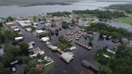
Flooding in New Bern, 2018 (USA Today)
Slow and wet
Hurricane Harvey in 2017 famously meandered slowly along the Texas coast, dumping the largest single-event rainfalls ever recorded in the USA. Florence infamously slowed to a crawl (1.6 to 3.2 km hr-1) after it made landfall in southeastern NC. This slow movement, keeping the storms over a given area for long periods, coupled with the extra moisture-carrying capacity of the storms, associated with climate change-driven warmer air and wate,r created perfect conditions for extraordinary precipitation quantities. Each 1 degree C increase in air temperature results in a 7 percent increase in saturation vapor pressure and how much water vapor the air can hold. This provides more fuel for hurricanes (as release of latent heat as moisture condenses in the rising air of the low-pressure center) and exacerbates the rain potential of a slow-moving storm.
Flooding in Wilson, NC from Hurricane Florence (https://vosizneias.com)
A study conducted before Harvey and Florence showed that hurricanes have slowed their rate of movement by 10% in recent decades. This is also linked to climate change: the TC slowdown is linked to weakening in atmospheric circulation in the tropical parts of the planet, a result of global warming according to author James Kossin found, even though the specific mechanisms involved are unclear. Subsequent research has also shown that TCs are maintaining their strength longer after landfall, exacerbating their inland impacts.
The basic physical principle of conservation of angular momentum also means that when a storm is reducing its winds without also reducing its total energy, the storm will grow larger in areal extent. This is exactly what happened with Florence, which dumped rain over a very large area—the unprecedented flooding in the lower Neuse and Trent River areas, for instance, occurred even though those areas never directly experienced hurricane conditions.
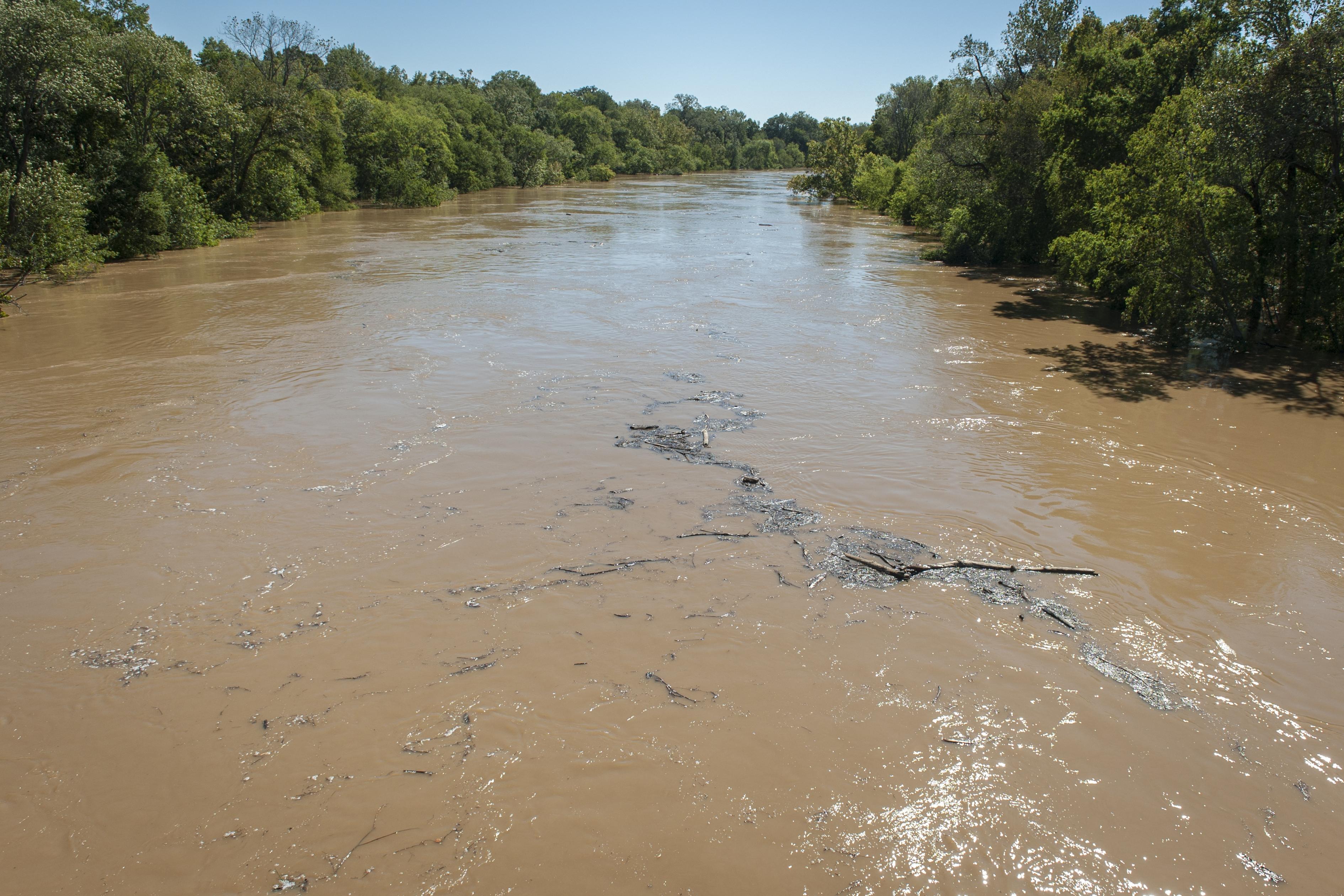
Cape Fear River in flood, 2016 (Fayetteville Observer)
Paleotempestology
The new TC regime applies to human history, but it would be instructive to know what the regime was like further back in time. Paleotempestology was coined to describe the study of past storms and storm regimes—mainly hurricanes and typhoons—based on the paleoenvironmental record. As far as I am aware, such studies in the Carolinas have revealed evidence of past hurricanes, but not in sufficient detail to determine if their rainfall regimes have changed.
Mallinson and others (2011), for example, showed that the N.C. Outer Banks contain a geologic record of inlet activity going back more than 2000 years. Inlets generally open and close during major storms and can therefore be used as a proxy for storm activity. Their results suggest that the Medieval Warm Period (MWP, about 950 to 1250) and Little Ice Age (LIA, early 14th to mid 19th centuries) were both characterized by elevated storm conditions, as indicated by much greater inlet activity relative to today. Given what is known of atmospheric circulation and sea surface temperatures during the MWP and LIA, they suggested that increased inlet activity during the MWP responded to intensified hurricane impacts, while elevated inlet activity during the LIA was in response to increased extratropical cyclone (northeaster) activity.
For another example, studies at Singleton Swash (Myrtle Beach, SC) revealed a 5700 year sedimentary record based mainly on foraminifera, compared to analog modern deposits from Hurricane Hugo in 1989 (Scott and others, 2003). Their evidence suggested that the most storms occurred in the 1000 years pre-Hugo, with evidence of at least one “giant storm” >5000 years ago. They posited that climate connections among the North Atlantic Oscillation and the position of the Bermuda High account for the pattern.
Some evidence of past precipitation trends going back >2000 years has been obtained from bald cypress tree rings along the Black River, NC (see Stahle et al., 2019). However, these provide evidence of droughts and wet spells on an annual and seasonal basis, rather than records of precipitation from particular storms.
References
Gori, A., Lin, N., Smith, J. 2020. Assessing compound flooding from landfalling tropical cyclones on the North Carolina coast. Water Resources Research 56, e2019WR026788. https:// doi.org/10.1029/2019WR026788
Mallinson, D.J., Smith, C.W., et al. 2011. Barrier island response to late Holocene climate events, North Carolina, USA. Quaternary Research 76, 46-57. https://doi.org/10.1016/j.yqres.2011.05.001
Scott, D.B., Collins, S.E., et al. 2003. Records of prehistoric hurricanes on the South Carolina coast based on micropaleontological and sedimentological evidence, with comparison to other Atlantic Coast records. Geological Society of America Bulletin 115, 1027-1039, https://doi.org/10.1130/B25011.1
Stahle, D.W., Edmondson, J.R., et al. 2019. Longevity, climate sensitivity, and conservation status of wetland trees at Black River, North Carolina. Environmental Research Communications 1, 041002, https://doi.org/10.1088/2515-7620/ab0c4a
Posted 29 December 2020
Comments or questions: jdp@uky.edu